-2")
NHC initiates advisories on PTC 9 in the Bahamas
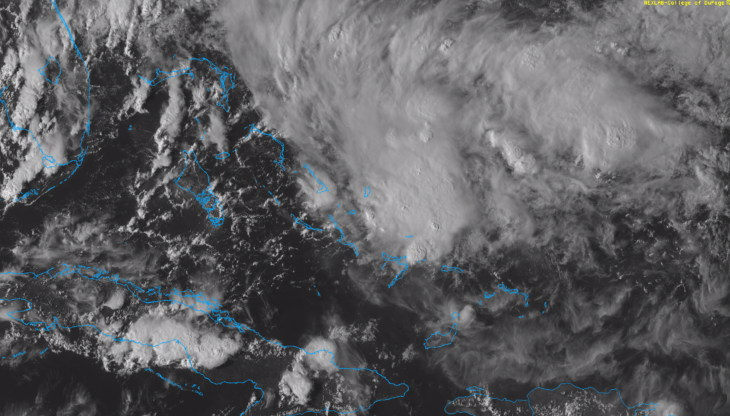
The National Hurricane Center has initiated advisories on Potential Tropical Cyclone (PTC) 9 this evening. The area of organizing thunderstorms is located in the Bahamas, and is expected to drift northwestward over the next day or so while continuing to organize.
Forecast model guidance is split in regards to where the system will eventually track. The GFS model and its ensembles suggest the system will remain loosely organized, while tracking westward toward Florida and into the Gulf of Mexico. The Euro model and its ensembles organize the storm more quickly, keeping it east of the Florida coastline and then moving the system off the Southeast US Coast. The latest NHC track lies somewhere in between.
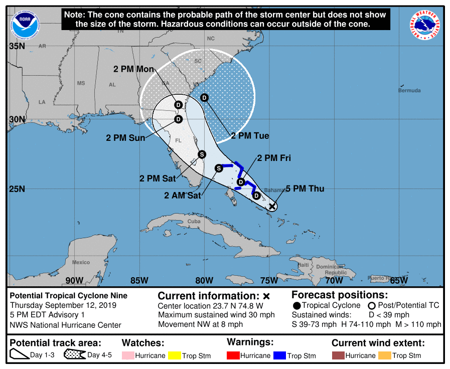
Uncertainty remains quite high in regards to the systems eventual fate, and there are many factors at play even in the short term. For instance, the storm is likely to be traversing waters overturned by Hurricane Dorian, which could limit the intensification of the storm. NHC currently forecasts the system to strengthen to a Tropical Storm before approaching Florida.
The system is expected to track through an area of the Bahamas that was ravaged by Dorian and is still recovering. If there is any good news, it is that the storm will be organizing as it passes that area, and not approaching it as a hurricane.
Uncertain near and long term future
As mentioned, model guidance remains split in regards to the systems track over the next 60 hours. Much of this uncertainty stems back to where the systems center of circulation organizes. The GFS model keeps the storm weaker and further south, while the European model pulls it northward and strengthens it much faster.
The uncertainty will continue beyond that time. If the European model is correct, and the system does trek northward while paralleling Florida, it could end up somewhere off the Southeast US coastline by next week.

This would be problematic, as forecast model guidance suggests that a large high pressure will build in to the north of the storm. This could block its seaward escape, and force the storm to meander near or off the US East Coast for a longer period of time.
At this juncture, the only action item for residents of the East or Southeast US coast is to pay attention to the forecast and monitor for updates. Details in regards to the systems future will become much more clear in the next 48-72 hours as the storm organizes.
Residents along the Florida Coast should take tropical storm precautions, and be especially mindful that the east coast of the state was just impacted by an offshore hurricane. There is no need to panic, but it is always prudent to prepare with adequate time to adjust for track or intensity changes.
Leave a Reply
Want to join the discussion?Feel free to contribute!