Posts

PM Update: Plenty of sun, low humidity

The sun is setting this evening on a gorgeous late-summer day (or early autumn if you’re using the meteorological calendar), and the main change in terms of sensible weather has been the drop in humidity. The past several days had featured rising dew points and increasing clouds with unsettled weather. But a cold front which moved through on Tuesday set the stage for a gorgeous Wednesday — and a persistent pleasant pattern which looks to settle into the area over the next several days. Light westerly winds and clear skies were the theme Wednesday, and look to be the theme through the weekend. A reinforcing shot of cold air, arriving just ahead of a mid level atmospheric disturbance on Thursday, will make things borderline chilly on Friday morning.

NAM model showing forecast low temperatures from Thursday Night into Friday morning. Upper 30's and 40's are common in the suburban areas of New England.

NAM model showing forecast low temperatures from Thursday Night into Friday morning. Upper 30’s and 40’s are common in the suburban areas of New England.

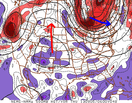
Forecast models show a disturbance moving through New England from Thursday into Friday, dragging a cold front south of our area into the Mid-Atlantic. The airmass from Canada which it brings along for the ride will only graze the area for a brief time, but 850mb temperatures will fall to the single digits (near zero in New England) with clear skies and light winds expected Thursday into Friday. Accordingly, forecast models show low temperatures falling into the 40’s in the interior suburbs, and 30’s in parts of New England.

Daytime highs on Friday could struggle to reach the lower 70’s — so it will certainly be feeling more like Autumn. Things recover a bit into the weekend, but the general theme of pleasant conditions with temperatures in the 70’s and perfect sleeping weather overnight will continue.


Tuesday begins transition into cooler pattern

Meteorological Autumn began September 1st with a warm, humid and unsettled weather pattern. Now, after just a few days, some significant changes are on the way. A cold front is shifting eastward off the Mid Atlantic and Northeast coast early this Tuesday morning, with some isolated showers and thunderstorms (one severe-warned storm on Long Island) possible on the Island and into Southern New England. For the rest of the area, a cloudy and drizzly start will give way to clearing skies by later this afternoon, as well as lowering humidity. The front is being driven off the coast by a mid level disturbance over the Great Lakes, which will be shunted eastward by another stronger disturbance over Southeast Canada. This feature will become important for us by later this week, as it ushers in a very cool airmass.

NAM model's forecast temperatures at the 850mb level in the Northeast US this coming Friday morning. Notice the values near or below zero over New England, and cold values extending as far south as NYC.

NAM model’s forecast temperatures at the 850mb level in the Northeast US this coming Friday morning. Notice the values near or below zero over New England, and cold values extending as far south as NYC.

A mid level ridge spike over the West-Central United States will allow a cutoff low over Eastern Canada to drop east-southeast, and the core of a cool airmass will clip the Northeast US later this week. Forecast models are indicative of 850mb temperatures dropping into the single digits by Thursday and Friday, with near or below 0 C readings over New England. Pleasant weather is expected, with plenty of sun, but it will certainly feel like autumn late this week.

Forecast high temperatures this week begin in the 80’s (Tuesday), but fall into the 70’s by Thursday and Friday, with overnight lows falling dramatically Thursday Night and early Friday morning, when some interior locations could fall well into the lower 40’s. With that said, the forecast looks pleasant with minimal rain chances moving forward.

Periods of heavy rain expected today

An unsettled weather pattern, which has settled into the area the second half of Labor Day Weekend, will rear its ugly head today as widespread showers and thunderstorms develop throughout the area. Areas of heavy rain have already developed early this afternoon, both over parts of New York City and also over Western and Central New Jersey. Limited instability should muddle what otherwise could have been a marginal setup for severe thunderstorms, but weak shear and lots of moisture suggest the potential for slow moving thunderstorms capable of producing heavy rain and leading to flash flooding.

Water Vapor Satellite imagery from the afternoon of September 2nd, 2013 showing moisture streaming into the area ahead of a cold front.

Water Vapor Satellite imagery from the afternoon of September 2nd, 2013 showing moisture streaming into the area ahead of a cold front.

The showers and thunderstorms are expected to continue through Monday evening, and may even linger into Tuesday morning across parts of the area — especially over Connecticut and on the Eastern end of Long Island. A more stable, cooler and less humid weather pattern is on the way by the middle of next week, but unfortunately Labor Day will have to be sacrificed in the process. Stay tuned for further updates including potential watches, warnings and advisories on the heavy rain and flooding potential.