-2")
Significant storm will bring rain, wind through Thursday
If you are a fan of changeable weather, today is for you. A major storm system, developing as a result of a mid level phase, will organize over the Tennessee Valley and shift northeastward to a position near New York City late tonight. The track will mean significant winter weather for our friends in Northern New England (including many of the major ski resorts), but more notably one of the more dramatic swings in sensible weather our area has seen in months. Temperatures will swing from the mid 60s to 70s in some spots this afternoon, all the way down into the 20s by Thursday morning.
Not surprisingly, the significant storm system moving through the Northeast US Wednesday into Thursday will feature a powerful thermal gradient and cold front. Initially, the thermal gradient will develop along a warm front which will stretch from southwest to northeast through the Northeast Wednesday afternoon. Parts of New Jersey could eclipse 70 degrees as southerly winds increase and temperatures increase in the low levels. Forecast models show drizzle and rain eventually increasing in coverage and intensity by Wednesday evening as moisture and lift begin to increase and the frontal boundary approaches Central Pennsylvania.
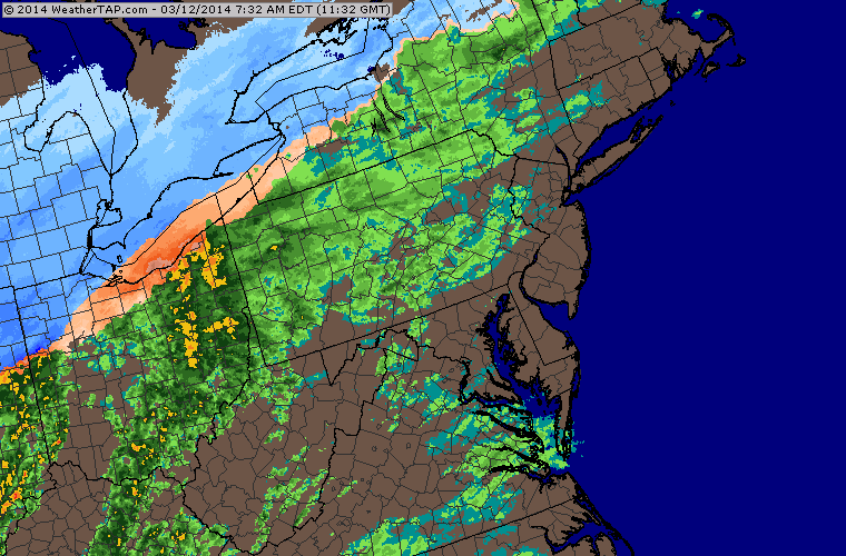
Regional radar imagery showing precipitation approaching the area as of 9:15am (weather tap).
Not forgotten in the entire atmospheric setup are the impressive mid and low level wind fields, which when coupled with increasing low level temperatures and relatively cooler air aloft could force the development of thunderstorms right near the cold front. The Storm Prediction Center has placed parts of the Mid Atlantic in a Slight Risk for severe thunderstorms, with the lesser risk percentage (around 5%) extending northward into New Jersey. Wind fields and low level shear suggest the potential for mainly isolated severe-level wind gusts and maybe a weak tornado or two — southwest of our area in the Mid Atlantic states.
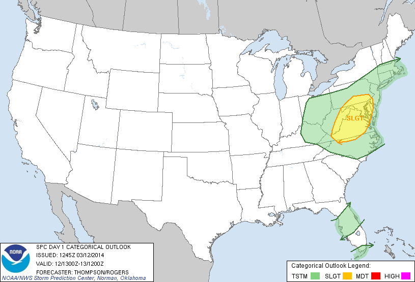
Storm Prediction Center categorical outlook for March 12, 2014 — showing a Slight Risk of severe weather in parts of the Mid Atlantic states.
Ultimately, in our area, the lack of surface instability will mitigate any threat for severe weather. But along the frontal boundary, winds could get quite gusty — and behind the frontal boundary, as temperatures fall dramatically, the west-northwesterly winds will pick up and aid in the rapid drop in temperatures. Wind gusts of 30 to 40 miles per hour are possible by Thursday as mid level and surface temperatures fall dramatically. High temperatures on Thursday will be 30+ degrees colder than they were on Wednesday in most areas.
Ski-resort heaven
For the first time this winter season, a New England ski-resort special is on the way. As the low pressure system tracks near our area and then off the New England coast, significant lift and a tremendous amount of moisture will be transported north of the thermal gradient into New England. A prolonged period of moderate to heavy lift over New York State and Northern New England will bring the potential for over a foot of fresh powder to many of the Northeast’s ski resorts which have seen the major snowstorms skip them to the southeast so far this season (and impact our area as they did so).
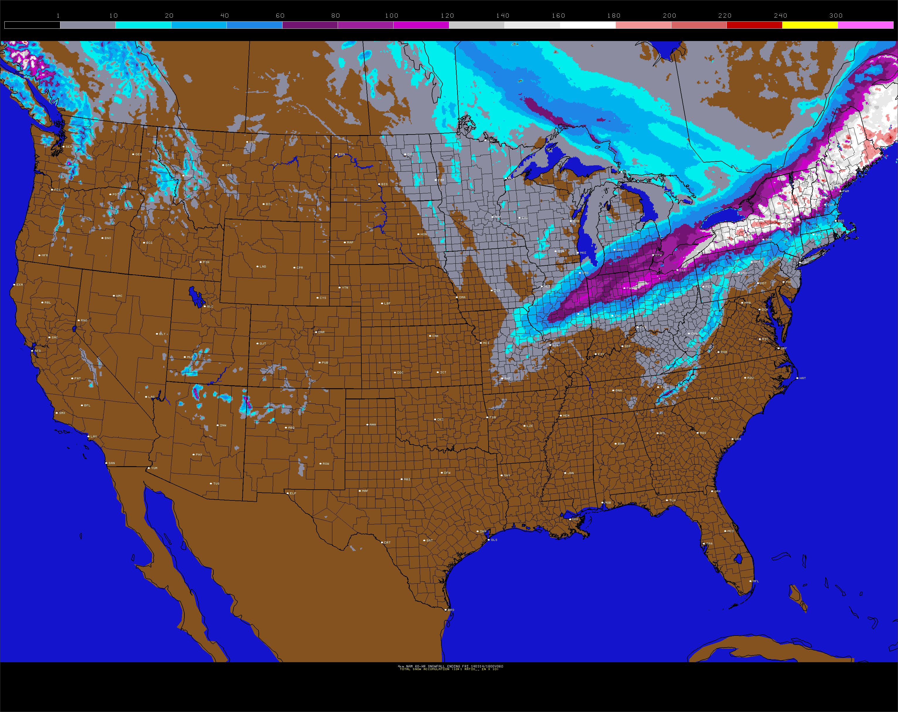
NAM model forecasting storm total snowfall amounts of 1-2 feet in Northern New England.
The ski resorts of Northern New England will likely be thanking their lucky stars. With the holiday weekend of St. Patricks Day approaching, and the second half of the season underwhelming so far, the 1-2 feet of fresh powder will set the stage for a strong finish in many areas. If you want to catch the fresh powder this upcoming weekend, head farther north to the ski resorts of Central and Northern Vermont and New Hampshire (Maine if you want to take a longer trip), where the new powder will be maximized.
Leave a Reply
Want to join the discussion?Feel free to contribute!