-2")
Foggy Friday followed by heavy rain Friday night
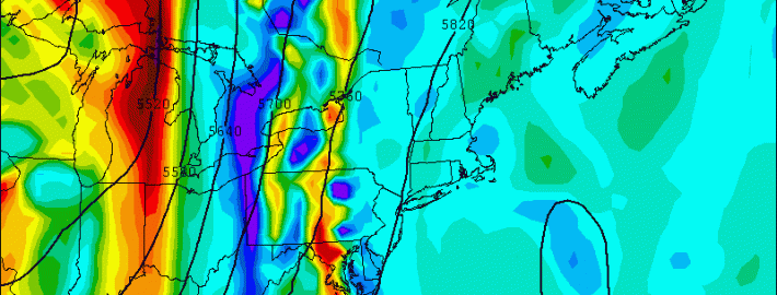
A slow-moving cold front, along with a weak warm front that crossed the region on Thursday, will combine to create interesting changes to our weather — namely the potential for heavy rain on Friday afternoon. The warm frontal passage brought the introduction of a warmer, moist airmass — increasing dew points and precipitable water values. As the cold front shifts toward the area during mid-day on Friday, lifting in the atmosphere will gradually increase which will help to generate heavy rain and even the chance of a thunderstorm come Friday Night.
A large ridge in the Western Atlantic will act to provide plenty of clockwise flow increasing our warmth and moisture. Additionally, to the west, we have a potent trough and associated cold front with plenty of lift. The large ridge is what initially makes the front slow to move eastward, prolonging our fetch of moisture. This is a weather pattern we had often during the beginning of last summer, which is why we had such humid conditions. The initial slower movement of the cold front will keep the heaviest rain to the west of our area during the morning on Friday — but a slow shift eastward is expected. Read more