-2")
Blocking sends disturbance south from Greenland
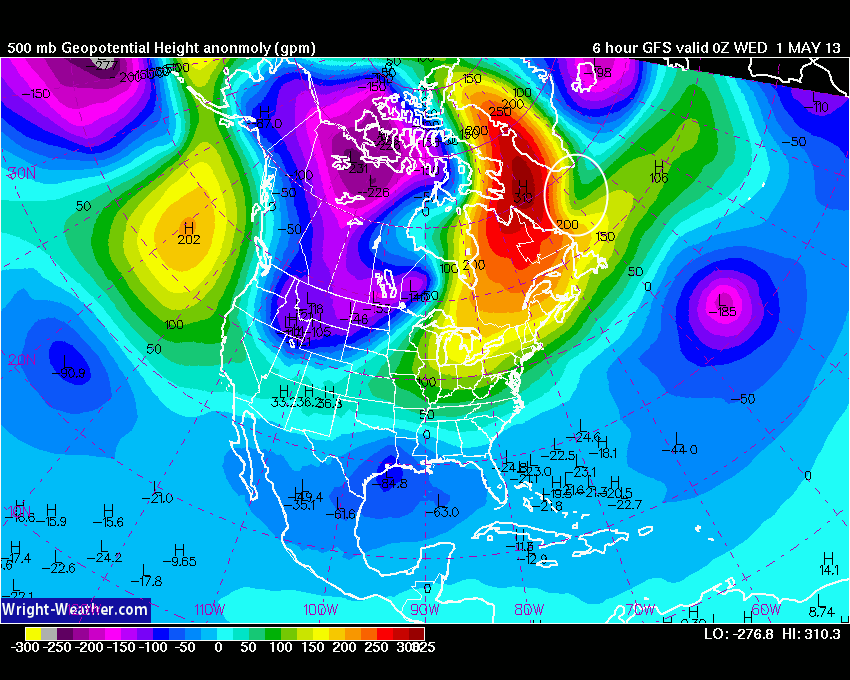
High latitude blocking, which we discussed earlier this week as an important predictor in summer temperature patterns around our area, is at it again. A large and anomalous blocking ridge, building north from Canada towards the higher latitudes into Newfoundland and Southeastern Greenland, is forcing a disturbance and upper level low to shift southward. The disturbance will track southward today — and can be seen on water vapor and visible satellite imagery early this afternoon. The feature won’t directly impact our area, nor will it cause any widespread unsettled weather on the east coast, but it could reinforce east/southeasterly winds as it passes later this week.
The track of the disturbance is the most unusual. To see an upper level low or disturbance track southward from Greenland all the way to a point just a few hundred miles off of the US East Coast is exceedingly rare. However, one glance at the blocking pattern aloft tells you the story — the disturbance had nowhere else to go, being forced into a small window between the trough over the Atlantic and the blocking ridge to the west over Canada. (Click read more for more imagery).
You can check out more imagery of the bizarre track of the disturbance below. Some of these links are time sensitive (i.e they will update each day, so the disturbance won’t be seen on these loops once it moves away from the satellite image later this week).
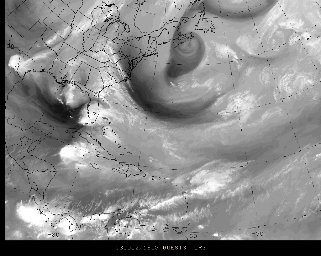
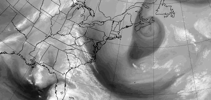
High resolution water vapor satellite imagery from the afternoon of May 2nd, 2013 showing the disturbance over the Northwest Atlantic tracking southward.
Water Vapor Satellite Imagery (PSU Ewall) | 24 Hour Loop
Leave a Reply
Want to join the discussion?Feel free to contribute!