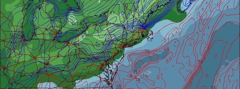
Forecast: Cooler breeze, lower dew points finally arrive
It has been a two week stretch of high dew points, fueled by a persistent West Atlantic ridge which has continually built towards the Eastern 1/3 of the US. Finally this morning, a frontal boundary pushed just off the area coasts helping to lower dew points with winds out of the northwest.
In addition, a cooler airmass aloft will settle into the area late this week with high temperatures falling into the 70s and lower 80s. The break in hot and humid weather may be somewhat short lived, but should still feel enjoyable.
Forecast models have been hinting at the potential for showers late this week, despite the cooler airmass, with a weak coastal system moving offshore. Thereafter, temperatures should return to near normal levels by this weekend — but chances of showers and storms may continue.
Dorian could form today: The NHC is carefully watching Tropical Depression 4 in the Eastern Tropical Atlantic this morning — and the system may soon form into Tropical Storm Dorian based on satellite appearance. The storm is forecast to continue on a slow westward heading over the next several days. Intensity forecasts remain rather low and the storm’s strengthening is expected to be mitigated at some point by strengthening atmospheric shear. Regardless, stay tuned for updates as the system continues its slow jog westward over the vast Tropical Atlantic waters.


Leave a Reply
Want to join the discussion?Feel free to contribute!