-2")
Forecast: Pleasant work week ahead
Although it may still technically be summer on the calendar, meteorological seasons seem to be the better indicator of sensible weather so far this week — especially this morning as low temperatures fell into the 40’s and 50’s with some upper 30’s in the northwest suburbs. The cool temperatures are occurring as a result of a cold front, which passed through last night and ushered in a cool (but progressive) airmass from Canada. These airmasses typically become increasingly common as the autumn goes on, but don’t stick around for too long early in the season. This year will be no different, as the week will feature pleasant weather but moderating temperatures.
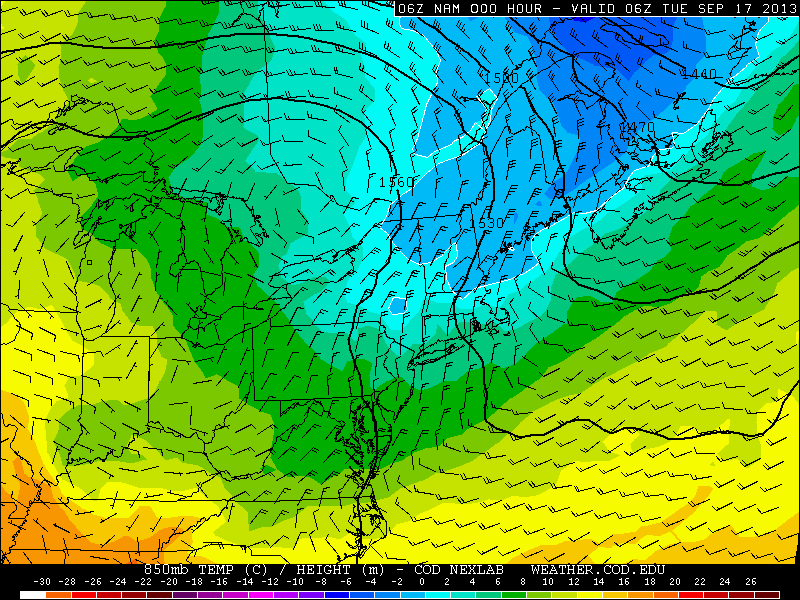
NAM model, showing the very cool temperatures at the 850mb level throughout the Northeast on Tuesday morning.
Canadian high pressure looks to be in control from Tuesday through Saturday, with only a slight chance of showers on Saturday afternoon. Deep blue skies with lots of sun can be expected on both Tuesday and Wednesday, with mostly sunny conditions continuing through Friday. Temperatures, however, will be a reminder that autumn isn’t quite in complete control yet. The airmass will modify during the week (the cool air loses its source and moderates towards normal in our area over time), and high temperatures will slowly rise. Tuesday will feature highs that struggle to reach 70 (mid/upper 60’s are more likely), but highs could approach 80 by Friday.
Regardless, this week looks to be a gorgeous one with no weather hazards or precipitation chances. Autumn can often be a transition season with plenty of disturbances and lots of chances for precipitation, so weeks like this can sometimes be few and far between. We hope you are all able to enjoy it!
Leave a Reply
Want to join the discussion?Feel free to contribute!