-2")
Nice fall weather today and tomorrow, scattered showers to end the week, potential pattern change to colder weather next week
On this Columbus Day afternoon, our area is seeing lovely fall weather with temperatures in the mid 60s, and a few mid and upper level stratus and cirrus clouds off to the west.
High pressure over the area is giving us nice weather. The Low pressure in the Plains will affect us later this week.
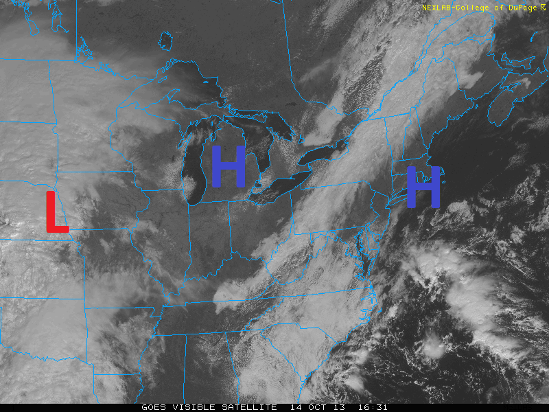
This is in large part thanks to the high pressure system that has settled in over our area, as seen in the above image. Sunny skies with thin clouds off to the west will continue for the rest of this afternoon. The high pressure is promoting some easterly flow off of the Atlantic, helping to usher in cool air off of the ocean — which is why temperatures will struggle to get out of the mid 60s.
The thin clouds are caused by a weak frontal system off to the west associated with the thin band of clouds in Upstate NY and Central PA. This front will dissipate as it heads east, but not before bringing in a few additional mid-level clouds for tonight. This will keep temperatures from really plummeting — lows should be in the upper 40s in cool spots, with low to mid 50s elsewhere.
Tomorrow looks to be a bit warmer thanks to the high pressure system in the Great Lakes building in. Winds will have a bit more of a westerly component, helping to create some downsloping, yielding temperatures around 70 degrees.
The forecast becomes a bit tricky starting on Wednesday, as the low pressure system in the Plains approaches the area and an inverted trough develops offshore. Clouds will be on the increase for Wednesday, and the inverted trough may help to spark a few showers for Wednesday well ahead of the front. Highs should approach the lower 70s. The front itself should cross the area for Wednesday night and Thursday morning, perhaps giving the area a a brief bout of steady rain — though the heaviest rain should be to the north and west of our area.
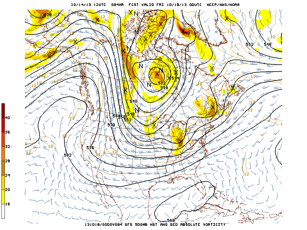
500mb and vorticity image from the GFS shows a potential brief break from unsettled weather on Thursday in the midst of shortwave ridging, but another storm system developing to our west potentially for Friday.
Thursday itself may be partly sunny, due to the fact that we will have some shortwave ridging. This is due to the upstream ridging from the shortwave that was the aforementioned cold front, and the upstream ridging from a new shortwave in the Ohio Valley. Temperatures should be in the lower 70s.
Overall, though, a large trough developing in Central Canada and the northern tier of the country will favor an active pattern to close the week and the weekend, and bring a mini train of shortwaves heading from the Ohio Valley and into the northeast. There will be one for Thursday night and Friday which may bring a few more showers, though there is a chance that the rain stays to the south.
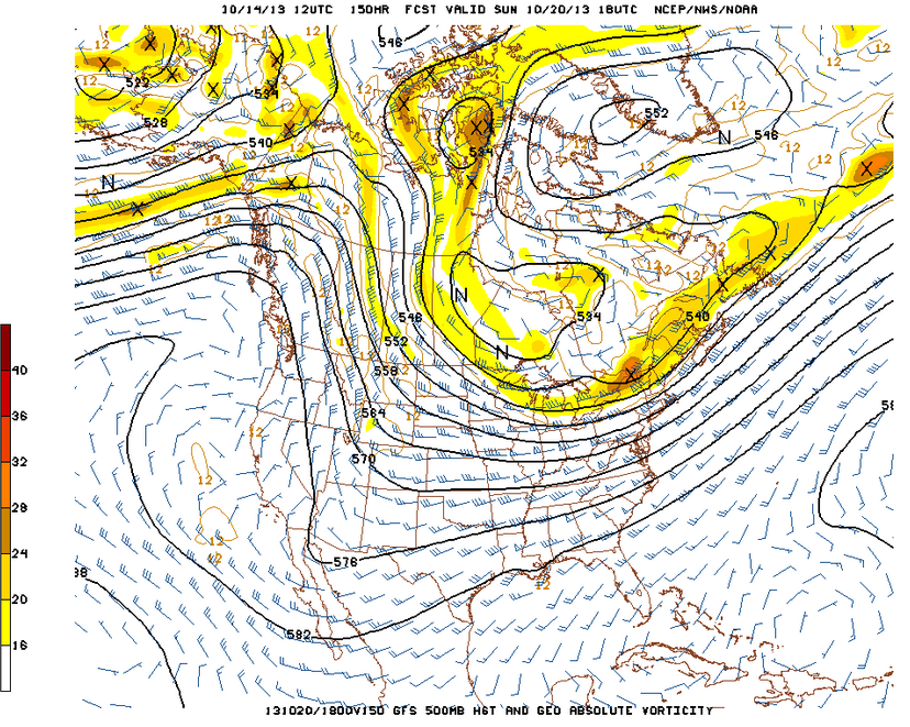
500mb image from the GFS for Sunday shows the large trough moving in, with a -NAO block to the north. This could potentially mean chilly weather for next week.
Saturday should dry out, but this is when we will have to start watching for a pattern change to colder weather. The large trough will start to dive southeastward towards our area, and some -NAO blocking may also develop, helping to keep the trough over our area. We are still uncertain as to whether the pattern change will be ushered in by a larger storm system, or just a cold front — but the potential transition period to a colder, crisp pattern would start on Sunday. More details on the potential pattern change will be addressed in future posts.
Enjoy your day, everyone!
Leave a Reply
Want to join the discussion?Feel free to contribute!