-2")
PM Update: First frost, freezes likely tonight
A chilly new airmass will push into the area this evening behind a coastal storm system, which is currently scooting east and northeast of our area. A few showers moved along the coasts of New Jersey and New York this morning and afternoon, but are expected to move northeastward and stream into Southern New England tonight. As the system shifts northeast, stiff west-northwesterly winds behind it will usher in a cold airmass with 850mb temperatures falling from around 2 C this afternoon to anywhere between -4 and -6 C by Thursday.
The National Weather Service has issued Freeze Warnings from 2:00-9:00am Thursday in Sussex Co (NJ) and Frost Advisories for Somerset, Morris, Hunterdon, Passaic, Bergen (NJ) Rockland, Putnam (NY) and Fairfield, New Haven (CT). Temperatures are expected to remain a few degrees warmer in the city, falling to the lower 40’s. The growing season may end tonight in many interior areas — and will have another chance to do so Thursday Night into Friday, where low temperatures are expected to be even a few degrees colder.
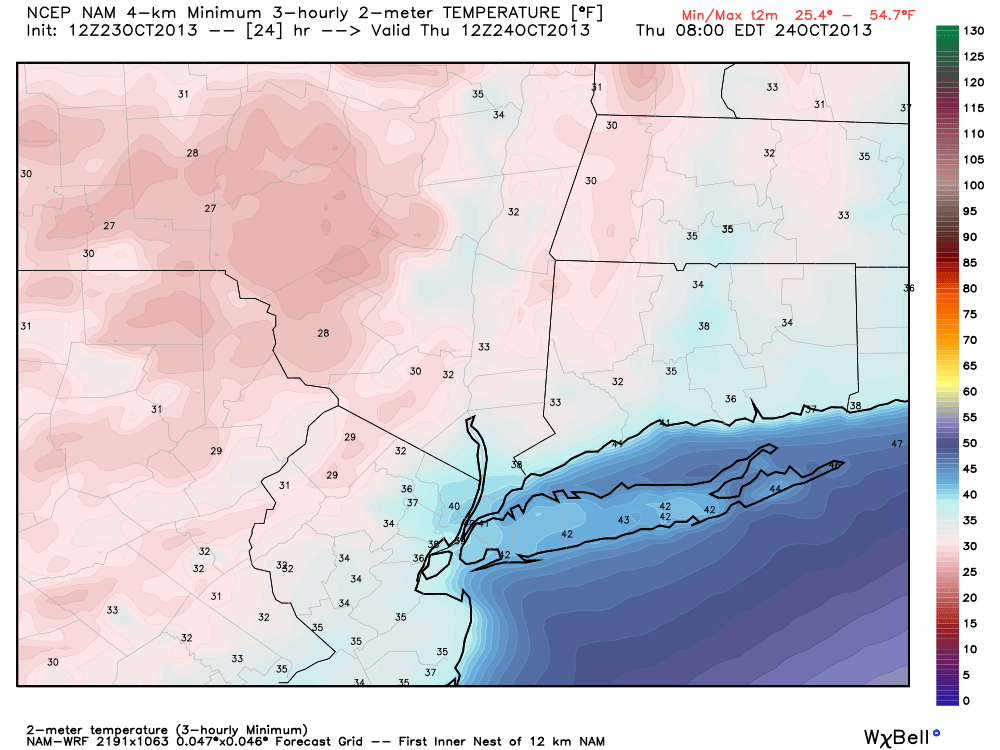
NAM model forecasting low temperatures in the upper 20’s to lower 30’s in the interior Wednesday Night into Thursday morning.
Sandy Archive Online: We are pleased to announce our Hurricane Sandy Archive page, which we made available today. The page features images, discussion, data and reports from Sandy which occurred almost one year ago this week. We would like to thank the various sources we used to accumulate the data (listed on the page), as well as those who helped to contribute to it. Stay tuned over the next several days for additional posts as the anniversary of the event approaches.
Great writeup as per usual.