-2")
PM Update: Pleasant, warming trend begins midweek
The cooler than normal weather which has dominated the pattern over the past week or so will take a brief respite over the next few days, as a storm system surges towards the Central US and brings a warm front towards the region. In the meantime, pleasant weather is expected tonight — with temperatures falling from the middle 50s into the 40s overnight.
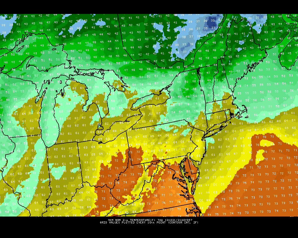
NAM model showing high temperatures in the middle to upper 60’s throughout the area on Halloween (Thursday).
The warm front, which approaches the area by Wednesday, will bring with it an increase in clouds. But more notably, temperatures will be rising steadily aloft. For the sake of comparison, 850mb temperatures will rise to near or over 10 C on Thursday — a far cry from the -4 to -6 C values observed this past weekend. Sensibly, this means the weather will be warmer. But the presence of clouds and showers will put a lid on the warming potential. Halloween looks to feature warmer air with temperatures in the 60s to near 70, but lots of clouds and the potential for showers.
ISS Today, ISON still brightening: The International Space Station will make a bright pass overhead at 6:15pm. The space station is expected to shine at a magnitude of -4, which is quite bright. In the west-northwest sky, it will slowly progress between 615 and 618, before disappearing.
Comet ISON continues to brighten on it’s trip towards the sun. Latest observations have the comet nearing magnitude 8, which is significantly brighter than the magnitude 11 observed last month. Increased brightening is expected to continue before perihelion a month from now on November 28, 2013.
Leave a Reply
Want to join the discussion?Feel free to contribute!