-2")
Forecast: Warmer, strong winds possible Friday
For the first Halloween in three years, the weather hazards in our area will be kept to a minimum. After a damaging snowstorm in 2011, and the recovery from Hurricane Sandy in 2012, today’s weather will feel like a major relief. Additionally, it will feel like the top of a week-long roller coaster of temperatures. Highs today will top out in the upper 60s to lower 70s, but the humidity will make it feel muggier than it has been in several weeks. A few showers are possible across the north and western suburbs later this evening.
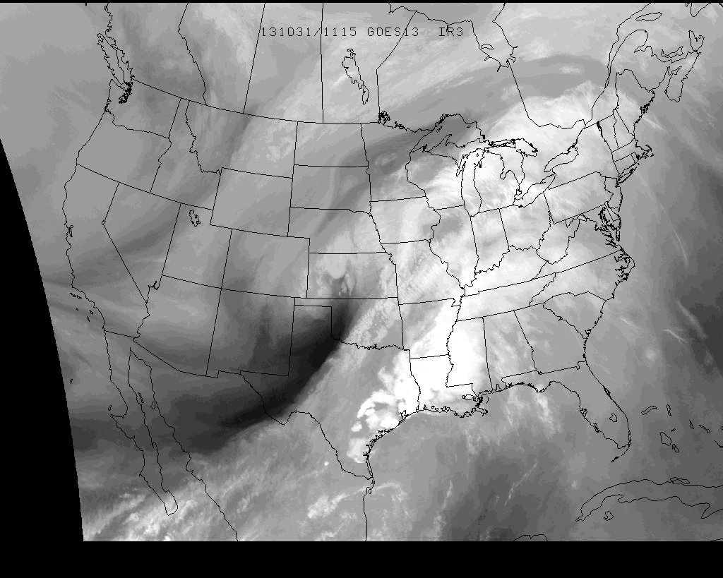
Water Vapor Satellite imagery from the morning of 10/31/13, showing moisture streaming towards the area ahead of a storm over the Central US.
Windy Friday: The storm system responsible for the southwest flow and warmer temperatures on Thursday will bring a front through the area on Friday — and plenty of dynamics in the mid and upper levels of the atmosphere. The result will be potential for very windy conditions throughout the area near and ahead of the front. Strong winds above the surface could mix down in any heavier precipitation, although limited instability should keep damaging winds to a minimum. Winds gusting over 40mph are not out of the question throughout the area as the front nears the area — and gusty winds are expected throughout much of the day. The Storm Prediction Center has placed parts of the area in a 5% risk for severe weather, mainly owing to the potential for isolated thunderstorms to mix down the aforementioned strong winds.
High wind watches have been issued for the East end of Long Island and much of Southern New England, where stronger winds are expected Friday. Here, the potential for stronger winds to mix down is expected to be slightly higher. Gusts to 50_ miles per hour are possible.
For more information on the High Wind Watch, visit the official watch information page from the NWS. Make sure to follow us on Twitter and Facebook for updates on additional watches and warnings which may be issued.
Leave a Reply
Want to join the discussion?Feel free to contribute!