-2")
PM Update: Much cooler air filtering in
Behind a major cold front, which moved through very early this morning, westerly winds began on Monday. Winds picked up considerably on Monday afternoon, but the air remained relatively warm. Temperatures in the mid levels if the atmosphere remaining somewhat warm allowed for the highs to reach into the mid 60s — making for a pleasant, comfortable late-autumn afternoon. But the airmass is changing rapidly behind the aforementioned cold front.
The low pressure system which helped drag the cold front through the area deepened below 967 hPa in Southeast Canada on Monday, and much colder air will surge eastward to the south of it. Temperatures will plummet into the 20s and 30s overnight on Monday evening into Tuesday morning throughout the area — especially over the interior. Pleasant weather is expected to continue through mid-week with near seasonal temperatures.
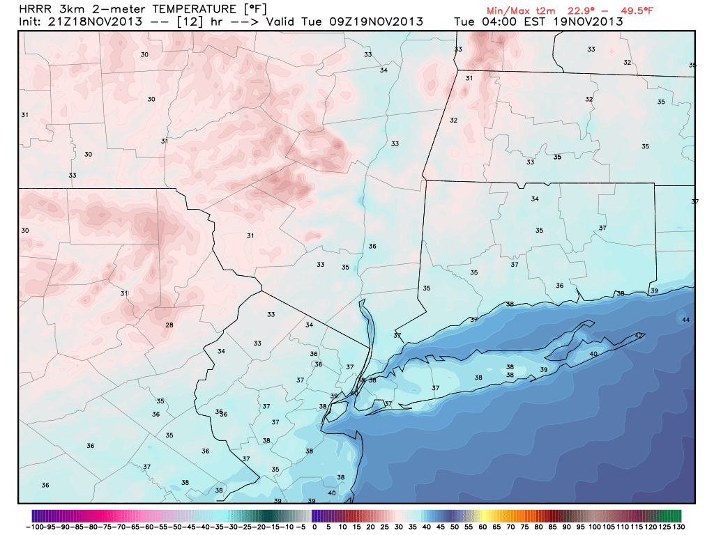
Forecast low temperatures on Tuesday morning, from the HRRR model.
News, notes: Our winter forecast comes out this Thursday, November 21st! We have been hard at work over the past several weeks and are finally almost finished writing the end product. If you haven’t yet, check out our latest updates on Comet ISON which is diving towards the sun and now only 10 days from perihelion. Our most recent article, with updates on how to see the comet, was posted earlier this morning.
Additionally, NASA will launch a rocket Tuesday Night which, weather permitting, will be visible up and down the East Coast. The 730pm launch is expected to be visible from NJ and NYC about 60 seconds after liftoff. Look to the southeast sky for a great view of the rocket.
Leave a Reply
Want to join the discussion?Feel free to contribute!