-2")
The forecast headache that is next week
Arctic air will be pouring into the Rockies, Pacific NW, and Northern Plains over the next several days as the mid level ridge centered near Alaska energizes. Whenever we see the Alaskan ridge, it suggests that cross polar flow has initiated from Siberia to North America due to the clockwise flow around that mid level high. This pattern is polar opposite of what we saw the past two winters over Alaska. Remember the stories of yards of snow and endless bitter cold in AK? That has not been the case as of late due to the strong positive height anomaly at the 500mb (18,000ft) level of the atmosphere.
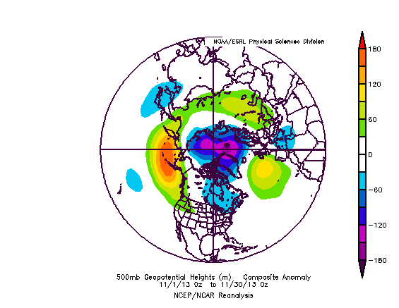
The composite for November 2013 illustrates the ridging that has been taking place in the northeastern Pacific and AK, exactly where a trough pattern dominated in 2012.
Going forward, this pattern is progged to more or less remain in place. We are currently seeing a dip in EPO values to around -4 to -5 standard deviations below normal. This is a rare occurrence and indicative of the powerful ridging over Alaska right now. As a consequence, bitterly cold air will be entering the USA late week and gradually spreading eastward across the Mid-west, Lakes, and finally the Northeast by the weekend.
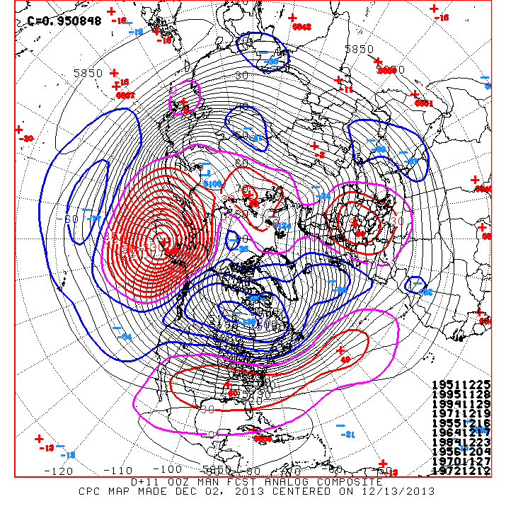
The analog package for the upcoming 10 days period suggests a high likelihood for negative EPO maintenance, as well as a continuation of the positive AO/NAO regime. Throughout history this teleconnection set-up has shown to produce SE ridging and a “gradient” pattern temperature wise across the USA, with colder north, warmer south scenario.
The 500mb pattern for the above dates is as follows for the northern hemisphere. Notice the strong positive height anomaly near AK indicative of the -EPO, and the +NAO/AO.
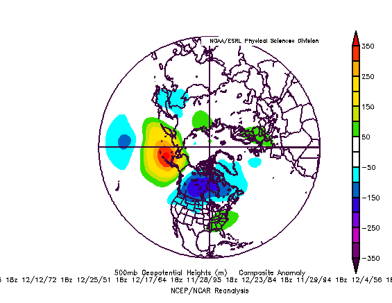
A closer look at the US shows the presence of the mid level SE ridge with higher than normal heights in the Eastern US and lower heights in the West due to the negative PNA.
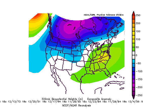
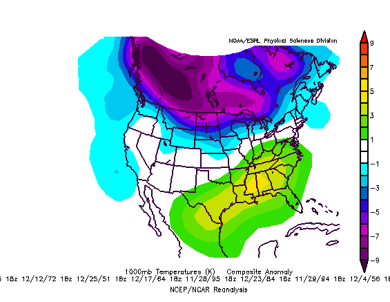
However, it is important to keep in mind that this will be a pattern where the 500mb heights could be slightly deceiving. Normal to above normal heights at the 18,000ft level may not be able to detect the strong low level cold at the surface. Case in point, below is the temp anomaly map for the above 500mb heights. Notice there’s normal to cooler than normal temps from the Mason-Dixon line northward, which is the pattern we should expect for the coming 15 days.
This dovetails into the forecast headache of next week. A thermal gradient induced by this -EPO/-PNA and +NAO/AO regime will set up across the United States, with a SW-NE mid level flow aloft from the Plains to the Northeast.
Numerous waves of low pressure are liable to run SW-NE along this gradient boundary, with snow/ice on the north side and rain to the south. The question is – where will these storms track and which side of the boundary will we be on?
Usually what happens in these situations is each successive wave of low pressure slightly suppresses heights along the east coast as it passes. So the first wave late this week should be the warmest, with rains for most of us. Thereafter, uncertainty abounds, and precipitation type will become an issue for later this weekend into early next week. Some guidance drives the surface low and associated H7/H85 lows to our north, resulting in rain, while other guidance is more bullish on a stronger surface high pressure holding the cold sufficient for moderate snow/ice. It’s too early to say which model if any is correct right now.
With that being said, the upcoming period, especially early next week, could get interesting for our first wintry potential.
Leave a Reply
Want to join the discussion?Feel free to contribute!