-2")
Forecast: Dense fog, warmth before big cold front
Friday Morning Update: Dense fog advisories have been canceled by the National Weather Service (despite the title of our article remaining the same) this morning. Periods of fog are still possible, but won’t be as thick or widespread. Showers are expected to become numerous over the next few hours and rain may become steady to briefly heavy at times. Temperatures will begin to drop throughout the area later this morning in response to an approaching and passing cold front.
The cold front, which will cross on region on Friday, will also bring periods of showers and unsettled weather throughout the day. More importantly, it will mark the end of any semblance of a warm airmass with its passage as temperatures will plummet behind it on Saturday through the second half of the weekend. In fact, rain and showers may end as frozen precipitation on Saturday morning, especially across parts of the interior. Any accumulations are expected to be minimal, but stay tuned for updates as it likely will be a short term/nowcasting type situation.
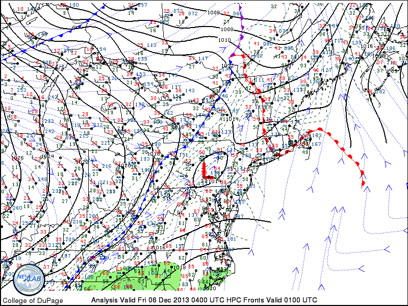
Surface analysis from late Thursday night into Friday morning showed an approaching cold front, with warm conditions still in place throughout the area.
More wintry weather possible on Sunday
With the cold front pushing just off the coast and east of the area on Sunday, colder air will have settled into the region but will remain more stubborn to our north over New England. An approaching mid level disturbance will trigger a weak low pressure system, which is forecast to shift from the Ohio Valley off the coast of the Mid Atlantic from Sunday into Monday. Warm air advection (push of warm air in levels of the atmosphere) is likely to occur throughout the mid levels at a fairly rapid pace as precipitation approaches the area, but a colder surface could mean a period of frozen precipitation across the interior.
Nearer to the coast, any snow or sleet that falls should transition to rain within an hour or so with minimal accumulations that will eventually wash away in periods of rain. But over the interior areas and higher elevations, some snow and sleet may accumulate on Sunday Night, depending mainly on the depth of the cold air and the speed at which warm air moves northward. We are expecting this to be another nowcasting situation, so stay tuned for updates as the weekend approaches.
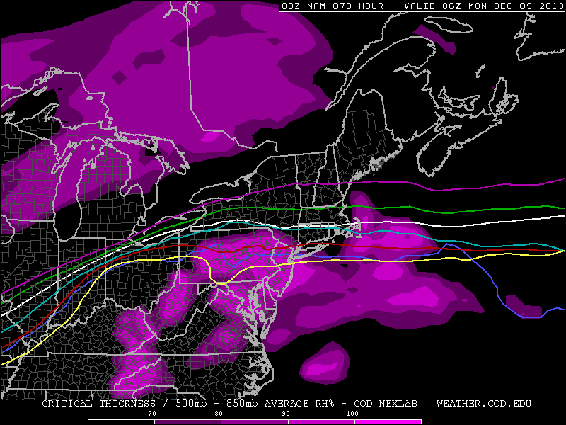
NAM model’s forecast precipitation and critical thickness lines for frozen precipitation on Sunday. Notice a small area supporting frozen precipitation — with quick warming occurring as a result of warm air advection.
As it stands now, periods of snow and sleet are likely away from the coast and city on Sunday Night, eventually transitioning to rain before precipitation ends. Some light accumulations are possible, and becoming likely, across these areas. We are expecting to release a forecast map within the next 24 hours as we further assess data and information.
By the beginning of next week, the multiple disturbances will shift east/northeast of the area, allowing a frigid airmass to take full control of the forecast. High pressure building in will secure the cold — with temperatures likely falling into the teens and possibly single digits in many areas overnight next week.
Leave a Reply
Want to join the discussion?Feel free to contribute!