-2")
PM Update: Wintry weather continues
Several inches of snow fell earlier today across parts of Southeast Pennsylvania, into Southern and Central New Jersey as a mid level disturbance triggered precipitation — which fell along a gradient between warm air advection to the south, and cold and dry air to the north. The combination lead to an enhanced frontogenesis event, with bands of heavy snow lasting several hours during the day on Sunday. Snowfall totals within warning criteria (over 6″) fell in parts of Delaware, Pennsylvania and New Jersey by the time the snow let up. Farther north, closer to Northern New Jersey and New York City, the drier air won the battle. A half inch or so of snowfall fell before precipitation entered a lull on Sunday evening.
Which is where we pick up — with a break in precipitation occurring throughout the area this Sunday evening. Warm air advection, however, is ready to come back for more — with additional precipitation expected to develop by later tonight into Monday morning. As the warm air advection helps to drive precipitation farther north, it will also warm the mid levels of the atmosphere — allowing for a gradual changeover in precipitation type throughout the area. Winds turning from northeast to southeast by later tonight will also warm the surface, especially along the coast. Although another period of snow is likely, it should be somewhat brief in the city and near the shore before transitioning to sleet and plain rain. Farther inland, a period of frozen precipitation is expected as well before a changeover. It is the far northern suburbs which may still experience a more prolonged period of snow and sleet — with the potential for 1-3″ of snow and sleet by Monday morning.

NAM model showing mixed precipitation accumulations through Monday morning — freezing rain, sleet, snow and rain.
The National Weather Service continues Winter Weather Advisories throughout much of the area through 3:00am (New York City and coastal areas) and 6:00 am (Interior suburbs of New Jersey and New York). Travel this evening will be slick, with areas of ice and snow on all roads. This will be less of an issue near the coast and in the 5 Boros, especially with the lull in precipitation allowing for crews to treat the roads. Inland, colder temperatures and another period of wintry precipitation suggest that the morning commute may be messy.
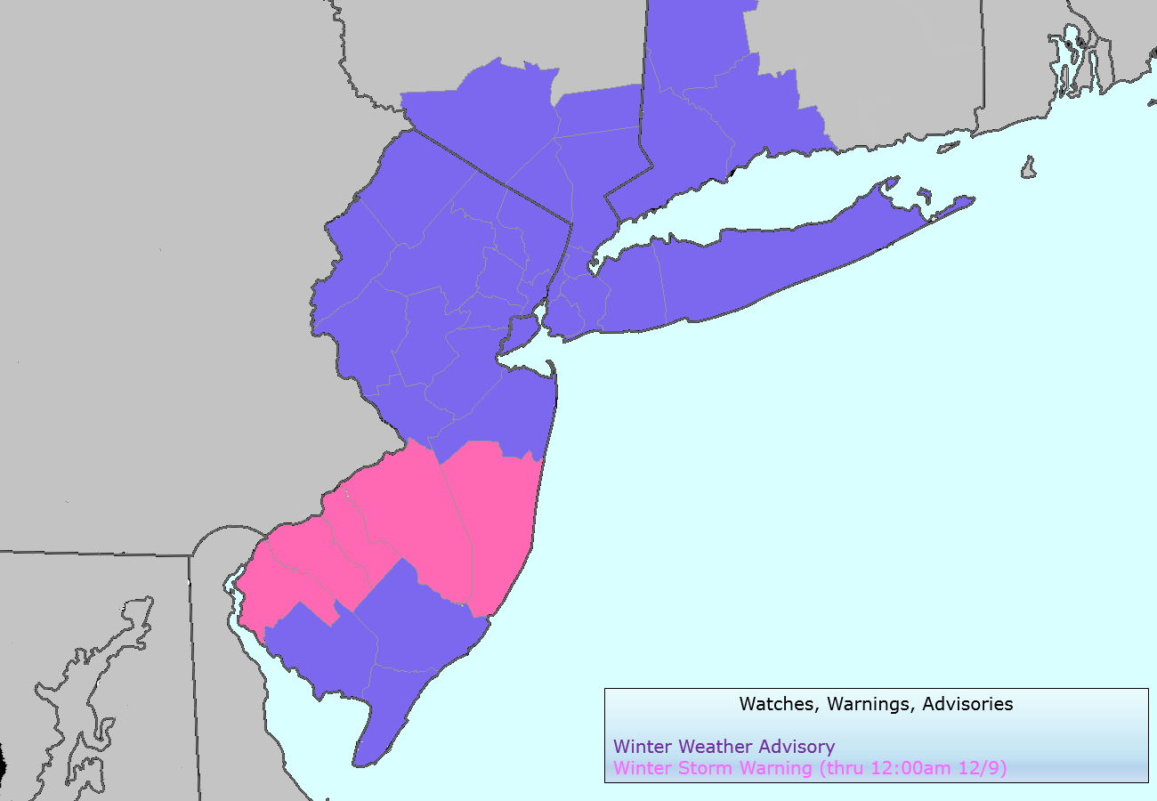
National Weather Service watches, warnings and advisories valid from Sunday Night into Monday morning
Despite the eventual changeover to rain, more wintry weather is expected early this week with a period of snow possible throughout the area on Tuesday. After Sunday’s system passes to the north and east, a reinforcing shot of cold air will bring temperatures both aloft and at the surface down to wintry levels once again. And a developing mid level disturbance may kick off additional precipitation throughout the area. Forecast models, however, continue to struggle with the intensity and placement of precipitation with some focusing the snow just offshore to our south and east. Newer models from this afternoon, however, suggest a period of moderate to heavy snow is possible throughout New Jersey and New York on Tuesday into Tuesday Night.
With the forecast model discrepancy it is rather difficult to predict snowfall amounts at this stage. But it appears plausible that, should the forcing for precipitation remain onshore, some locations could pick up another advisory-level snowfall (2-5″) on Tuesday with the disturbance. The positioning of that area of snow remains of high uncertainty.
Stay tuned on Monday for additional information on the potential for snow through Tuesday — and of course, keep an eye on our social networks throughout the night tonight for information on the incoming second round of precipitation and changeover from snow to sleet and rain.
Leave a Reply
Want to join the discussion?Feel free to contribute!