-2")
Wintry weather continues; More snowfall Tuesday
A wintry mess was the most fitting way to describe the morning commute on Monday as snow, sleet, and freezing rain provided a myriad of issues with travel. Traffic, accidents, and delays on the area roads and with local mass transit likely lead to a headache for most — if you were able to get in to work or class without an issue, consider yourself lucky. The ice and wintry precipitation caused closures of schools and businesses over the interior, but coastal and urban locations including the NYC Metro were much warmer by morning — allowing for a more wet commute than white.
The disturbance moving through the area will shift northeastward on Monday, ending with scattered showers throughout the area. Colder air will begin to filter in rapidly behind the system on Monday Night. As an early warning, you’ll want to be extra careful on the evening commute and during any overnight travel as well. The falling temperatures could lead to re-freezing of any water on roadways and other surfaces.
But our problems don’t end there. Forecast models have come into better agreement on another disturbance which will shift northeast through the area on Tuesday. Much colder air will have moved into the area both aloft and at the surface, so this storm system looks to provide less difficulties in forecasting precipitation type: Mainly snow. Bands of snow will develop by late morning into afternoon on Tuesday, accumulating initially across the interior ( a little slower to do so on the coast and in the city with warmer ground and surfaces).
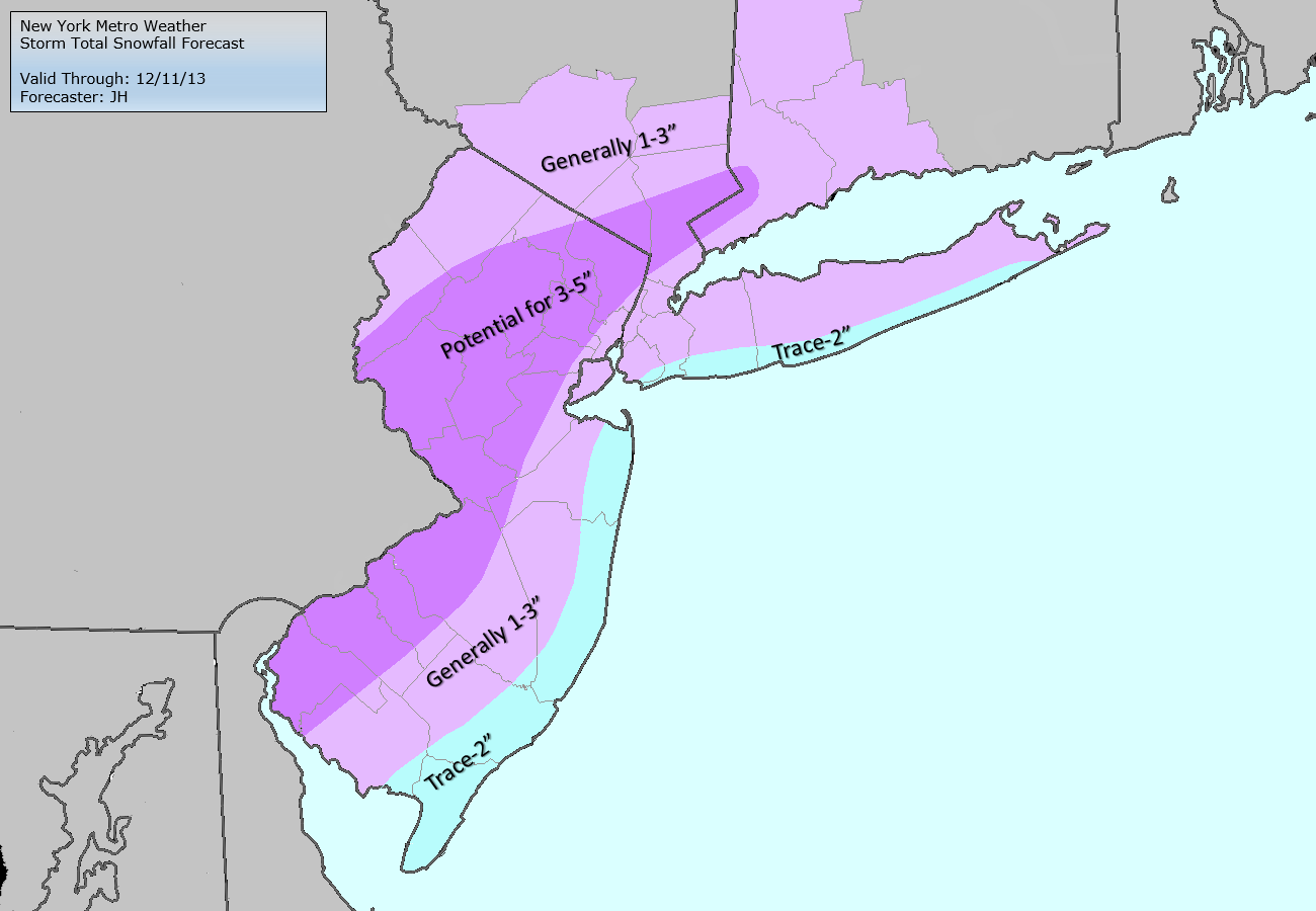
Storm Total Snowfall forecast through Tuesday evening. Please note that forecasts are subject to change prior to the event.
Several hours of light to moderate snow continuing into Tuesday night have increased confidence in an “Advisory level” snowfall event of 1-3/2-5″ throughout the area, with higher amounts likely away from the city. Still, our first legitimate snowfall of the year will occur — so once again plan some extra time for your travels. Our official snowfall map is attached, and later today expect a severe weather briefing and forecast totals at specific locations.
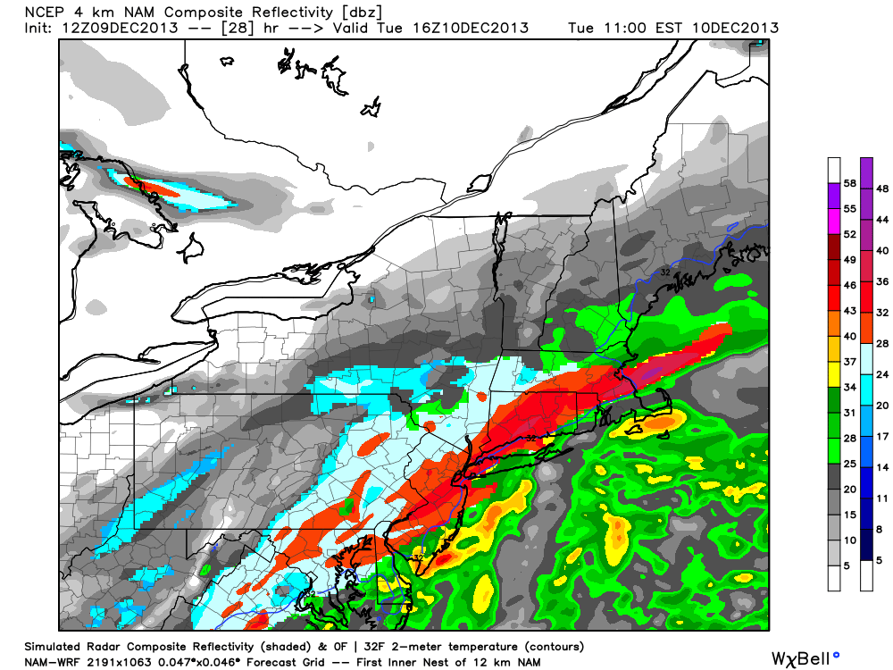
NAM model showing a band of heavy snow over the New Jersey and New York City Metro area Tuesday morning.
Stay tuned later today for our pre-storm briefing post which will include detailed information on timing and snowfall amounts which we are still ironing out during the forecast shift today. Finally, make sure to stay tuned to our social networks. We’ll be live all day and will tweet and post a link to our live blog thread for Tuesdays snowfall when it is posted. If you have any questions, comments or reports (pictures are awesome too), don’t hesitate to contact us!
Leave a Reply
Want to join the discussion?Feel free to contribute!