-2")
Tranquil weather will give way to weekend nor’easter
Colder, but more tranquil weather has settled into the forecast area to end the holiday week. After some light snow showers associated with a weak front and coastal system on Thursday, pleasant weather is expected on Friday and Saturday. Additionally, there will even be a bit of a warming trend both days, as high temperatures reach into the 40’s. The arctic air which stepped into the area earlier in the week won’t have any reinforcement until early next week, and so airmass modification will allow for temperatures to push warmer on both Friday and Saturday especially as the surface high pressure slips off the East Coast.
By Sunday, the weather becomes more active as a southern stream disturbance will slingshot up the coast. The system will ride on the eastern periphery of an incoming trough over the Central United States which, in its own right, will carry a ton of cold air with it. This means a few things, however. First, the system looks to be progressive despite its deepening off the coast. Second, the system will have plenty of warm air with it — and the cold air will have already modified out of the Northeast US. The aforementioned antecedent airmass won’t hold much potential for wintry precipitation. As such, the main concerns for this weekends system are a period of heavy rain and some gusty winds.
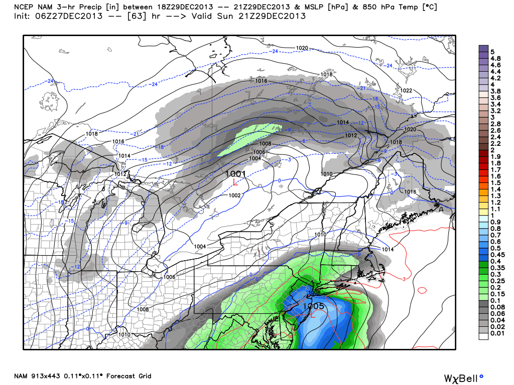
NAM model forecasting a coastal storm system on Sunday, providing the area with heavy rain.
Despite the increasing confidence in a system moving up the coast, some uncertainties still exist in regards to the eventual track of the system. Forecast models have been waffling between a track closer to the coast, and a farther offshore/more suppressed surface low track. The difference in the two would be fairly noticeable in terms of sensible weather in our area. A track closer to the coast would bring a deeper storm nearer to the area — and subsequently provide a period of heavier rain and gusty winds near the area shores. Farther east/southeast, and the rain becomes lighter and impacts along the coast (as far as wind/rain are concerned) become a bit lighter.
At the present moment, confidence in a storm track close enough to the coast for a period of heavy rain is high. Increasing clouds on Sunday will give way to showers developing from southwest to northeast and increasing in intensity by Sunday evening. Making matters worse — the airmass at the surface certainly won’t feel “warm” despite the lack of support for frozen precipitation. It seems fairly likely that many areas will experience a period of steady rain with temperatures only hovering in the mid to upper 30’s. So be sure to pack your heavy jackets, blankets, and umbrellas for Sunday Night. If there ever was a night to stay in and enjoy a movie and hot cocoa, Sunday night looks to be the night.
Beyond Sunday’s storm system, the pattern looks to remain active. Much more cold air will become involved as the polar vortex becomes re-established over Central Canada. That said, the degree of storminess remains somewhat up in the air — as a lack of high latitude blocking and a generally progressive pattern provides potential for a fast flow and cold, but dry weather. More long range discussion forthcoming today (including a video!). Be sure to stay tuned here and on our social networks for the latest.
Leave a Reply
Want to join the discussion?Feel free to contribute!