-2")
Colder, more wintry weather set to return
It was a wonderful Saturday. High temperatures in the 50’s, plenty of sun and no precipitation to speak of. The first “winner” of a day in several weeks, in fact. The unfortunate news is that it won’t last long, and in fact the weather from Saturday will become a distant memory by the middle of the upcoming work week. The winter pattern, which dominated for the last month or two, will return — and remain relatively relentless.
Colder temperatures will begin filtering into the area by Sunday, as a frontal boundary nears the area. All won’t be lost, still, as high temperatures will reach back into the 40’s and 50’s just ahead of the front. But as the front nears, temperatures will begin to drop — and winds turn to a much cooler direction. By late Sunday Night into Monday, forecast models are in agreement that light precipitation will begin to develop just behind the cold front, beginning as rain and likely ending as snow in some locations away from the coast.
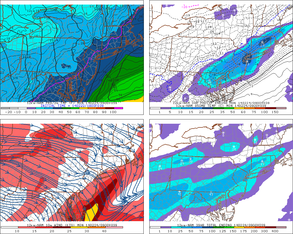
NAM model forecasting precipitation along a frontal boundary on Monday morning.
The threats for wintry weather won’t end on Monday morning, and colder air will begin to pour into the area as a large upper level trough works its way towards Southeast Canada. High temperatures will return to the 20’s and 30’s throughout the area during the middle of the day on Tuesday and Wednesday, with cold northwesterly winds serving as a reminder that winter isn’t quite over yet.
Another disturbance moves towards the East Coast during the middle of the week, on Wednesday, and forecast models have hinted at the potential for a developing coastal storm. At this time, however, most agree that the system will remain generally progressive (not a farfetched idea given the suppressive Polar Vortex hanging out just to our north). But any trend towards a stronger or more amplified disturbance could mean trouble –as the system would amplify up the coast and bring the threat for wintry precipitation to the entire forecast area.
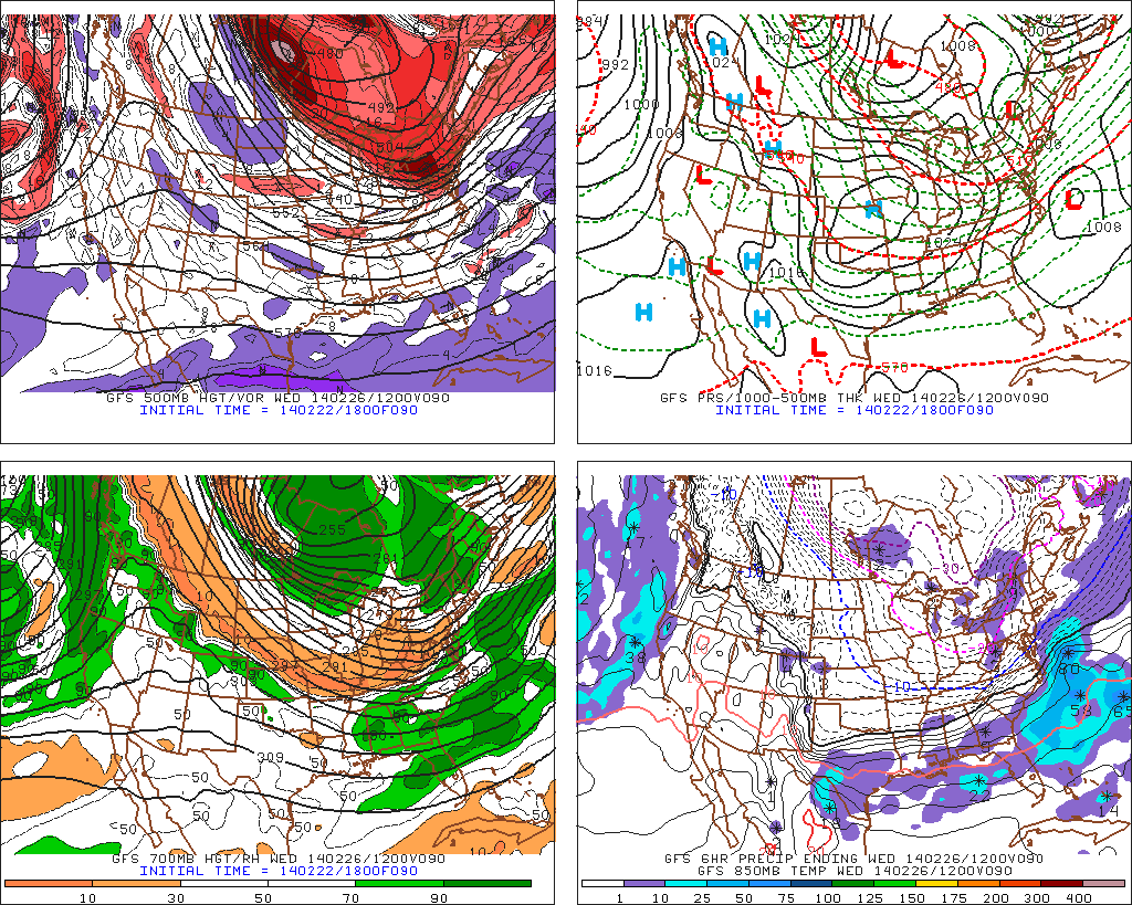
GFS model showing a storm system off the East Coast on Wednesday.
The active pattern, with plenty of disturbances, looks to continue through the end of the work week and into the next weekend. And with plenty of cold air available just to our north, the threat for wintry precipitation seems higher than normal, although we don’t have any specific storm threats that we are ready to pin down yet beyond Wednesday. As far as a break in the pattern, and some more sustained normal or above normal temperatures, no signs of it yet. But we’re watching carefully for the first appearance of a respite in the wintry pattern on the model guidance.
Leave a Reply
Want to join the discussion?Feel free to contribute!