-2")
Cold air filters in, light snow likely this week
Temperatures fell back towards normal on Monday (it wasn’t hard to notice the lack of warmth and return of colder wind), with highs generally only reaching the mid to upper 30’s throughout the area. While this certainly felt more chilly than what we experienced this weekend, the real chill is still on the way this coming Tuesday and is expected to continue through the week. More interestingly, a parade of disturbances is likely to traverse the country from the Pacific northwest towards the East Coast, providing multiple opportunities for wintry precipitation in the area.
The main difficulty in the forecast will be the exact track of these systems, owing to the positioning of the Polar Vortex which is forecast to remain parked over Southeast Canada. This positioning allows for plentiful cold air, but also suppresses the baroclinic zone and favored storm track to our south. Forecast models, picking up on this and the southward sag of the arctic front, have trended farther south and east with the storm system forecast to track near the East Coast on Wednesday — the first in the parade. Currently, light snow still seems likely due to favorable jet streak positioning, but the heaviest precipitation is expected to remain offshore.
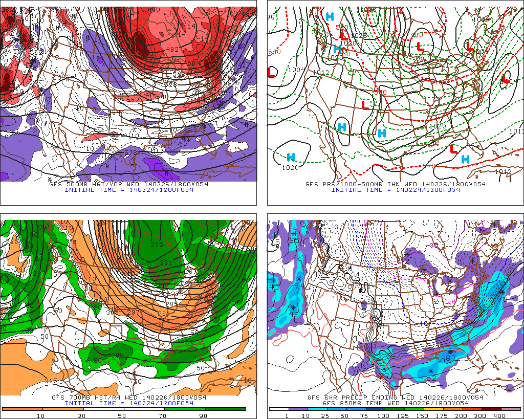
GFS model showing Wednesday’s potential system passing mostly seaward.
Beyond the middle of this week, cold air will remain entrenched in the area and especially so just to our north. Multiple disturbances from the Pacific are forecast by most guidance to move into the Western US and occasionally the Southwest US before ejecting northeastward towards the MS Valley and Northeast US. For forecasters, the issues become timing and temperatures as we begin to move forward over the next several days. After the initial system on Wednesday, models have begun to key in on another system during the upcoming weekend.
The pattern looks to continue beyond the upcoming weekend, as well, with potential events during the early part of next week as well. All indications as of now continue to point to a cold pattern with chances for wintry precipitation.
Leave a Reply
Want to join the discussion?Feel free to contribute!