-2")
Wednesday’s light snow gives way to near record cold
Light snow is falling throughout the area this morning and will continue to do so for the next several hours. The culprit is a weak mid level disturbance and associated elongated surface low, which in actuality is quite progressive and weak. But sufficient lift for precipitation and the presence of markedly colder air will set the table for a very light snow event through Wednesday evening. Accumulations will be quite light, thanks to the transient and light nature of precipitation and still relatively warm ground temperatures, ranging from a trace to 1″ in some isolated areas. The snow is expected to wind down by later Wednesday afternoon.
More notable than the light snow accumulations will be the impending shots of cold air, which will move from Canada and the Great Lakes into the Northeast on Thursday and Friday. A piece of the displaced Polar Vortex will shift southeastward toward Southeast Canada, and the resulting arctic front will drag anomalously cold air into the area behind Wednesday’s weak storm system and another clipper on Thursday. Temperatures aloft, at the 850mb level to be specific, will fall below -20 C in much of the area. Compare that to the +15 c temperatures at 850mb which reached the area last Friday, and you have yourself an idea as to how cold the airmass really is.
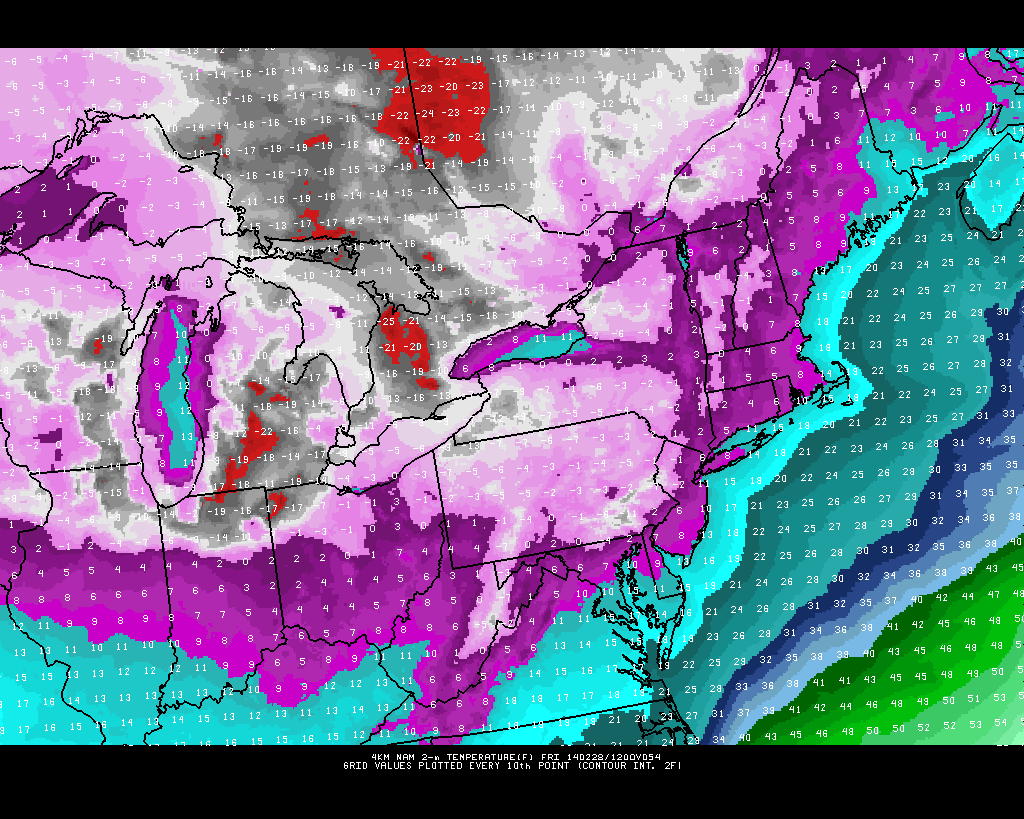
High resolution NAM model forecasting low temperatures in the single digits to near zero in the area on Friday morning.
Forecast models are in good agreement on single digit temperatures Friday morning throughout much of the area, with the potential for near or below zero temperatures in the interior and elevated areas. Although this may seem somewhat commonplace for this winter so far, such low temperatures this late in the season are extremely rare in New York City and would be approaching record-cold temperature levels for the date. For instance, record low temperatures on Friday morning throughout New York City’s Metro area reporting stations are all in the mid to upper teens. If forecast models are correct, low temperature records would certainly be broken.
Even more interesting is the potential credibility of these forecast models given the anomalous pattern in place. What usually would be tossed up as an overdone forecast needs more consideration this time around. For one, the airmass is anomalous in itself, with true arctic air entering the area. But more importantly, the airmass modification (which occurs as an anomalous airmass like this one reacts to its surroundings and modifies) will be muted by the extremely cold pattern which has been in place throughout the Northeast all year. The frozen Great Lakes will help to keep the airmass quite cold and dampen the aforementioned modification, while a northwesterly wind from that direction will keep the arctic air source quite fresh in our area.
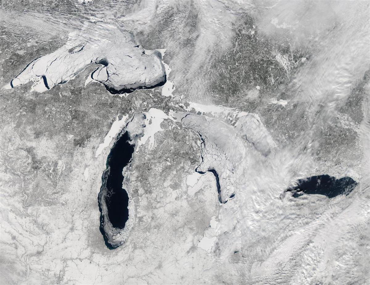
The mostly frozen eastern Great Lakes could act to dampen airmass modification and keep arctic air quite fresh in the area, aiding in potential for record cold on Friday morning.
So by Friday morning, when northwesterly winds are advecting in an arctic airmass — it will feel quite legitimately like mid-winter. The statistics for this occurrence are somewhat staggering. The last time NYC dipped into the single digits in February? 14 years ago, in 1990 when they fell to 7 and 9 degrees. The record lows on Friday at Kennedy and Laguardia airports are 15 and 14 degrees respectively. Forecast models indicate that these records have a good chance of being tied or broken.
Beyond the near record cold this weekend will come the potential for a more significant precipitation event early next week, which we touched on yesterday. But the details of the storm system remain quite cloudy (no pun intended) at this point. We’re monitoring the potential carefully, so although we don’t have specifics at this point, keep the potential winter weather event in mind at least for now.
Leave a Reply
Want to join the discussion?Feel free to contribute!