-2")
Ending the developing misconceptions regarding the Polar Vortex
It has been a media frenzy. Since January, when a piece of the Polar Vortex made its dramatic trip through the Central and Eastern United States, the misconceptions regarding its origins and actual definition have continued. Whether made in a joking manner or not, some of the ideas regarding the Polar Vortex’s actual characteristics have created a bit of an issue for meteorologists. When using it to describe the pattern, we now have to keep in mind the potential media impacts. To be frank: That is not the way it should be.
The Polar Vortex, in our hemisphere, is a persistent cyclone which is located near the North Pole. It features a counter-clockwise rotating pool of cold, dense air — some of the coldest on the globe, in fact. The vortex moves around to a certain extent, but generally remains in the vicinity of the poles. What separates and moves southward (sometimes towards our area) in anomalous patterns, are pieces of the Polar Vortex which feature characteristics of the vortex itself and similar air masses.
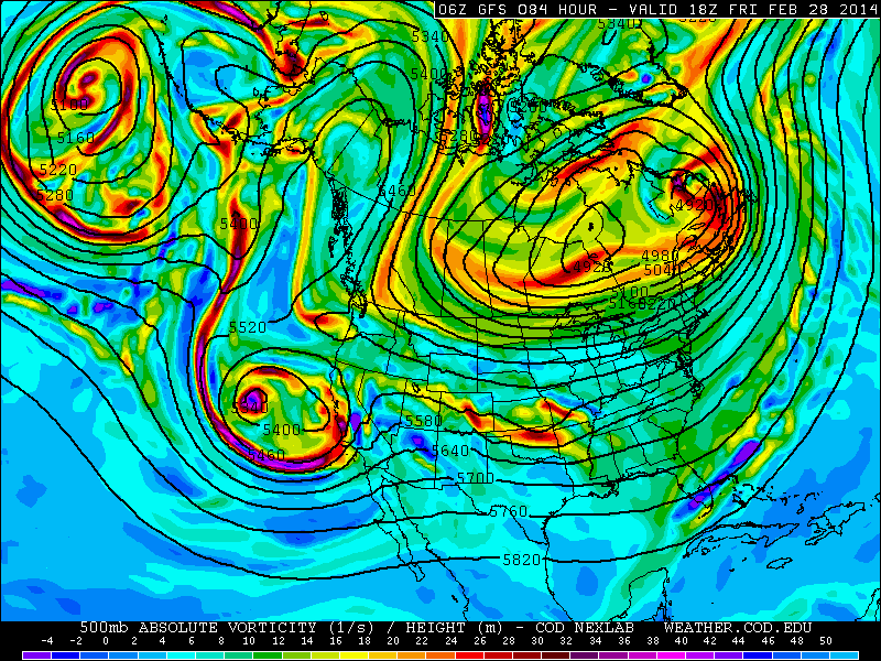
A significant piece of the Polar Vortex is forecast to drop into Southeast Canada later this week. Here, the GFS model forecasts its position at 500mb at 84 hours.