-2")
Warmup, rain ahead of impressive cold front
Fair weather and warming temperatures will be the story on Tuesday, as westerly winds continue and temperatures warm up aloft. Highs on Monday, which reached into the 50’s, will be bested by the early afternoon hours through much of the area. The warmest temperature readings are likely to come from Southern and Central NJ, where short term forecast models show some potential for temperatures to reach into the upper 60’s by afternoon with abundant sunshine. Despite being a few degrees cooler, areas farther north will also be feeling the warmth especially compared to what the past several weeks have had to offer.
The warmth will feel a bit more muggy by Wednesday, as a storm system approaches the area from the Tennessee Valley and eventually tracks fairly close to the area by later Wednesday. Drizzle and increasing clouds will put a damper on what otherwise will be another warmer than normal day, especially south of a warm front which is forecast to position itself from west to east in Central New Jersey. Rain will become more steady later in the day on Wednesday and may actually become heavy for a period of time late Wednesday night.
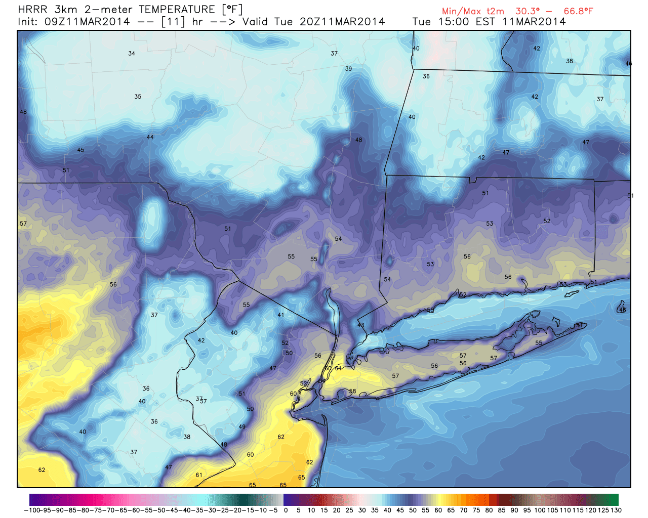
HRRR model forecasting high temperatures in the mid 60’s in parts of the area Tuesday afternoon.
Waiting in the wings of the warmup and warm front, however, will be a very strong cold frontal boundary situated just to the southwest of a strengthening low pressure system passing over New England. So by Thursday morning, this front will swing through (possibly with a period of heavy rain and a rumble of thunder) and bring a dramatic drop in temperatures. Aloft, temperatures will fall at 850mb from +11 C to -15C in just 3-6 hours time, with very gusty winds.
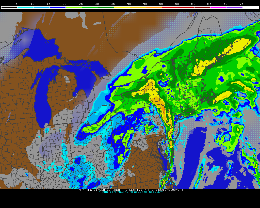
NAM model forecasting a line of heavy rain/thunderstorms along a strong cold front early Thursday morning.
The winter weather potential on Thursday remains somewhat up in the air. The basics of the setup argue that snow could fall, especially in interior areas, behind the cold frontal passage should sufficient moisture and lift remain. But meteorology argues that the dry slot moving into the area in the mid levels of the atmosphere will likely limit any frozen precipitation behind the front to flurries or snow showers. We’ll be keeping a close eye on it for sure, as well as the potential impacts any winter precipitation could have on the Thursday morning commute.
For now, the main focus remains on the warmup on Tuesday and Wednesday, as well as the development of drizzle and then steady rain on Wednesday evening. The strong cold front approaching late Wednesday Night into early Thursday morning will bring a dramatic end to the brief warmup — and a return to colder than normal temperatures is expected through the upcoming weekend.
Leave a Reply
Want to join the discussion?Feel free to contribute!