-2")
April off to a wonderful start with warming trend
Maybe it’s best that we just forget about March as a whole. The only people who would’ve enjoyed March 2014 are those who enjoy cold temperatures and no snow — a rare breed — and so most were lift disappointed and chilly. Spring got off to a slow start, with temperatures running 4 to 6 degrees below average during the month of March. And there was almost no snow to speak of in New York City despite multiple chances for accumulating snowfall. April, on the contrary, will get off to a great start. Temperatures in the mid 50’s to near 60 on Tuesday will mark the beginning of a warming trend which will continue into the middle of the work week.
High temperatures by Wednesday should eclipse the lower 60’s in many locations, as westerly winds and warming mid level temperatures with full sunshine allow for the warm air currently over the Tennessee and Ohio Valleys to advect eastward. Par for the course this time of year, things will be a bit cooler near the area beaches and shores. Despite the westerly winds, cold ocean waters make it very difficult for coastal locations to stay warm throughout the day in April. By the end of the week, the forecast gets a little bit more dicey with an approaching warm front and the potential for some backdoor-front action from New England.
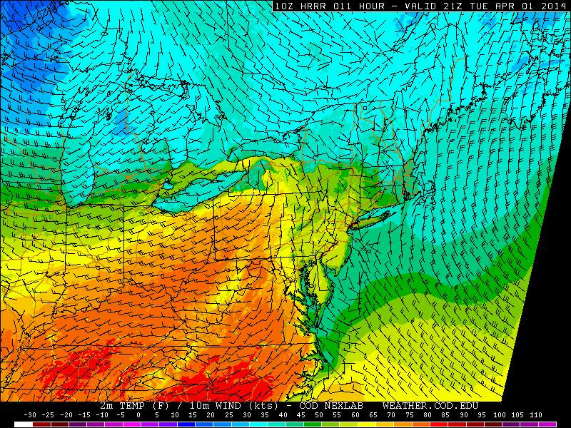
HRRR model showing high temperatures exceeding 60 degrees west of NYC on Tuesday.
Forecast models have been hinting at the potential for multiple mid level disturbances to move east/southeastward from the Great Lakes through the Northeast beginning on Thursday and continuing into Friday. In a set-up reminiscent of some of the uglier, cooler spring days in this area, a warm front looks to situate itself southwest of the area as a cool northeast flow pumps toward us from New England.
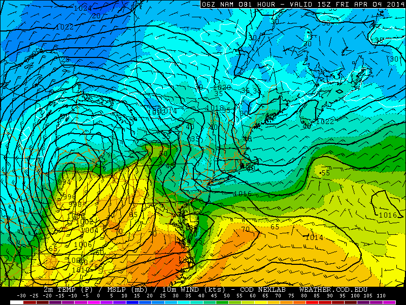
NAM model showing a warm front south of the area late this week with cool air remaining entrenched over New England.
This means that the warm air over our area during the middle of the week would be bottled up over the Mid-Atlantic states beginning late this week into the weekend. But pinpointing the position of these warm fronts is very difficult for forecast models, and almost always leads to a low confidence forecast. Currently, agreement is developing that the front will develop and remain “trapped” over the Mid-Atlantic states, positioning itself somewhere in Southwest NJ. But we’ll continue to monitor the setup as we move forward.
Leave a Reply
Want to join the discussion?Feel free to contribute!