-2")
Period of heavy rain likely Monday, nice week ahead
The morning began in a bit of a haze — literally — as smoke from a brush fire in Southern New Jersey billowed north/northeastward toward much of New Jersey and the 5 boros of New York City. So if you’re smelling the smoke and seeing the haze this morning, in all likelihood you do not need to be alarmed. Temperatures, on the other hand, started out seasonably today in the 30’s and 40’s and will rebound a bit more into the 50’s by the afternoon hours. But an approaching storm system will end up bringing an end to any pleasant weather by this afternoon.
A low pressure system shifting through the Ohio Valley will bring a warm front and area of enhanced lift for heavy precipitation with it later today. Showers are expected to shift northward towards Southern and Central NJ by late morning, and then into Northern NJ and NYC by early to mid afternoon. If you’re headed out to the Yankees home opener this afternoon, bring an umbrella and rain gear. Although the first pitch and ceremonies likely won’t be a washout, the increasing likelihood of showers and steady rain by mid to later innings suggests things could get a little dicey in terms of potential rain delays or even postponement.
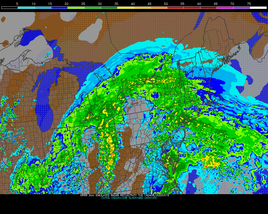
HRRR model showing heavy rain in the area this evening.
The best support for heavy rain comes later on tonight, as a frontal boundary and aforementioned lift near the area. Increasing moisture will aid in the potential for heavy rain, and forecast models (save for the GFS) are in good agreement on a period of steady and heavy rain beginning around dinner time and continuing into the evening hours. Total rainfall amounts could near 1″ in some locations where rain remains heavier, but confidence in those amounts is still somewhat low given the spread amongst forecast models. The heaviest rain moves out of the picture by mid evening hours, but additional showers are expected through Tuesday morning. Temperatures will be warming, too — as southerly winds begin later today. We could reach into the 60’s by Tuesday morning.
Behind this precipitation and frontal boundary, the upcoming week looks to be rather pleasant with very little precipitation. As far as temperatures are concerned, the first order of business is Tuesday afternoon — and the idea that forecast models are under-doing the potential for downsloping and warming temperatures with west/northwesterly winds. Essentially, although the frontal boundary clears the area Tuesday morning, mid level temperatures remain rather warm until the mid afternoon hours. With west-northwesterly winds behind the front and little influence from the cooler area waters, temperatures could rise well into the 60’s by the afternoon hours on Tuesday.
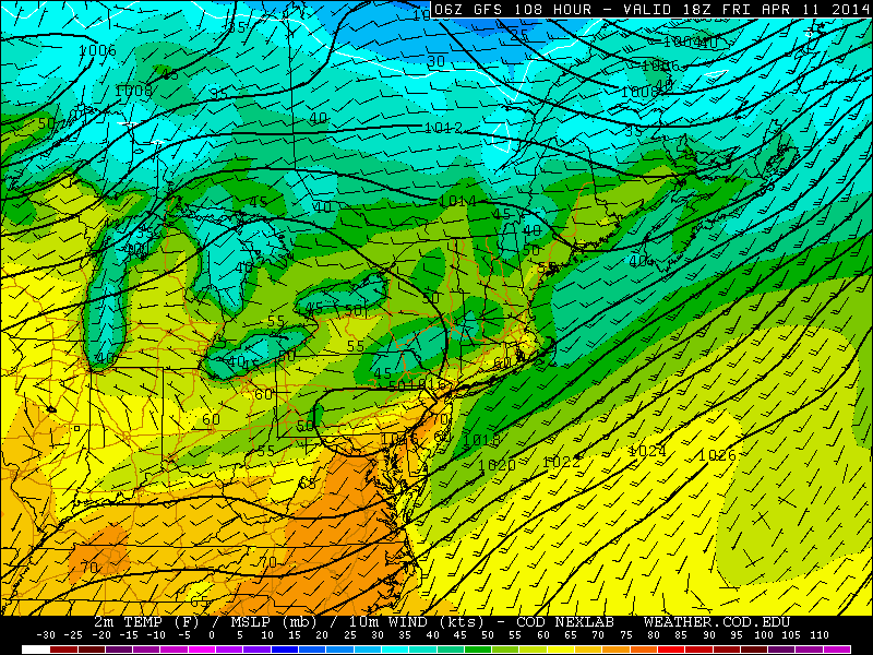
GFS model showing high temperatures nearing 70 degrees on Friday.
Even more encouraging, for those who are excited for spring-time temperatures, is the fact that after a brief cool down aloft on Wednesday (it’ll still be pleasant outside) mid level temperatures will be on the rise once again by late week. With another storm system moving into the Western US and an additional disturbance to our northwest, mid level heights will rise on Thursday and Friday. Surface temperatures will respond, moving into the 60’s on Thursday and maybe even into the 70’s on Friday ahead of an approaching cold front. So while we’re off to a bit of a rocky start with the heavy rain this week, we have a lot to look forward to over the next several days.
Leave a Reply
Want to join the discussion?Feel free to contribute!