-2")
Pleasant, warmer weather takes hold through late week
A developing high pressure system will bring increasingly pleasant weather to the area during the middle part of this work week — and despite being in a generally active spring pattern which many disturbances moving through the country, the pleasant pattern looks to hold through at least early next week. Moderating temperatures will the story on Wednesday through Monday — with a brief interruption by a period of rain late this week into the early weekend. But high temperatures will rebound into the 60’s and potentially warmer during the next several days.
A potential wild card in the setup will be the wind direction, especially near the coasts. Cooler ocean waters this time of year can have a major impact on temperatures near the shore. Forecast models are in good agreement that Wednesday will be a true winner of a day with temperatures nearing 60 for highs in most locations and a light west/northwest wind. By Thursday, however, things change as winds turn southerly and a warmer airmass begins advocating into the region. Although marking the start of a warmer trend, the southerly winds inevitably mean a sea breeze or ocean influence along the shores of New Jersey and Long Island.
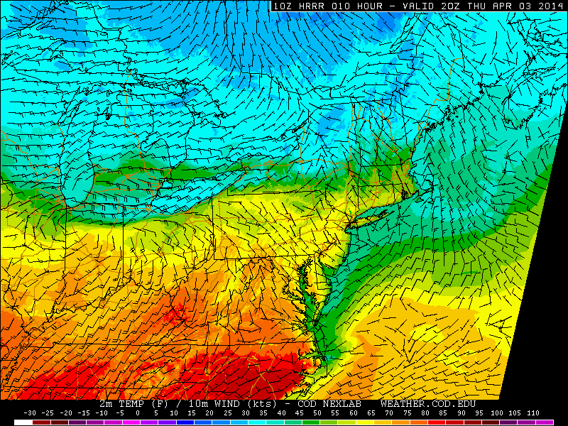
HRRR model forecasting highs near 60 this afternoon.
Friday dreary, but late weekend makes up for it
A frontal boundary approaches and slows dramatically near the area on Friday, owing to a compressing mid level height field. The frontal boundary will eventually weaken and wash out, but not before a disturbance tracks along it on Friday into Friday Night. Forecast models have come into better agreement on the disturbance, which looks increasingly likely to deliver a period of steady if not heavy rain with embedded thunderstorms. South of the front, over much of Central and Southern NJ, temperatures could reach into the 70’s on Friday — before the front sags southward.
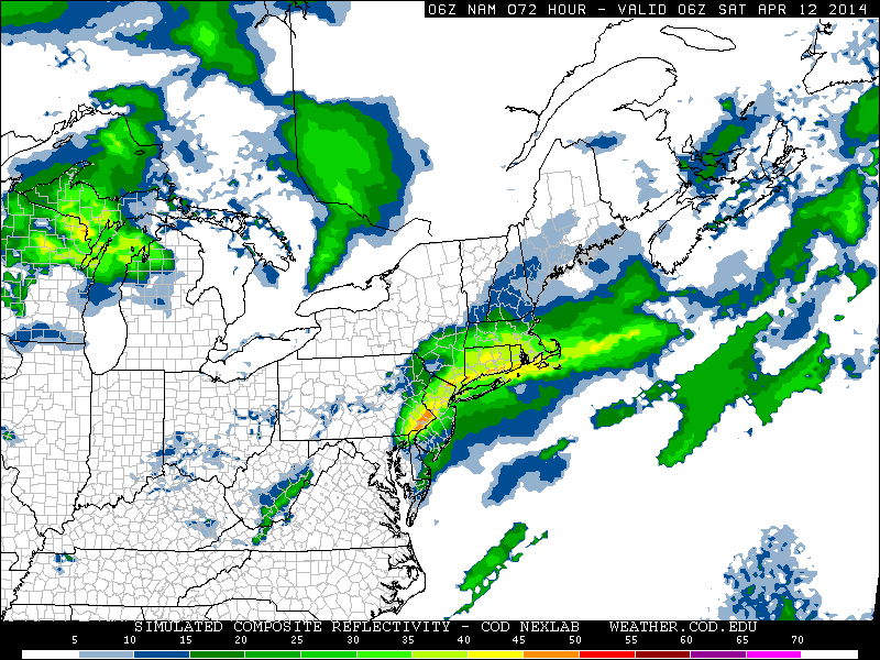
NAM model forecasting steady to heavy rain in the area Friday night.
The good news is that forecast models agree on the idea that the front will eventually wash out and weaken once the low pressure system passes seaward very early on Saturday. This will open the door for warmer air to advect into the area aloft, and temperatures on Saturday with sunshine could reach well into the 60’s. This trend looks to continue into both Sunday and Monday, as a low pressure system develops through the Central US.
It is this period which we are monitoring for potential widespread 70+ degree readings, as southerly winds bring in the warmest air of the season so far with a storm system to our west. Early forecast models indicate the potential for 70+ readings throughout a large majority of the area on Monday and potentially even Tuesday before a cold front approaches.
Lunar eclipse will put on quite a show next week
We always like to preface these topics with “Weather permitting”. We missed a potential once in a lifetime asteroid eclipsing a star a few weeks ago due to clouds and rain.
So. Weather permitting, a wonderful total lunar eclipse is on the way on April 14th — the first of two lunar eclipses which will be visible from North America this year. The eclipse will officially begin shortly after 12:30am on the night of April 14th (so the morning of April 15th) and will progress through the overnight hours. Totality (the moon will be fully eclipsed, and glowing red due to sunlight being bend around our atmosphere) will occur at 3:06am on the morning of April 15th.
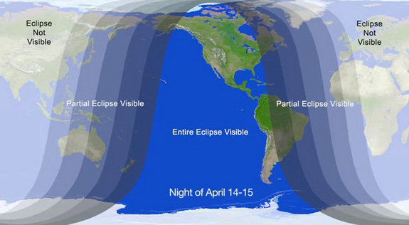
NASA graphic showing where the eclipse will be visible on April 14-15.
Over the next few days, we’ll have more information on the anticipated weather conditions. Here’s to hoping for clear skies and great viewing!
Leave a Reply
Want to join the discussion?Feel free to contribute!