Another beautiful weekend, slow warmth but no big heat next week
Another delightful weekend is on the way, as a ridge of high pressure has settled in behind a cold front. The ridging extends throughout much of the atmosphere, which is preventing clouds from forming — thus the crystal clear blue sky day we have had this afternoon.
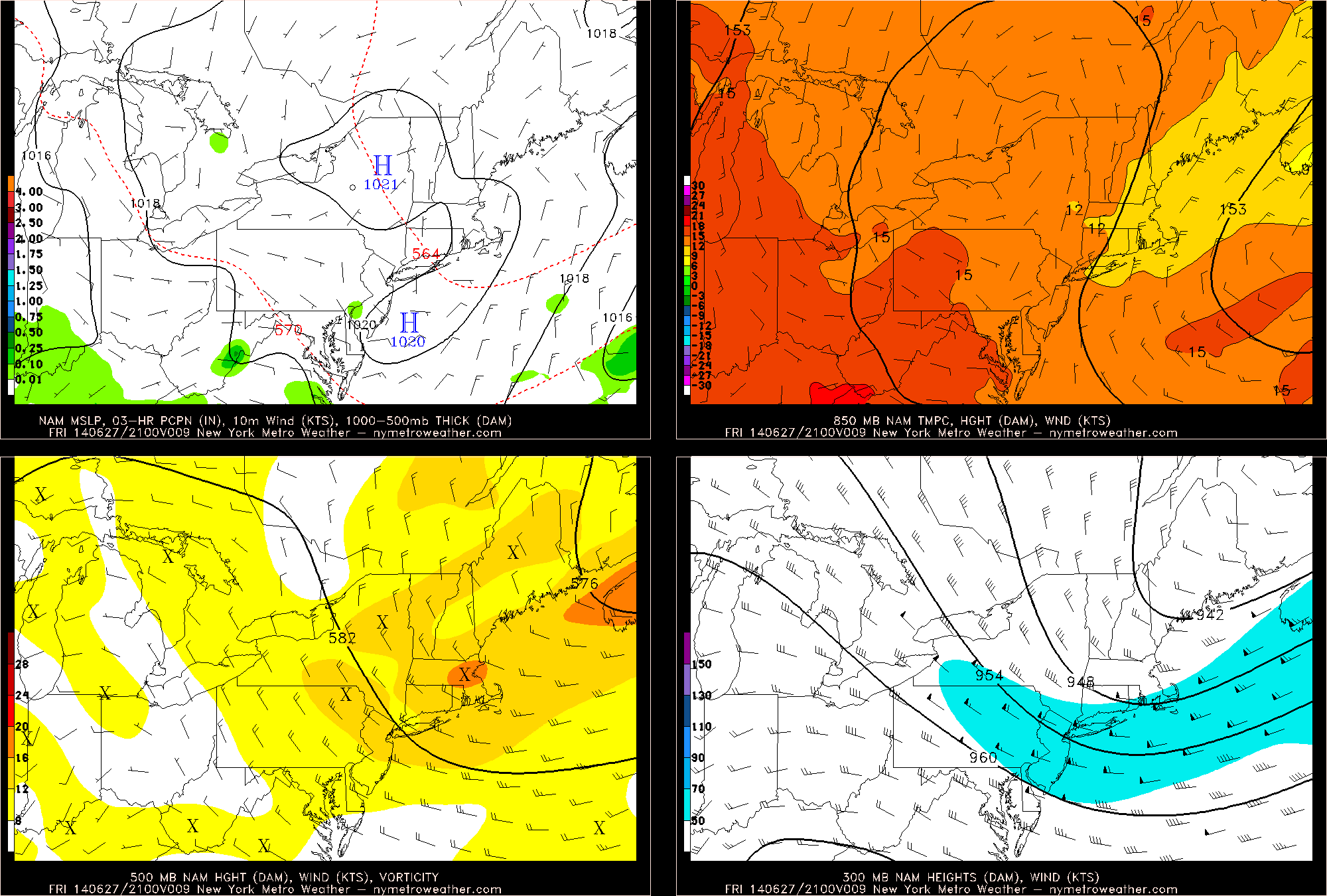
Today’s NAM valid for 5:00pm this afternoon shows an ideal combination of weather features throughout the entire atmosphere for sunny and tranquil conditions.
The above is a 4-panel chart from the NAM model valid for 5:00pm this afternoon. On the top left, we can see a well-defined area of surface high pressure — on the top right, we can see a nice ridge in our 850mb heights, as well as 850mb temperatures between 12 and 15C, which under sunny skies, yield high temperatures around 80 degrees. We also see that we are on the downstream side of the ridging at 500mb and 300mb, which further yields downward vertical motion associated with higher surface pressures — thus a lack of clouds. This general weather pattern will persist through the entire weekend, leading to sunny skies, low humidity, and temperatures in the low-to-mid 80s.
Tonight, the area of high pressure will continue to build in, and since winds generally flow around an area of high pressure, the center of the high pressure itself tends to have very calm winds. This will lead to a clear night with calm winds, with low temperatures generally in the low 60s, though perhaps mid 60s closer to the city and the shores.
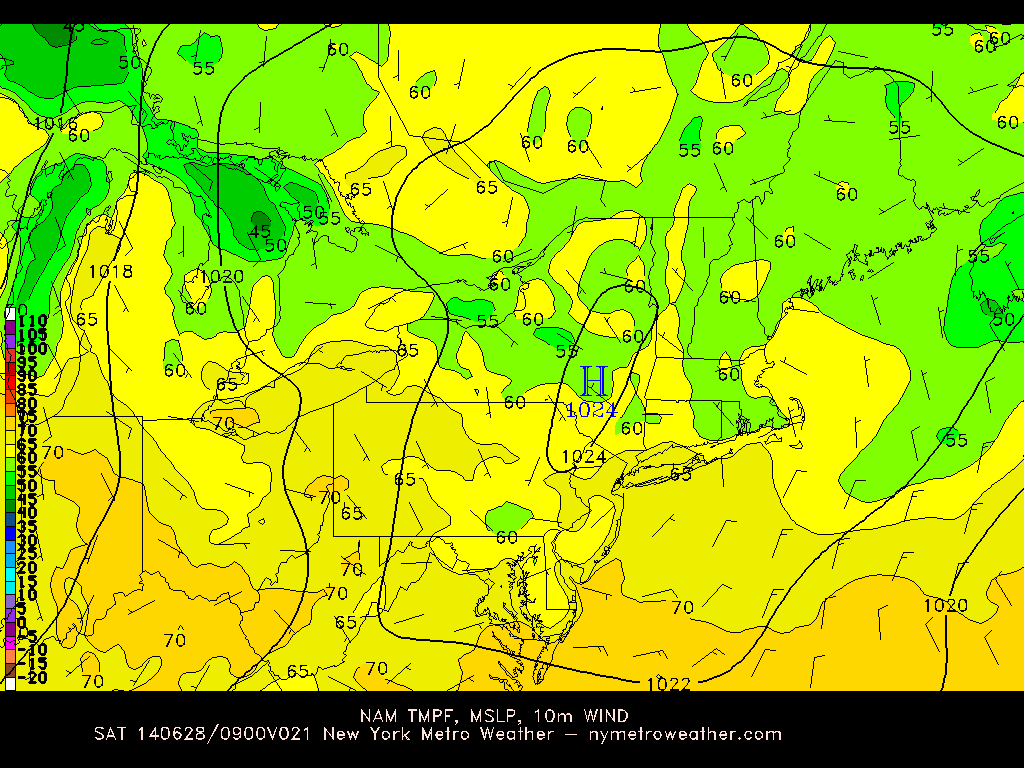
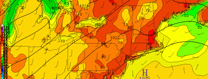
Today’s NAM valid for overnight tonight shows an area of high pressure dominating, and temperatures generally falling into the low 60s.
Moving forward to tomorrow, not much will change, as the area of high pressure will still be pretty much directly overhead. This will lead to calm winds and sunny skies once again. Additionally, humidity levels will continue to be on the low side. The one caveat to tomorrow’s forecast is that the calm winds will allow for a sea-breeze to form, which may keep temperatures a tad cooler on the beaches. High temperatures will generally be in the low-to-mid 80s tomorrow, but may remain in the upper 70s on the beaches for most of the day.
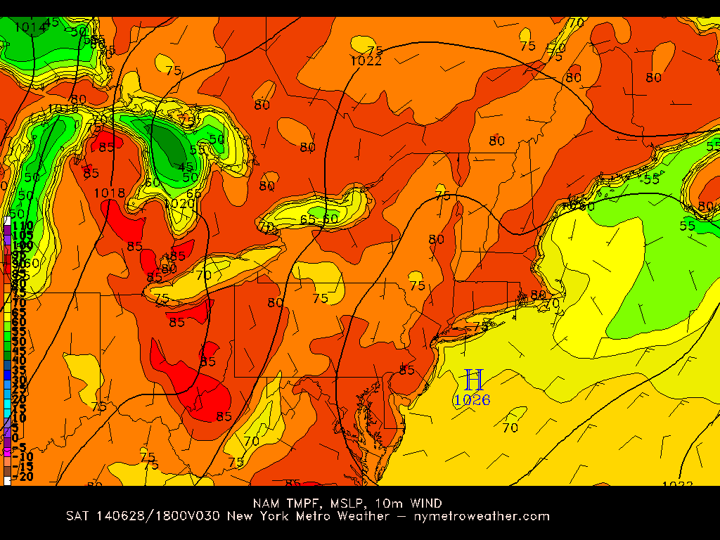
Today’s NAM model valid for tomorrow afternoon shows the area of high pressure still in-place, with temperatures warming into the low-to-mid 80s. However, temperatures may be slightly cooler along the shores.
Tomorrow night will be another clear and calm night, with temperatures falling back into the low 60s.
Sunday will be a very similar day weather-wise with the high pressure generally remaining in-tact. However, given that the high pressure will slowly be moving south and east into the Atlantic Ocean, there may be a bit more of a southerly flow to the winds — this should help to enhance sea-breezes along the beaches and perhaps keep highs inland in the low 80s instead of mid 80s. Temperatures along the beaches could also be a couple of degrees cooler than they were on Saturday.
Monday should feature one more comfortable day with plenty of sunshine thanks to the high pressure still being close-by. However, throughout Monday afternoon and night, humidity will slowly be on the increase, as a trough and cold front slowly approaching from the west will turn surface winds southwesterly, bringing in a warm and humid airmass.
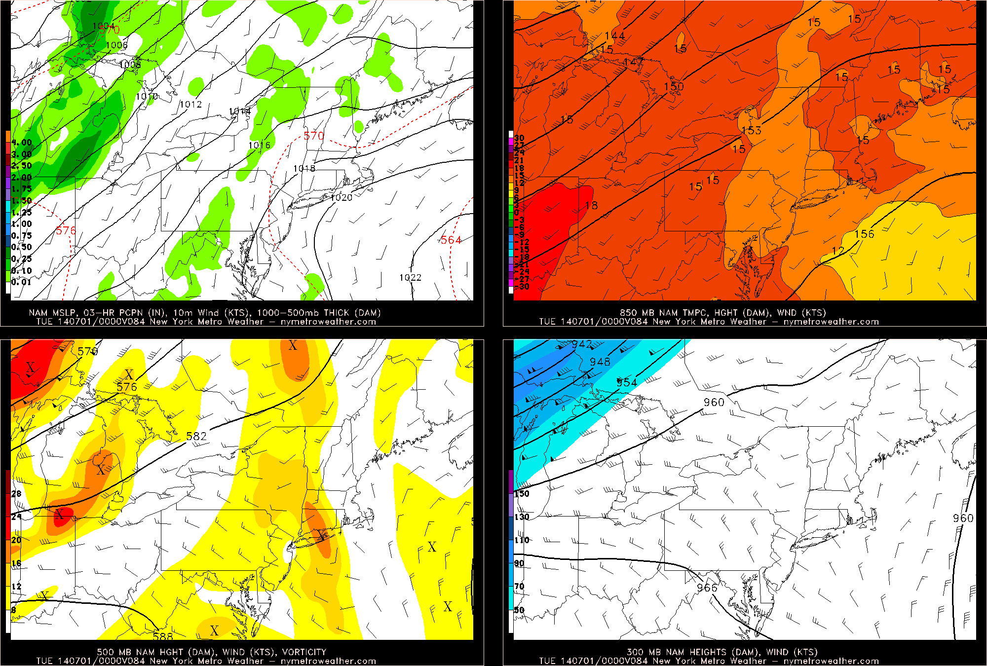
Today’s NAM valid for Monday night shows a trough slowly approaching from the west, increasing southwesterly flow. This will increase our humidity and lead to the chance for some showers and thunderstorms on Tuesday and Wednesday afternoon.
The incoming trough is well-evidenced by the strong gradient of lower surface pressures in the Ohio Valley, as well as the lower heights at 850mb, 500mb, and 300mb. In response, there is a much warmer airmass at 850mb ahead of the cold front, with 850mb temperatures between 15 and 18C off to our west.
Monday night’s temperatures should remain around 70 degrees, thanks to the higher humidity, and the aforementioned warmer 850mb temperatures should arrive on Tuesday and Wednesday, which may lead to high temperatures in the upper 80s. The increased humidity from the southwest flow (especially evident at the surface and at 850mb) could lead to heat index values in the low 90s. With the increased heat and humidity as well as a trough approaching, there may be a risk of showers and thunderstorms on Tuesday and Wednesday afternoon as well. As of now, we do not expect the showers and thunderstorms to be severe due to wind shear being low, but instability should be quite high so we will certainly be looking at this closely.
What does appear more certain is that a sustained heat wave does not appear to be in the cards anytime soon. The oscillation between warm & humid and seasonable & dry will continue for the foreseeable future.

Leave a Reply
Want to join the discussion?Feel free to contribute!