-2")
Severe thunderstorms again today, Arthur a ‘Cane
Severe thunderstorms rocked the NY/NJ area on Wednesday evening, owing to rich tropical moisture and strong atmospheric instability. Behind storms of that nature, typically, the airmass becomes less humid, cooler and drier. Thursday will be atypical in that sense, as tropical moisture will actually increase once again. Rising dew points and humidity values will continue — and temperatures in the 80’s and 90’s are expected again by early afternoon. And, again, an approaching mid level disturbance is expected to aid in the development of strong to severe thunderstorms by afternoon.
Storms will progress from southwest to northeast, initially forming in Pennsylvania and making their way through New Jersey. As was the case on Wednesday dangerous lightning, flash flooding, strong winds and small hail are all possible in strong to severe thunderstorms that do develop. The National Weather Service has issued a Flash Flood Watch for much of the region, and the Storm Prediction Center has placed the area in a Slight Risk for severe thunderstorms through this evening.
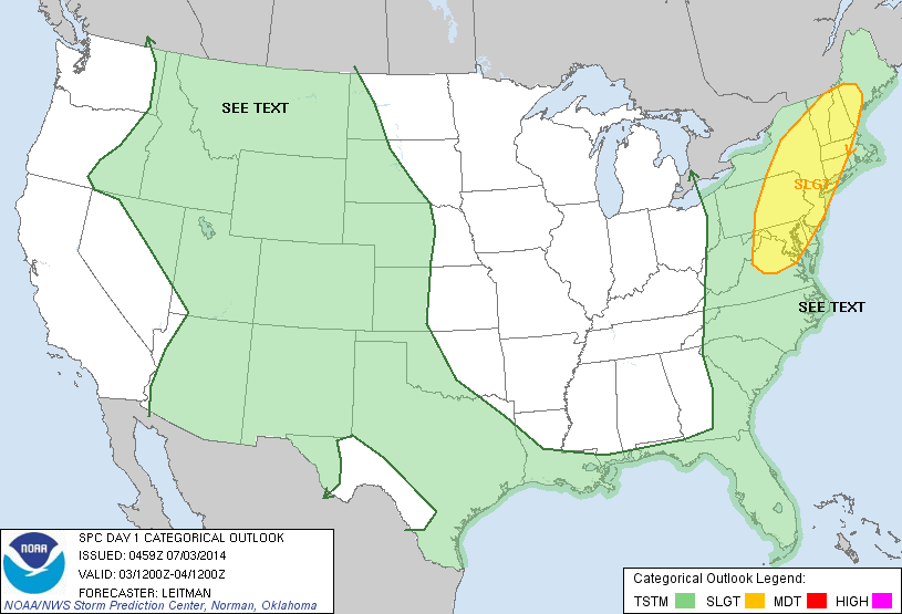
Todays Day 1 Outlook from the Storm Prediction Center showing a Slight Risk near our area.
Meanwhile, Arthur strengthened into a hurricane this morning off the Southeast Coast of the United States, and continues to strengthen slightly this morning within a low-shear environment. Maximum sustained winds were near 80 miles per hour. The storm is riding on the western periphery of model tracks, and is expected to skirt the Outer Banks of North Carolina later Thursday into Early Friday. Thereafter, the mid level disturbance affecting our area today will begin to influence Arthur, kicking the system on a northeastward trajectory. This will spare our area any major impacts, and move the system toward the 40/70 Benchmark in the NW Atlantic.
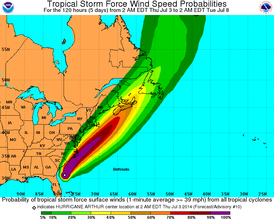
Probability of Tropical Storm force winds from Arthur, via the National Hurricane Center.
The second half of the holiday weekend looks to be much improved when compared to the first, as the mid level disturbance slides east and finally takes the hot and humid airmass with it. Pleasant weather with highs near 80 is expected on both Saturday and Sunday — and with Arthur out of the way by Friday afternoon, we may even be able to sneak in pleasant conditions during the fireworks Friday evening. This will be a bit of a stretch, though — models are very close to keeping rain around during the firework display. We’ll have to carefully monitor and track the movement of rain Friday afternoon.
Stay tuned today for more information on the developing threat for strong to severe thunderstorms.
Leave a Reply
Want to join the discussion?Feel free to contribute!