-2")
Labor Day weekend forecast takes a pleasant turn
A forecast which initially looked somewhat dreary, with clouds and thunderstorms widespread, has taken a positive turn on the upcoming Labor Day Weekend. Forecast models have converged on a solution which will bring multiple perturbations in the mid level flow to the north and west of our area, instead of over our area, from Friday through Sunday. And while the exact solution remains uncertain, the idea that the disturbances will pass north and west of us is gaining traction — and is a very positive sign for those of us looking to spend some time outside this weekend.
What we will first deal with is the passage of a frontal zone, bringing scattered showers and storms to the area early in the morning hours on Thursday. These will clear fairly quickly, moving seaward by Thursday morning’s commute. Westerly winds will have built back in by that time, and decreasing low level temperatures will keep surface temperatures nearer to 80 degrees when compared to the 90 degree temperatures on Wednesday. The air will feel less thick and humid as well.
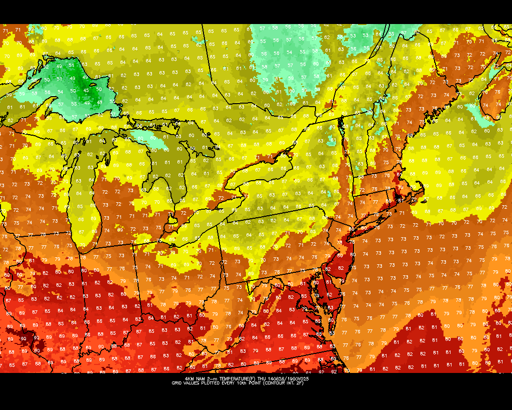
NAM model showing highs barely reaching 80 degrees on Thursday afternoon.
By later this week, models are in good agreement that mid level heights will again begin to rise. While it may take some time (temperatures will still be in the 70’s and the nights will be somewhat cool through Friday), the rising mid level heights will effectively shunt the incoming disturbances in the flow off to our north and west. This suggests that both Friday and Saturday could turn out to be real winners of days. The exception could be on Friday near the shore, where the onshore flow could keep things a bit cooler.
Saturday currently looks like the best day of the weekend. Rising mid level heights will peak during the afternoon hours, with winds keeping the seabreeze generally at bay (no pun intended) until the mid afternoon hours. Highs should rise well into the 80’s with plenty of sun. Sunday will bring the approach of lowering mid to upper level heights as a progressive pattern to our northwest brings a large-scale trough toward the North-Central United States. This means an increasingly likely chance of storms by afternoon and evening. Some of those could potentially be strong or severe.
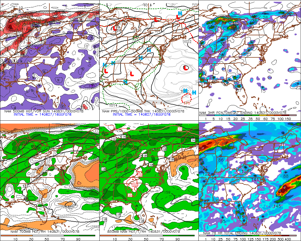
NAM model showing mid level heights building in the East this weekend, keeping weather pleasant through Sunday.
Generally, through the weekend, temperatures will remain near normal. But the good news moving forward is that a prolonged period of unsettled weather looks unlikely for the upcoming holiday weekend. Instead, plenty of sun and pleasant weather is expected until Sunday. Even then, warm air and partly cloudy skies will be in place before any scattered thunderstorms. It looks, right now, like a classic summer weekend is on the way.
Yeah, we’re excited too.
Leave a Reply
Want to join the discussion?Feel free to contribute!