-2")
Scattered thunderstorms later today in advance of strong cold front
After a lovely fall day on Wednesday, the humidity is back on the rise, as we revert back to summer. The culprit is a storm system and associated strong cold front — the latter of which will be passing through our area on tonight. Immediately out ahead of it, however, will be an increase in southerly winds and a warmer airmass. Often times, a warm, humid airmass in conjunction with a strong cold front can trigger strong thunderstorms. Initially, the threat for severe weather looked pretty high, but as we illustrated in yesterday’s article, there was major uncertainty as to the degree of instability that the atmosphere would hold. As we approach Autumn, high instability values tend to be harder to come by, and as we got closer to today, models gradually backed off on the degree of instability.
CAPE stands for Convective Available Potential Energy — the higher these values are, the more potential the atmosphere has to support strong, organized lifting for strong thunderstorms. Typically, values around 1,000 J/KG support marginal severe weather, while values 1500 J/KG and higher are more likely to support severe weather. With our area hovering only around 500 J/KG, it will be hard to expect much in the way of severe weather. That being said, this cold front will pack quite the punch with potent dynamics. This will allow for strong wind shear — in the order of around 40 knots — from the surface through the middle of the atmosphere. This means that any thunderstorm that does form could still produce strong wind gusts. Notice how further to the south, the CAPE values are higher, but the wind shear values are much lower — there is no truly impressive juxtaposition between the instability and the wind shear that is often necessary for widespread severe thunderstorms.
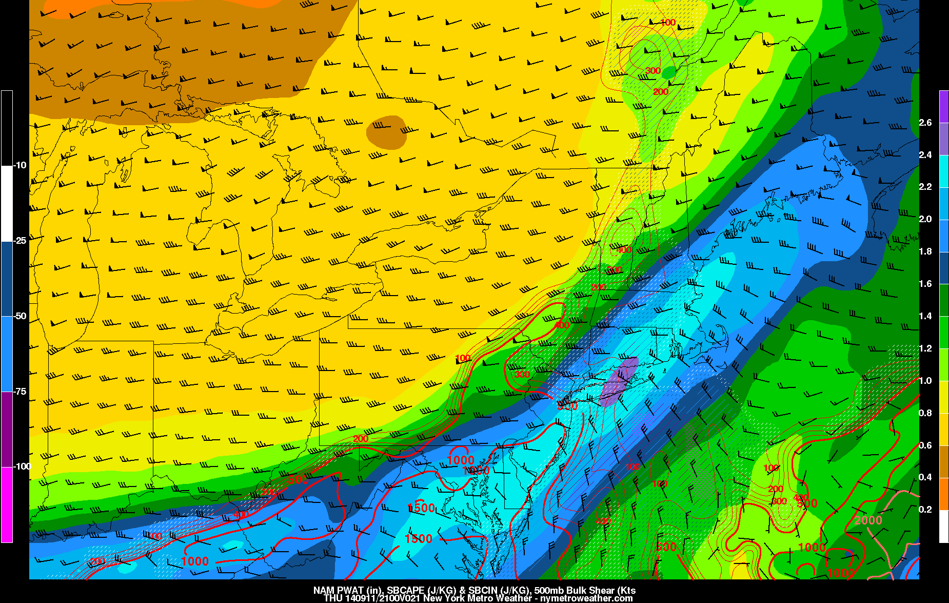
Forecast image from the most recent 00z NAM model, valid for 5:00pm today. Despite sufficient wind shear, CAPE values are forecast to be well below the threshold for widespread severe weather.
Heavy rain could still be a factor as we head towards the evening rush due to the relatively high Precipitable Water values — a measure of how much moisture the atmosphere contains. Combine this with the approaching cold front, and periods of heavy rain may be likely in many locales during the evening and overnight.
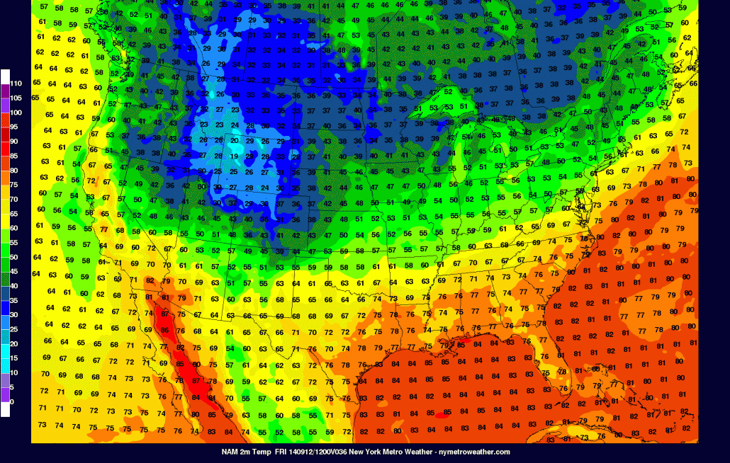
Once the cold front crosses, the airmass will return to an autumnal feel, with northerly winds and temperatures in the mid 70s on Friday, as well as plenty of sunshine and low humidity. Unfortunately, we are monitoring the potential for some showers on Saturday, as another storm system approaches. There is still some uncertainty, as not all models have the storm system affecting us; but tonight’s NAM model does show a period of moderate rain on Saturday, as well as temperatures not getting out of the 60s.
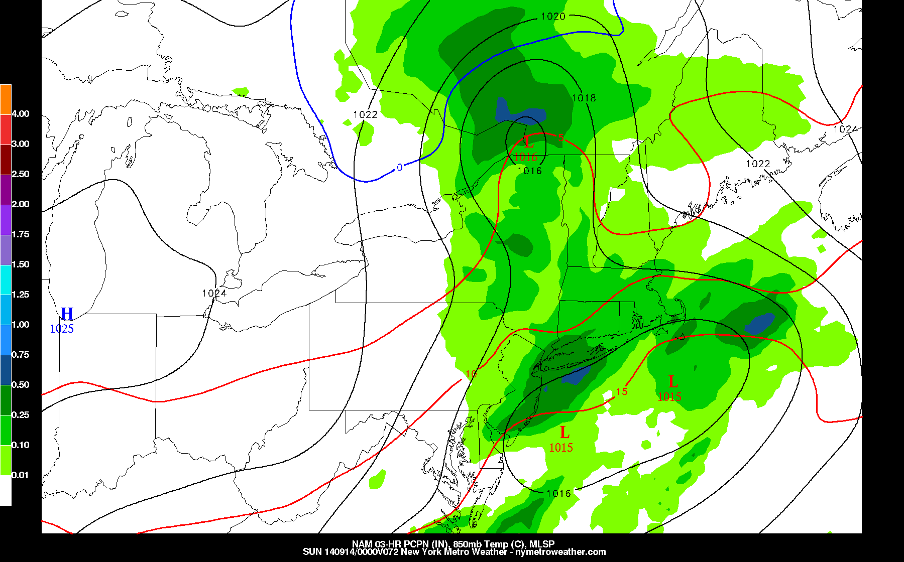
The most recent 00z NAM model run shows a storm system giving the area rain on Saturday. Some models disagree, however. Peaks of sun are still possible.
Regardless of how Saturday turns out, Sunday looks to be a gorgeous fall-like day. Temperatures will drop into the 40s and 50s by early Sunday morning, with temperatures rising into the low 70s, along with mostly sunny skies. Sunday night into early Monday morning will feature the coolest temperatures of the season throughout the northeast. Widespread 40s should be common-place, and the GFS model shows some interior locations falling into the 30s!
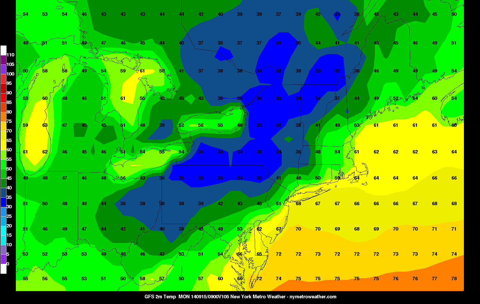
The most recent 00z GFS model shows temperatures falling into the 30s and 40s in parts of the northeast on 5:00am Monday morning.
Tomorrow could be the last summer-like day for a while — so if you are a summer-lover, enjoy it, because Fall is about to arrive.
Leave a Reply
Want to join the discussion?Feel free to contribute!