PM Update: Dreary, coastal storm passes by

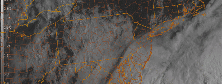
Rounds of clouds with sprinkles and showers will rotate inland from the Western Atlantic ocean this afternoon and evening, as a coastal storm system passes off the shores of the Mid Atlantic and Northeast states. Ultimately, the coastal storm will be shunted off to the north and east, and the westward extent of the precipitation shield limited by westward mid and upper level winds. Still, enough showers and sprinkles will rotate inland tonight to keep things dreary and cool. It’ll be a little less dreary inland — and more dreary near the coast. With a not-so-great evening on the way (weather wise, at least) here are some highlights on our weather and links from around the world of meteorology today:

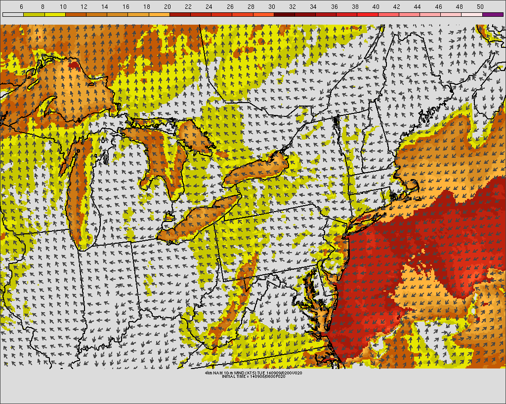
  • The onshore flow will continue tonight. Along with the aforementioned showers and drizzle, clouds with gusty winds (especially near the shores) are expected. Surf will be rough as well. If you’re headed out on the waters, be careful.
  • A major change in the weather is expected by Thursday, as a significant system organizes in the Central US and moves into Canada. This will bring the return of southerly winds to our area by Thursday — and warmer temperatures.
  • As a major cold front approaches our area on Thursday evening, showers and storms are expected — some may be strong or severe. The SPC has placed our area in a 5% risk for severe storms. The highest threat currently looks likely to be west of NYC.
  • The iPhone 6 was announced today — and it will include a barometer! This means we can all launch our phones up on weather balloons now, and drop them into Hurricanes for data!

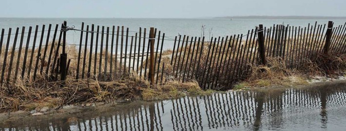
Have an awesome Tuesday evening. Image courtesy Dave Dicello.

Morning roundup: Unsettled, coastal storm slips by

Temperatures in the 50’s and 60’s made this Tuesday morning feel extra Autumn-like, despite easterly winds and an onshore flow. Clouds were more prevalent over southern/eastern areas of New Jersey and Long Island. The marine air will continue pushing westward today, and the gusty winds and higher surf will return to the area shores once again. The clouds and showers won’t necessarily be widespread, but they’ll certainly put a bit of a damper on the day.

A developing coastal storm, owing to a mid level disturbance passing near the East Coast, will bring a period of rain very close to the New Jersey and Long Island coasts on Tuesday morning and afternoon. But westerly winds pressing on the system aloft will keep the precipitation from spreading inland. Instead, breaks in the clouds will be just as common as scattered showers throughout the area — and so while Tuesday won’t be sunny and bright, it won’t necessarily be a washout either.

Read more

PM Update: Onshore flow, tidal flooding, more

Monday started out with sun and a pleasant autumnal breeze, but ended with clouds and an onshore flow. The dreary weather will continue through Tuesday as easterly winds increase ahead of a developing coastal system. The unsettled pattern looks to continue through the week. Here are your handy links to keep you updated in the world of weather:

  • Tidal Flooding is possible along the area shores, and the NWS has posted Coastal Flood Watches as a result. The onshore flow won’t help the situation. Winds gusting over 25 miles per hour are also expected.
  • Temperatures will fall into the 60’s tonight, but it will feel cooler as the onshore flow continues. We know we’ve said “onshore flow” a lot — but really, it will be noticeable.
  • A coastal storm will develop off the coast on Tuesday and may bring a period of rain to our area. The worst impacts are expected to skirt eastward, though, due to a developing system to our west.
  • Major flooding occurred in Phoenix — in fact, the wettest day on record there — with 3.29″ of new rain. Roads, interstates, property, etc were flooded in a significant event.
  • A major cold front is expected to pass the area, but not until this weekend. Unsettled weather is possible up until then.

Have a great Monday Night!

Active, more autumn-like pattern this week

After a hot and humid start to the weekend, a major cold front brought thunderstorms and a drop in temperatures. The pattern which has settled in to start this week is much more autumn-like, with temperatures in the 70’s and lower 80’s and much more comfortable dew points and humidity values. The pattern, however, will turn more volatile by the middle of this upcoming week with multiple storm systems and unsettled weather.

The trend toward more unsettled weather will begin late Monday into Tuesday, as an onshore flow develops and strengthens. Winds will pick up near the area shores, gusting over 25 miles per hour at times as an easterly fetch brings clouds and low level moisture inland from the beaches. This will bring an end to the sunshine which will dominate much of Monday. A mid level disturbance moving northward from the Mid-Atlantic states will aid in the development of showers, spreading into parts of New Jersey from southwest to northeast on Tuesday.

NAM model forecasting gusty winds along the shore Monday Night into Tuesday.

NAM model forecasting gusty winds along the shore Monday Night into Tuesday.

Read more