-2")
Frost and freeze conditions tonight, unsettled next week
After a beautiful Saturday, a cold front charged through the region on Saturday night, leading to much colder temperatures last night and today. The airmass has that true fall/early winter “crisp” feel, as it is very cool and dry. The dry conditions along with clear skies and light winds tonight will allow temperatures to continue to plummet. Because of this, the National Weather Service has issued Frost Advisories and Freeze Warnings for much of the area. Low temperatures will be in the upper 20s to low and mid 30s for much of the region. Closer to the city, however, temperatures will remain in the upper 30s, due to the Urban Heat Island effect. Make sure to bundle up tonight and tomorrow morning!
Temperatures will rebound relatively nicely tomorrow, reaching the upper 50s to around 60 — about five degrees below average. Skies will also be mostly sunny, so tomorrow looks to be the “good” day of the week, as conditions will gradually become unsettled starting on Monday night.
A storm system will be developing at the base of a large trough centered near the Great Lakes. This storm will signal a change in wind direction to the southwest, providing more clouds, an increase in moisture, and a bit warmer of an airmass. Thus, on Monday night, temperatures will hold in the low 50s. On Tuesday, the storm will still be in the developing process, so widespread heavy precipitation is not expected. However, overcast skies and periods of showers are still expected.
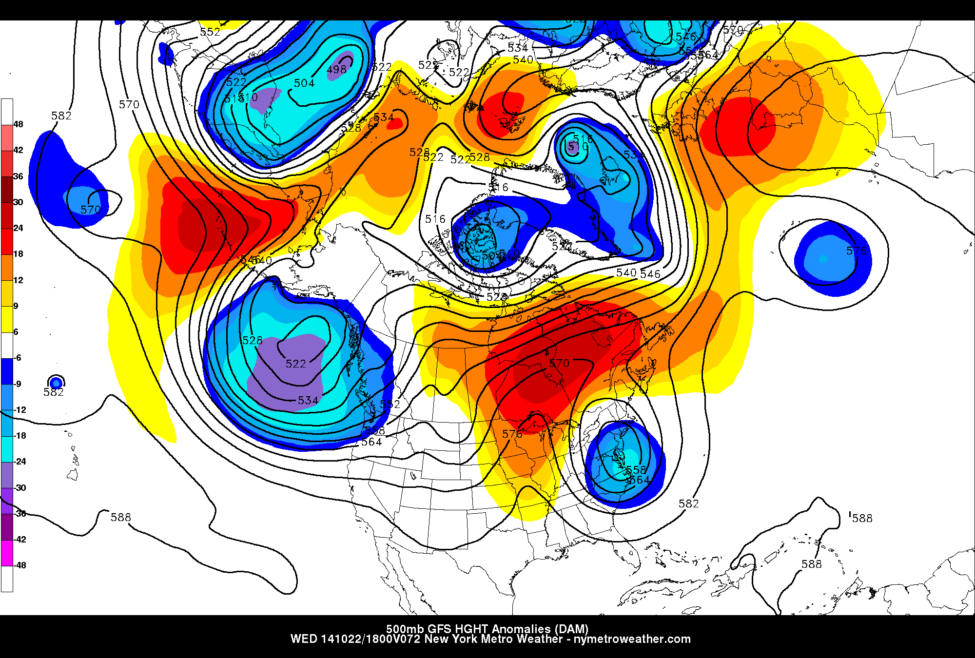
Today’s 18z GFS model valid for Wednesday afternoon shows a blocking pattern in Canada, and a storm system off the Mid-Atlantic coast. The blocking has caused the storm to “cut off” from the jet stream, allowing it to stall, giving us unsettled weather for several days.
Moving forward to Tuesday night and the rest of the work-week is when the forecast becomes a bit more tricky. Consensus has increased that a large blocking pattern will be developing, which will force the storm system to come to a halt. Additionally, this will force secondary redevelopment off the Mid Atlantic and New England coast. Where exactly this re-development occurs will determine whether we get a heavy rain event, or simply periods of showers.
As of now, it does appear likely that the re-development and subsequent greatest organization will occur a bit too far northeast to give the entire area a true washout. That being said, periods of moderate rain to heavy rain are likely as we head towards Tuesday night and Wednesday.
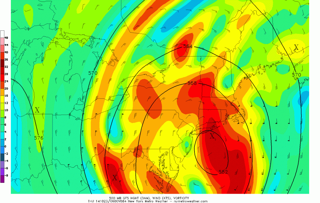
Moving forward to Thursday, the system will still be in close proximity to the area, but will have organized to our north. This will lead to heavy rain in New England, but not necessarily our area. However, clouds and occasional showers can still be expected.
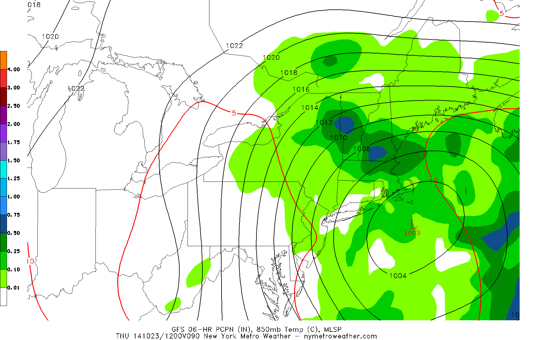
Today’s GFS model valid for Thursday morning shows some showers in our area, but the heaviest rain developing in New England.
The storm will begin to occlude on Thursday night, but still be near the area. This means that although precipitation may come to an end, clouds will still be lingering on Friday. Fortunately, the system will finally be out of the area for the weekend, leading to sunny skies and seasonal temperatures.
Leave a Reply
Want to join the discussion?Feel free to contribute!