Chilly weather remains entrenched through tomorrow

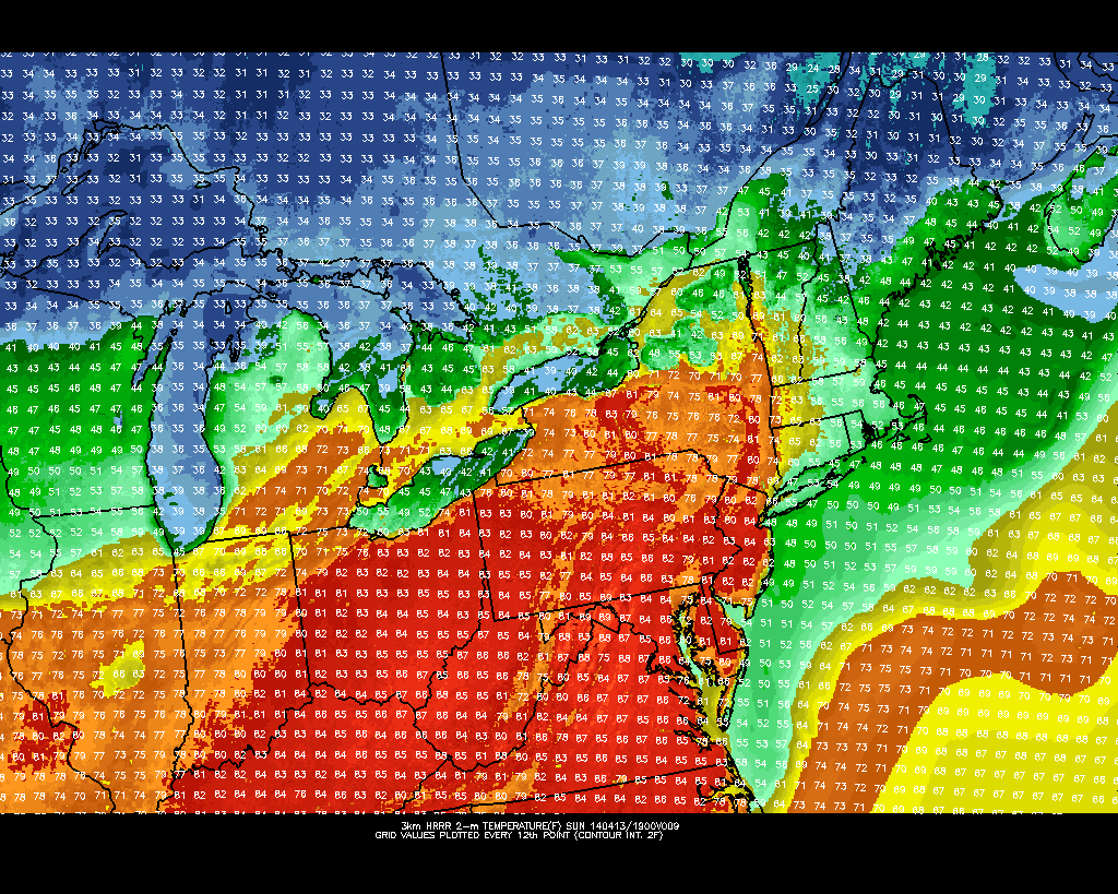
Just two days ago, parts of New Jersey were approaching 80 degrees. Then yesterday, a strong cold front came through and gave most of the region minor accumulations of snow and sleet! Newark Airport officially recorded 0.4″ of snow, LaGuardia Airport had 0.3″, New Brunswick, NJ had 0.2″, and Freehold, NJ reported 1.5″ of snow.

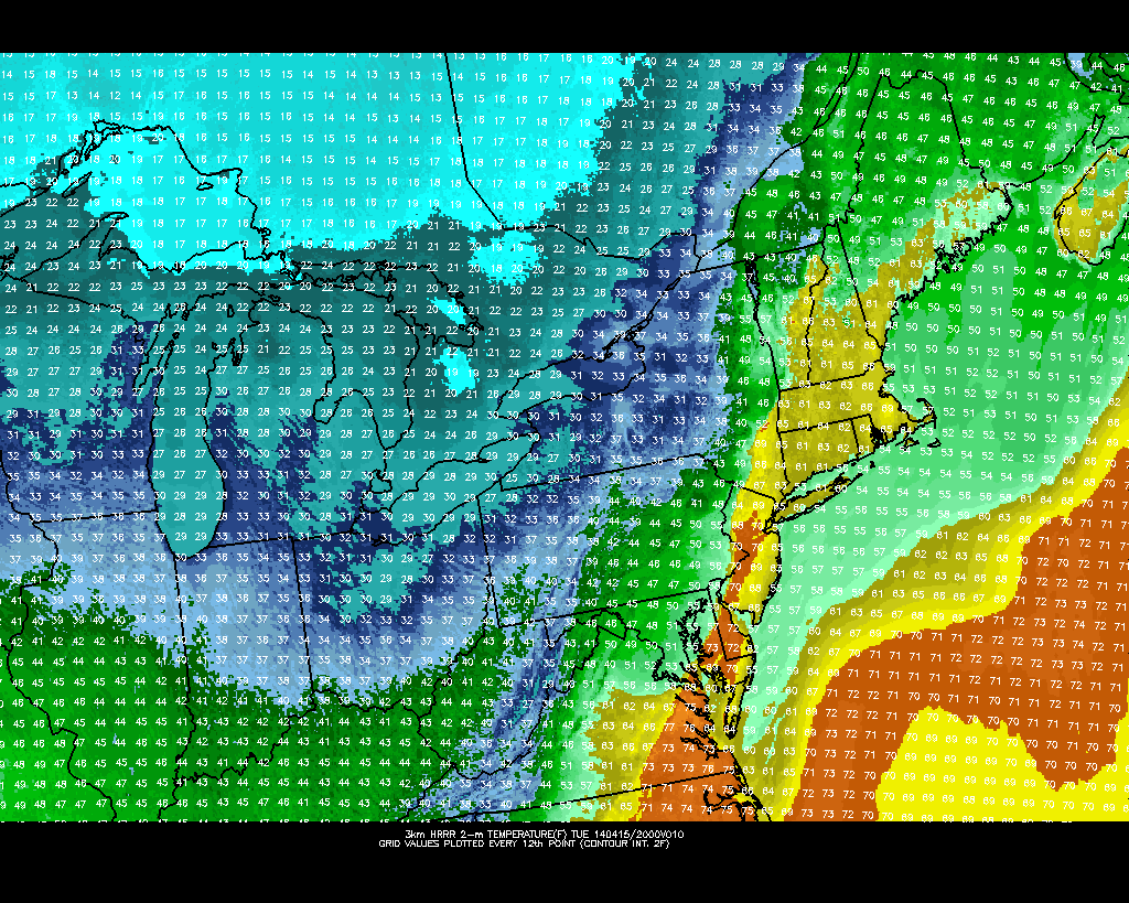
The cold airmass responsible for the snowfall will remain entrenched for the rest of the afternoon, tonight, and tomorrow, as a cold high pressure system slowly slides eastward. It was to our northwest last night and this morning, which brought in strong northwesterly winds from Canada — its gradual approach shifted our winds to northerly, which is actually an even colder wind direction, keeping our highs in the 40s this afternoon. The winds have calmed a bit throughout the day, but are still blustery — however, as the high pressure continues to get closer, we will be directly underneath it, where winds are much calmer. Thus, we expect winds to keep getting calmer and be very light during the evening.

Today's high resolution NAM model shows temperatures falling to around freezing for tonight's overnight lows (PSU E-Wall).

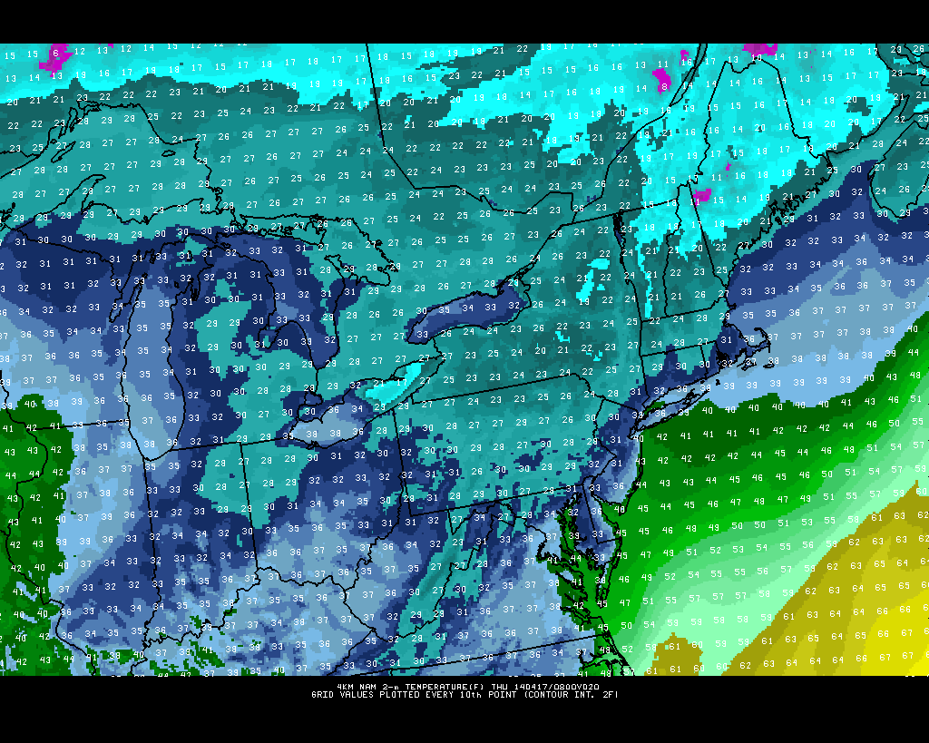
Today’s high resolution NAM model shows temperatures falling to around freezing for tonight’s overnight lows (PSU E-Wall).

The initially calmer winds will feel nice; however, calm winds and clear skies associated with the high pressure — especially in a cold and dry airmass — lead to radiational cooling conditions. This will allow temperatures to quickly drop into the 30s this evening. As the night goes on, the high pressure will slide to the east of us, which puts us back into the flow of wind — this time, out of the northeast, so winds will increase to around 10mph as the night goes on.

Read more

Major cold front will bring rain, wind and temperature drop

The warm, sunny weather of the past several days is on the way out. Although our area has experienced several cold fronts over the past few weeks, none have come with quite the vigor which Tuesday’s front will. Northwesterly winds behind the front, a strong mid and upper level system, and a fresh supply (seasonally speaking) of Canadian air will all accompany the frontal boundary. Southerly winds continued this morning ahead of the front, with a broad area of heavy rain lingering just off to our west. The winds are expected to pick up as the afternoon draws on.

Along the frontal zone, an impressive thermal gradient will exist later this afternoon. Forecast models indicate the potential for a 25-30 degree temperature drop during the evening. Widespread heavy rain is expected to be accompanied by embedded thunderstorms, which could drop over 1″ of rain throughout a majority of the area. Making matters worse (or more dramatic, depending on how you look at it) is the potential for strong winds, nested just above the surface, to mix down in this heavier precipitation. Forecast models indicate the potential for wind gusts of 30 to 40 miles per hour as the front passes.

A strong cold front will approach the area this afternoon, with a  dramatic temperature gradient.

A strong cold front will approach the area this afternoon, with a dramatic temperature gradient.

Read more

Warmup continues ahead of cold front

Temperatures in the 70’s, plenty of sun, and a light breeze were the main characteristics of the weather throughout much of the area on Saturday, during a day which likely will be remembered as one of the more pleasant in recent memory. Much of the same is expected on Sunday — in fact it will be a few degrees warmer — as high pressure moves east of the area and the airmass modifies further. Southerly winds will continue to pump in warmer air both aloft and at the surface, so much of the area away from the coast will warm up into the upper 70’s if not 80’s.

The only exception will come near the area coasts, where cool marine air will rear its ugly ahead once again. A slightly southeasterly component to the wind will introduce an influx of colder air off of the ocean waters, which remain in the 40’s. Forecast models with higher resolution are picking up on temperatures in the 40’s and 50’s along the south shore of Long Island and New Jersey coast. While this may be somewhat aggressive given the initial diurnal heating likely this morning, temperatures in the 50’s and 60’s should be more common near the coast with the possibility of low clouds rolling in off the water and blustery southeast winds.

HRRR model showing high temperatures in the 80's on Sunday, but temperatures only in the 40's and 50's near the shore.

HRRR model showing high temperatures in the 80’s on Sunday, but temperatures only in the 40’s and 50’s near the shore.

Read more

Moderate to strong El Nino becoming increasingly likely

While our area has been enjoying a stretch of pleasant and warmer weather, many meteorologists and weather hobbyists alike have been analyzing interesting data in the Equatorial Pacific: signs of a developing El Nino. An El Nino is generally defined as a trimonthly period where waters in the Equatorial Pacific — from 160 Degrees East to 80 Degrees West Longitude — are warmer than normal. This tends to have effects on the general atmospheric circulation, which will be detailed in this article. The Climate Prediction Center breaks this area into four different Nino regions, since warm anomalies in different regions of the Equatorial Pacific can lead to subtle, yet important changes in how the El Nino behaves.

The four El Nino regions (NCDC).

The four El Nino regions (NCDC).

The region used to officially define an El Nino event is Nino 3.4, which spans from about 170 Degrees West to 120 Degrees West. That is not to say that the other regions are not important; they are just not used in the official calculation. Let’s take a look at an example of an El Nino event:

The strong El Nino event of 1997-1998. Notice how warm the waters are in the eastern Equatorial Pacific.

The strong El Nino event of 1997-1998. Notice how warm the waters are in the eastern Equatorial Pacific (CPC).

The El Nino of 1997-1998 was the strongest on record, as it had temperature anomalies between +2C and +5C across the eastern Equatorial Pacific. Also notice how the warmest anomalies were east of Nino region 3.4, which is a classic strong El Nino phenomenon. Let’s see how the forecast from one of our climate models compares to the 1997-1998 event.

The latest CFS model shows an El Nino emerging (CPC).

The latest CFS model run shows an El Nino emerging (CPC).

The values on the left are anomalies in Kelvin, which can also be represented by degrees Celsius, since the incremental increases are the same for Kelvin and degrees Celsius. On the bottom, we see tri-monthly periods. The wavy black line shows what had previously been happening — generally, there was no anomaly at all, indicating no El Nino, nor its counterpart, a La Nina. However, moving forward in time, notice how all of the lines, which represent forecasting members, show a pretty fast increase in the anomaly through the coming months. Another interesting point is how the red lines are the earlier members, and the blue lines are the latest members — and there appear to be more blue members hedging towards the warmer side of the mean than the red lines — which is perhaps an indicator of a further warming trend.

The threshold for a strong El Nino is an anomaly of +1.5C or higher, which certainly seems attainable according to the CFS. While not nearly as strong as the 1997-1998 El Nino, it would certainly still be pretty strong, and the fact that the latest members look warmer than the mean indicates that the El Nino could verify warmer than the forecast mean.

Now that we know what an El Nino is, as well as how strong it is forecast to become, let’s examine what causes an El Nino, and what effects it has on our weather pattern. Read more