What causes storms to strengthen?

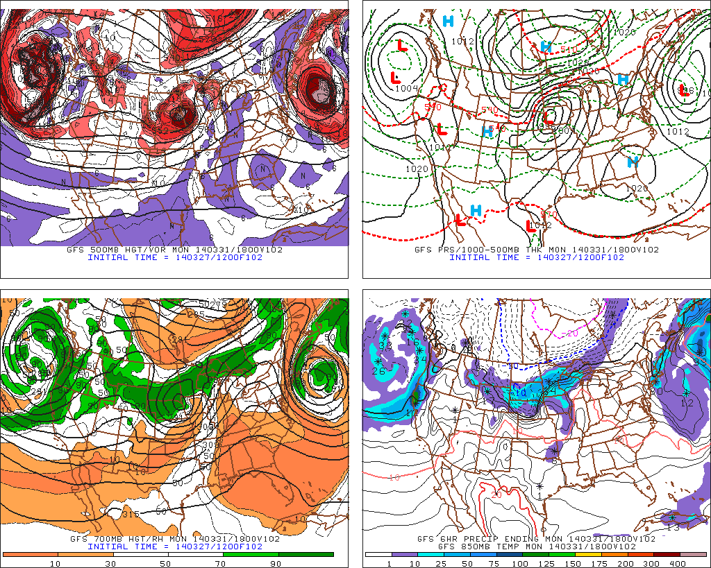
In light of Wednesday’s meteorological bomb of a storm that was just offshore, we have decided to write an article that explains why storms strengthen to begin with, and how they can get to be as strong as this storm got. Wednesday’s storm went under what we call “bombogenesis” (yes, that is a real meteorological term), meaning that its pressures dropped more than 24 millibars in 24 hours. At once point, surface analysis showed the storm being as strong as 955mb, which is equivalent to a category 3 hurricane!

As most of you probably know, a lower pressure means a stronger storm, and a higher pressure means a weaker storm — or if the pressure is high enough, an area of tranquil weather. Now the question becomes, what causes pressures to fall in a certain area, and why do they sometimes fall so rapidly?

The most important meteorological aspect for pressure falls is an area of upward vertical motion. If air is being lifted vertically, then pressure within that column of air has to decrease, because air is escaping that column when it is moving vertically. Naturally, if less air exists within a column, the pressure in that column will be less.

The atmosphere always wants to maintain balance, so to accommodate for the air that is being lifted vertically, there is a need for air to converge at the surface to replace what is lost at the surface, and to generate the lift to fill the void in that column of air as well. This is one reason why air converges at the surface in areas of lower pressures; it is all part of the balancing act of the atmosphere. Air also flows from higher pressures to lower pressures, being that lower pressures are an area of least resistance; another aspect of this balancing act. All areas of relatively higher pressures essentially shove air away, and it all converges where the lowest pressure is. This surface convergence leads to upward vertical motion, which leads to storm development, precipitation, and an additional lowering of pressure.

To illustrate this further, think about the opposite scenario: wouldn’t it make sense for pressure at the surface to be higher if there were downward vertical motion, meaning that air is being pressed downward towards the ground?

A water vapor animation taken yesterday afternoon, beautifully illustrates the size and strength of the storm system (wx.rutgers.edu).

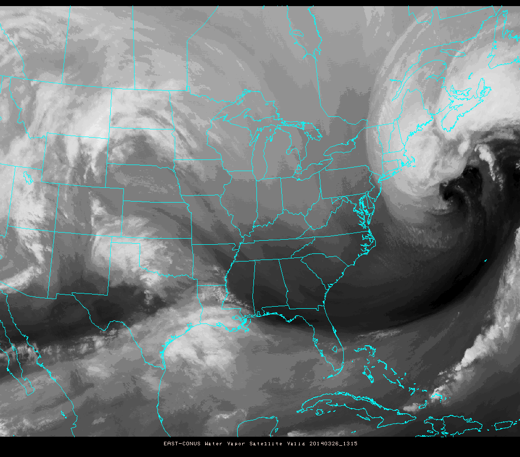
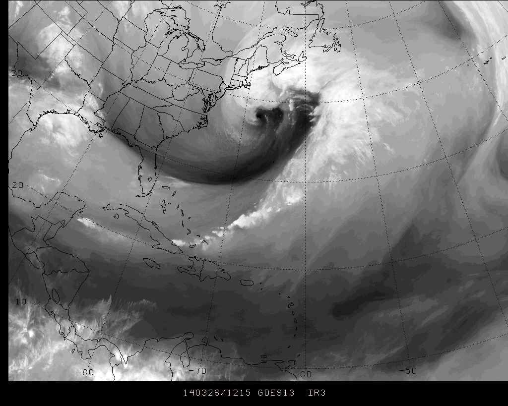
A water vapor animation taken Wednesday afternoon, beautifully illustrates the size and strength of the storm system (wx.rutgers.edu). You may need to click to animate.

Let’s go over the factors that cause upward vertical motion:

Read more

Warmup begins, brings unsettled weather

After a powerful Nor’Easter which featured a minimum central pressure of 955mb and wind gusts over 80mph on Nantucket, cold air swept back into the area late Wednesday into Thursday. Wind gusts in our area were more modest, but still over 30 mph in many spots. The cold airmass which moved into the area helped us set records of our own on Thursday morning. LaGuardia, Newark and Kennedy airports all set record low temperatures for the day, breaking records which were set during a similar cold snap in 2001. The departure from normal temperature remained more impressive than the actual surface temperatures, which actually only fell into the low 20’s. Normal lows this time of year, however, are in the mid to upper 30’s.

Fortunately, the colder than normal airmass will fall victim to a very progressive pattern, and is already on its way out. Temperatures on Thursday afternoon will rise into the 40’s to near 50 in many areas, under full sunshine and warming temperatures aloft. A continued warmup is expected from Saturday through the early part of next week. However, with the warmth will come southerly winds, increased moisture and a few low pressure systems which will do their part to provide the area with unsettled weather and multiple chances for rain.

GFS model showing a parade of systems moving eastward from the Pacific into the United States.

GFS model showing a parade of systems moving eastward from the Pacific into the United States.

Read more

Images, updates as massive Nor’Easter slams Cape Cod

What may eventually be the strongest Nor’Easter in the past 20 years or more is currently developing to the south and east of New England, deepening rapidly to some of the lowest pressures observed in a non-tropical storm system in the Northwest Atlantic on record. Although the storm system spared our area major impacts, parts of Cape Cod and especially Nantucket are feeling the brunt of the developing low pressure system. We’ll follow along today and post some of the latest images, information and news as it comes through.

Water Vapor satellite imagery showing massive storm system in the Northwest Atlantic

Water Vapor satellite imagery showing massive storm system in the Northwest Atlantic

Read more

Strongest storm of season likely to spare our area

In what will all but certainly be winters dying breath, a large and powerful coastal storm will develop Tuesday into Wednesday off the southeast states while traversing northeastward to a position southeast of the 40/70 benchmark. In doing so, and owing to a major phase in the mid levels of the atmosphere, the storm will strengthen rapidly and explosively — dropping from around 990mb to somewhere in the 950’s mb. This will make the system the strongest of the season by far, and the strongest in our area since Hurricane Sandy.

The aforementioned phase involves three disturbances which originate from different parts of the mid level flow and jet stream. Pacific and polar energy will merge over the Northeast United States, and a favorable jet structure will allow for rapid strengthening of the low pressure system. More notable for us, however, is how all of this will occur a hair too slow and a tick too far east/northeast — allowing us to dodge what would’ve otherwise been an incredibly high impact storm system.

NAM model showing a major storm system developing offshore, barely grazing the coast.

NAM model showing a major storm system developing offshore, barely grazing the coast.

Read more