-2")
Could it actually snow on Saturday?
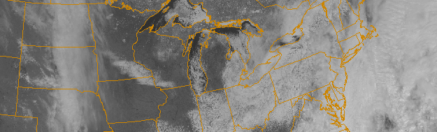
You can’t really be surprised that snow is once again in the forecast, can you? After a two month period featuring record breaking cold and snow, temperatures soared into the 60’s on Thursday evening. But a cold front swept through the area Thursday Night, ushering in colder than normal air once again. Highs on Friday barely reached into the 40’s. And on Friday Night into Saturday, forecast models are indicating a return of post-frontal precipitation with a chance of, yes, light snow throughout the area and into New England.
As a large mid and upper level system slides from the Ohio Valley to the Northeast US Coast, enough atmospheric energy will force the development of a low pressure system offshore. While the center of low pressure will be hundreds of miles to our east, an inverted trough extending westward from it will be the culprit in our snow chances. Light snow could develop as early as Friday Night and is expected to continue in parts of the area until Sunday morning. But the location and intensity of the snow becomes the main detail we’ll have to iron out.
What’s causing the snow to reach our area despite the low pressure center being so far away? The aforementioned inverted trough. These are basically areas of lower pressure which extend westward from a surface low. They can stretch for hundreds of miles away from the center of low pressure. The area of lower pressure also comes with an area of enhanced lift for precipitation, which causes precipitation in the form of rain or snow to extend westward. While the inverted trough’s development seems to be all but a certainty at this time, it’s location is extremely difficult to pinpoint.
Forecast models have been waffling back and forth tremendously with the exact position and intensity of the inverted trough. While we do know that the inverted trough will produce bands of precipitation (in the form of snow in many areas), intricate atmospheric details will determine where those band set up. The latest modeling in the past 24 hours has shifted these bands east of New York City — over Long Island and New England. Given the positioning of the mid and upper level atmospheric features, this makes plenty of sense.
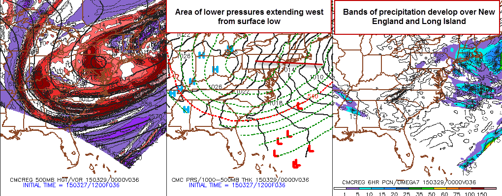
Regional Canadian model showing the mean sea level pressure (center) and precipitation (right) on Saturday.
Snowfall accumulations will also be difficult to forecast, not only due to the time of year, but also the forecast model uncertainties. While the ground is warmer this time of year, our main concern is precipitation rate. Think of it this way: Light snow will almost certainly melt on the ground over time. This becomes especially true late in winter and early in Spring. But if snow falls steadily and heavily enough, it can accumulate — and fairly rapidly. At the present time, our best forecast is:
A period of light snow, but no accumulation in NYC or New Jersey
A Trace to 1″ of snow from NYC Eastward over Long Island and Connecticut
Bands of 1-3″ of accumulation where heavier snow falls over New England and Long Island.
Forecasting these bands location will be a challenge for forecasters on Saturday. Mesoscale analysis will tell us more as the event unfolds. We encourage you to stay tuned and follow our accounts on social media for the latest updates!
Trackbacks & Pingbacks
3adequately
[…] friends at New York Metro Weather tell us that New York can expect to see some light snow starting Friday night and trickling into Sunday as a cold front sweeps in […]
Comments are closed.