-2")
Severe weather outbreak possible in the Midwest today
Severe weather season is kicking up, and today could feature a dangerous outbreak of storms over the Midwest and North/Eastern Plains states toward parts of the Mississippi River Valley. The Storm Prediction Center has issued a large “Moderate Risk” for severe thunderstorms in those areas, the second highest risk category they use (only High Risk denotes a greater potential), with the potential for widespread damaging wind gusts and strong tornadoes.
A large high pressure ridge, currently situated over the Central United States, is slowly shifting eastward. But, more notably, the high pressure dome is serving as a highway for severe thunderstorm formation on its northern edge. Along the periphery of the ridge, atmospheric disturbances have been sliding east and then southeast from the Northern Plains into the Mississippi Valley. These disturbances are acting to force thunderstorm development within an incredibly unstable and supportive environment for severe thunderstorms.
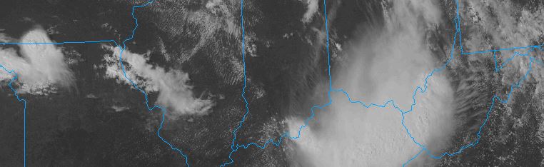
Earlier today, a large Mesoscale Convective System (MCS) moved from areas Northwest of Chicago, all the way southward through Cincinnati. This system continues its trek southeastward at a very fast pace (over 50 mph at times) this afternoon and evening. The complex has produced widespread reports of strong, damaging winds since earlier today.
But later today, the Storm Prediction Center anticipates regeneration of strong and severe thunderstorms, in the form of supercells, over areas well to the North of where this complex tracked today. All the way north in Iowa and Wisconsin, an atmospheric disturbance will force the development of new updrafts — or the birth of new thunderstorms. These storms will form and then drop south/southeastward, into a highly unstable environment.
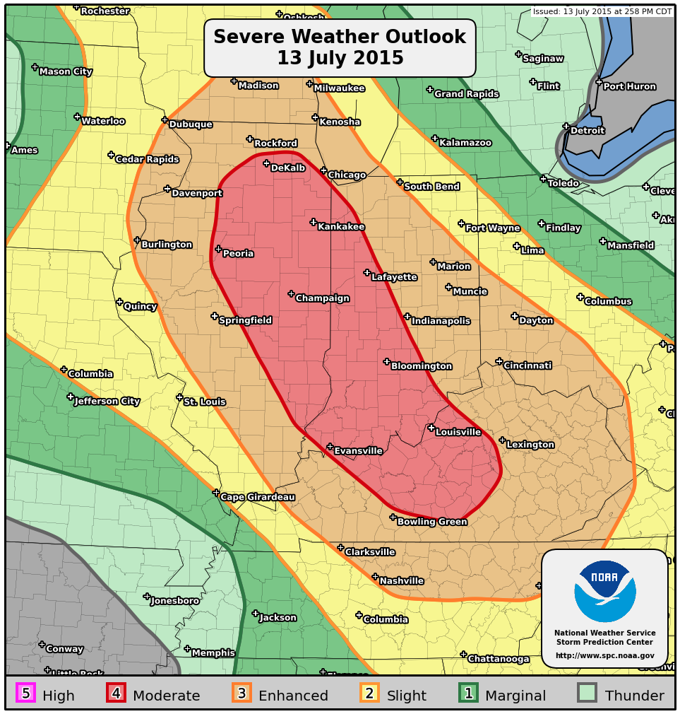
Storm Prediction Center outlook for today and tonight over the Midwest US.
Thunderstorms need a few things in place in order to become severe and organize: Instability, favorable wind shear, and lift. (There are plenty of other technical things necessary but we won’t quite go there). All of the necessary ingredients are present. Extreme instability exists — with CAPE values (convective available potential energy) over 5000 joules in many places. Atmospheric shear for storm organization is impressive — and thunderstorms are expected to pose a threat for strong tornadoes before they organize into a complex that may produce widespread damaging winds again.
The Storm Prediction Center uses some very strong wording in its latest outlook:
 A LARGE BOWING MCS IS TRACKING SOUTH-SOUTHEASTWARD ACROSS CENTRAL
   IND.  THIS SYSTEM WILL PROGRESS INTO CENTRAL KY AND EVENTUALLY INTO
   MIDDLE/EASTERN TN.  A VERY MOIST/UNSTABLE AIR MASS IS PRESENT AHEAD
   OF THE STORMS...ALONG WITH INCREASING WINDS ALOFT.  PRESENT
   CONDITIONS SUGGEST STORMS MAY INTENSIFY INTO A LONG-LIVED AND
   DAMAGING BOW ECHO WITH THE RISK OF WIDESPREAD DAMAGING WINDS
   /DERECHO/.
There’s the magic word — Derecho. While many have used this word for hype over the past year or two, today looks like a day where one could legitimately form. How exactly does a derecho form? Picture it this way: In order to form, the extreme instability needs to align with the favorable wind shear to allow storms to accelerate while maintaining intensity. And when they do so, while continuing to slide into an unstable environment, they can become fast moving powerhouses which produce severe winds over a large area.
This graphic shows the long-lived history (since Sunday PM) of the squall line currently moving southeast eastern KY. pic.twitter.com/7vheFunoQv
— NWS SPC (@NWSSPC) July 13, 2015
The Storm Prediction Center has noted the potential, obviously, as discussed above. But they’ve also recognized the complex from earlier this morning which moved over 700 miles in 18 hours. Believe it or not, derecho’s do have a broad definition which they need to fit in. These derechos, which must move over a long distance/area at a fast speed, need to have wind gusts over 58mph (NWS definition) throughout its path. Once the storm complex stops producing wind gusts of this magnitude, the derecho “area” ends.
So while one complex may be weakening over the Mississippi Valley tonight, another will be forming to its northwest — potentially as a second round of storms with a stronger, more intense Derecho.
Stay tuned for updates throughout the day as the storms progress through the Midwest. While they aren’t a threat to our area, they will affect millions on their trek southeastward today and tonight.
Trackbacks & Pingbacks
2hearsay
Comments are closed.