-2")
Monday’s snow threat trends north, still a concern
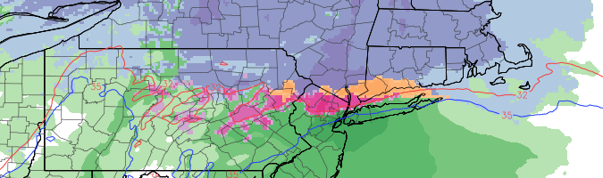
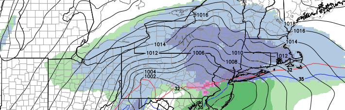
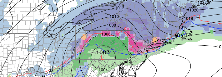
The winter weather potential for late this weekend into early next week has been well advertised. A low pressure system is forecast to develop from the Ohio Valley into the Northeast states late this weekend, along a thermal gradient otherwise known as a baroclinic zone, and force the development of precipitation in the Northeast States. Forecast models, however, had been displaying tremendous uncertainty with the positioning of that thermal gradient — uncertainties which were well documented. The past 48 hours have seen forecast models trend farther north with the thermal gradient, changing the complexion of the storm threat completely.
What this means for our area, is that precipitation type and amounts become less certain. The thermal gradient, essentially, is a boundary where there is a large temperature gradient over a short distance. Along and just north of this zone, enhanced lift for precipitation can occur as the development of a low pressure system is promoted near or just south of it. With this gradient trending north, forecast models have introduced warmer temperatures in the mid levels, and have shifted precipitation northward into New England.