Spring Weather Awareness: Severe storms, and SPC

Each year, as the atmospheric pattern begins to undergo a transition and wavelengths begin to change, the threat for strong to severe thunderstorms becomes a focus of the meteorological community in New Jersey, New York and Connecticut. Spring, in fact, marks the beginning of “Severe Weather” season in our area — which generally has been known to begin on May 1st. There are obviously severe thunderstorm events outside of that date, but in general the most consistent potential for organized severe storms begins in May and ends in August or September.

Interestingly enough, severe thunderstorms feature some terminology and atmospheric interactions which can be very confusing not only to interpret as meteorologists, but to understand on the public level. Knowing the basics of how organized thunderstorm events develop, and how forecasters attempt to predict and quantify their potential, will help to make things a little less confusing when severe weather season comes around this year.

Read more

Nor’easter likely to spare our area major impacts this weekend

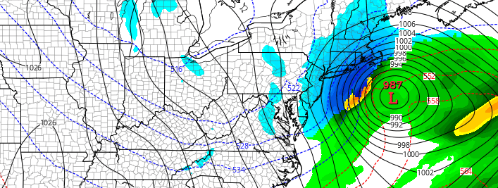
After a few days of concern, forecast models have trended more progressive and weaker with a Nor’easter which will pass off the coast of the Mid Atlantic and eventually New England this weekend. While models have been in good agreement that the storm itself will occur, inconsistencies have been common in regards to the exact track and intensity of the storm system. A convoluted atmospheric setup has wreaked havoc on even the most reliable forecast models.

A few days ago we highlighted the main players in the storm systems evolution. As of tonight, forecast models continue to fine tune the exact evolution of these features. Most interestingly, a lead disturbance ahead of the main storm system is now expected aid it de-amplifying the mid level height field. In simple terms, this will help to suppress the main coastal storm farther to the southeast.

Read more

Weekend Nor’easter increasingly likely, but impacts still uncertain

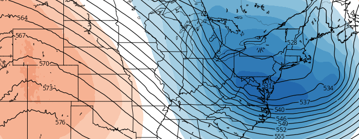
Forecast models have come into better agreement, over the past day or so, in regards to the eventual atmospheric pattern evolution over the next several days. The evolution of the pattern has been a topic of major discussion over the past several days, with hints of the potential for a Nor’Easter several days ago. After a few blip model runs which showed the storm system, operational and ensemble guidance was a mess — with each suite showing separate evolution’s and resultant solutions in regards to the track and intensity of a developing surface low off the East Coast.

On Wednesday, however, global model guidance came into much better agreement on the evolution of a few major features, all of which will play a major role in the development of a powerful Nor’Easter from Sunday into Monday. The majority of global model guidance, including ensembles, agree on this. The question moving forward will be, as it always is, in the details and nuances of the setup. Those will decide whether or our area receives a glancing blow, or significant impacts and potentially a late-season winter storm.

Read more

Here’s what we know about this weekends potential storm

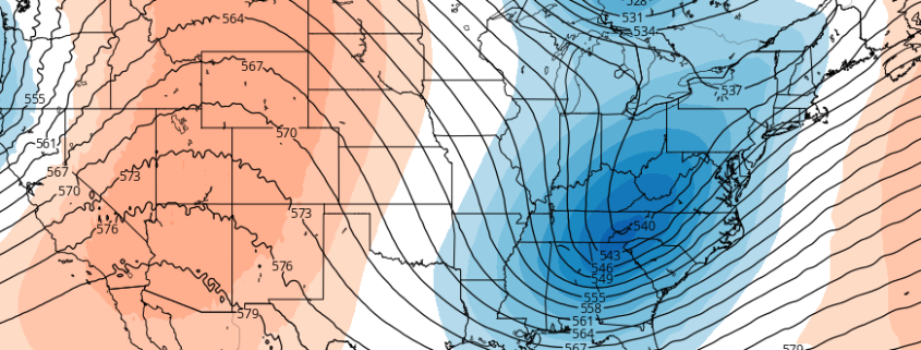
Just when you thought old man winter had packed his bags and headed north for the year, he’s making a push to overstay his welcome once more. Forecast models have come into better agreement on the eventual evolution of the atmospheric pattern over the next several days, and there’s one thing that is certain: It will certainly be colder than it has been for the past week or two. Temperatures will settle near and below normal by this upcoming weekend.

Models also have hinted at pieces of energy which may enter the US from the Pacific, signaling the potential for a storm system along the East Coast this upcoming weekend. But the details, as they often do at this time frame, remain highly uncertain. Here’s what we know so far:

Read more