-2")
Monday Overview: Pleasant, Warm Weather Continues Into This Week
After an unseasonably chilly weather to begin April, more spring-like weather has arrived for region over this past weekend. Pleasant weather will continue much of this week. A cold front will moving south through the local region late tonight or Tuesday morning. Model guidance shows this front will most likely come through the region dry, with moisture very limited and best forcing well north and east of the region. The next chance of any rainfall of consequence will come late Thursday night and Friday.
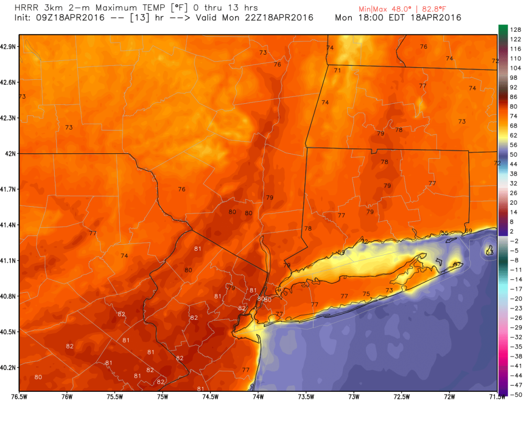
- For today, very warm conditions likely today with temperatures reaching the upper 70s to lower 80s, over inland sections of New York City, New Jersey, and the Lower Hudson Valley. These temperatures are around 15 degrees above average for this of time of year. Sea-breezes developing–due to the strong thermal gradient–will cause temperatures closer to the shore, to drop from the lower to middle 70s early this afternoon to back down into 60s late this afternoon and this evening.
- A cooler airmass starts to flow into region behind the cold front Tuesday afternoon. But northwest downslope winds with deep mixing may still cause temperatures to rise in the upper 60s to lower 70s for highs with clouds breaking for some sunshine. Wednesday will be cooler high temperatures in lower to middle 60s,with a northerly winds around high pressure to the west.
- Upper-level ridge builds back over the region with southwest flow late this week. This will cause temperatures rise several degrees above average again on Thursday and Friday, at least into upper 60s to lower 70s. Thursday will be mostly sunny, before a storm system coming from the Southwest United States, may cause more showers on late Thursday night and Friday. Details with this system will come into focus over next few days.
- Just a friendly reminder, visit our SportsCast page for latest weather on Yankees and Mets games around the region this week.