-2")
Monday Musings: Warm, Dry Today…Backdoor Cold Front & Possible T-Storms Tomorrow
High pressure off the Mid-Atlantic coast will be control of weather. A couple passing upper-level disturbances will bring cause clouds to mix with sunshine today. But light southwesterly winds will help temperatures to rise into upper 60s to lower 70s, away from the south-facing shores. Tonight will be partly cloudy with low temperatures upper 40s to lower 50s. A warm front lifting north the region may cause some scattered showers and isolated thunderstorms late tonight or early tomorrow morning.
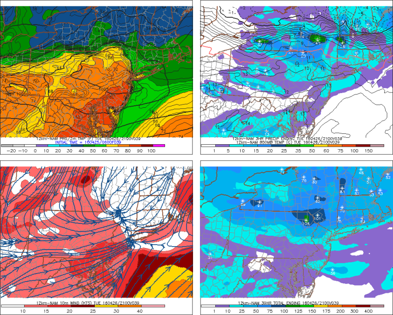
Clouds could break for some sunshine during the midday hours tomorrow. Meanwhile, stronger confluence underneath a -NAO block and upper-level low over Southeast Canada will begin to force the warm front to move back south as a backdoor cold front during the day tomorrow. Model guidance currently has the front over West-Central New Jersey tomorrow afternoon with a huge difference in temperatures from northeast to southwest. A wave of low pressure moving along this frontal boundary, along with an upper-level shortwave trough will help trigger more showers and thunderstorms tomorrow afternoon and evening.
With a strengthening mid-level flow and moderate instability forecast south of the front, there is potential for a few of these thunderstorms to be strong or severe. Particularly, over West-Central and Southern New Jersey where the Storm Prediction Center now has a marginal risk. Further north, more showers or elevated thunderstorms are more likely with a stable marine airmass settling in, north of the frontal boundary. But heavy downpours and lightning can still occur regardless. Then skies clear late Tuesday night. High pressure builds in for Wednesday for mostly sunny skies. But a cooler airmass will be in place. Temperatures will be in upper 50s to lower 60s.
Other brief musings for today:
- Showers and thunderstorms could cause at least delay the Mets vs Reds game on Tuesday night. Stay tuned to our SportsCast page for more forecast updates.
- While we have risk for few strong or severe t-storms in this region, a bigger severe weather outbreak is possible for Central Plains on Tuesday with a large, negatively-tilted upper-level trough. Timing of shortwave and jetstream energy rotating around this upper-level trough into a moist, unstable airmass, will be crucial with storm initiation and intensity in this region.
- Another wave of low pressure may affect local region on Thursday and Friday. But there is model disagreement with this system. The GFS model shows a track over Northern Mid-Atlantic region, giving most of the region some rainfall. On the other hand, the ECMWF model shows stronger confluence from the upper-level over Southeast Canada forcing this wave farther south–keeping more of the region dry.