-2")

Tuesday Overview: Near record warmth thru Wed, then cooler & unsettled
More summer-like warm temperatures are in store for today, as strong, anomalous ridge for this time builds over the region. Mostly sunny skies are expected today with highs reaching the lower to middle 80s. A deepening low over Southeast Canada will cause winds to somewhat gusty of south later this afternoon. These winds could keep parts of Long Island and south-facing shores a little cooler. But temperatures are still closer to normal for July. A few record highs were broken across the area already yesterday. These are record highs from National Weather Service will be jeopardy again today.
Central Park,NY 82 (1990)
LaGuardia Airport,NY 79 (2007)
JFK Airport,NY 77 (1964)
Newark,NJ 80 (1964)
Islip,NY 74 (2006)
Bridgeport, CT 75 (1990)
Mostly clear skies and warm conditions remain into this evening. The clouds will increase overnight as a weak cold front approaches from the northwest. But high pressure will likely keep the region the dry overnight. Low temperatures will be in the 60s for much of the region. The cold front will push south through the region tomorrow. More clouds may mix with sunshine during the day tomorrow. But west-northwest downslope winds will likely help temperatures rise into lower to middle 80s over much of the region. Temperatures could reach or break record highs again on Wednesday. Then a cooling trend begins Thursday and Friday with some showers possible, as a large upper-level trough and low pressure along a frontal boundary affects the region. However, current model guidance shows this low pressure organizing too late for a widespread, heavy rainfall for the local region. A few other highlights for today.
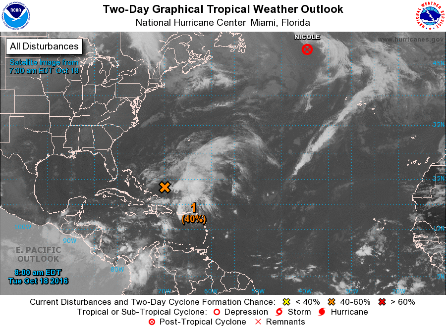
- NHC is giving moderate chances a non-tropical low near the Bahamas for sub-tropical or tropical storm development over the next 48hrs.
- More significant rainfall is possible over parts of New England by Friday, currently under a severe or extreme drought
- Drier weather is expected this weekend with breezy conditions and below normal temperatures.
For more details on the forecast, including video discussions and long-range outlooks, sign up for our Premium membership today!