Saturday Overview: Chilly Weather Today…Milder on Sunday

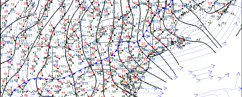
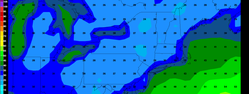
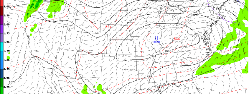
A colder airmass settled over the region, as expected overnight and this morning. But this airmass will be already on it way out this afternoon, as the pattern remains quite progressive. After quite a cold start with most of the area dropping into the 30s and some upper 20s, temperatures will rise into the upper 40s or lower 50s with plenty of sunshine this afternoon. Which is still chilly and somewhat below normal for November 12th. Strong and large high pressure centered over Ohio Valley will keep skies free today of much cloud cover through tonight.

Mostly clear skies and light winds will lead to more radiational cooling tonight. Especially for the suburbs, where lows will bottom upper 20s to middle 30s. Closer to NYC and urban areas lows will be upper 30s to lower 40s. On Sunday, more southwest winds with high pressure shifting south of the region, will support warmer high temperatures in upper 50s to lower 60s during the afternoon. More sunshine and dry weather will dominate throughout the day.  It should feel more pleasant than today! Some more highlights for early next week:

Read more

Friday Overview: Mild & Breezy Today, Quick Cold Blast Arrives Tonight

Temperatures this morning are already well into the 50s with west winds. As a strong cold front approaches, today from the northwest, temperatures will likely continue to rise into the lower or middle 60s over much of the region. But winds be increasing out the northwest by this afternoon with the front moving through the region. These winds could gust to between 30 to 40 mph at times. These winds will also help usher in a much colder airmass later tonight. Temperatures will begin falling through 50s and 40s later this afternoon and evening.

Winds will diminish overnight, as a cold airmass settles over the region. Many of the suburbs will get down into the middle 20s to lower 30s by dawn. The National Weather Service has issued Freeze Warnings for the parts of the area where growing season continues. Where a hard freeze and patchy frost is likely with vegetation. In NYC and some other urban areas temperatures are expected to drop into middle 30s with some pockets of frost possible by Saturday morning. Some other highlights for this weekend.

Read more

Thursday Overview: Pleasant Weather Returns, Colder by Saturday AM

After a dismal day on Wednesday, high pressure over the region will provide more pleasant Autumn weather today with plenty of sunshine. Temperatures will be cool but seasonable for this time of year. Highs will be in the mid-upper 50s with only some light breezes out of the northwest by this afternoon. High pressure will continue to keep skies will be mostly clear during evening and overnight hours tonight. It will be chilly, with low temperatures likely in the 40s in NYC and coastal areas and some 30s over the inland areas.

On Friday, a strong cold front will be moving through, during the late morning and early afternoon hours. Some more clouds may be around with sunshine tomorrow. But mainly dry conditions are anticipated with a lack of lift and moisture with the front. High temperatures before the front passes, will be in the upper 50s to lower 60s. It will also become breezy with gusty northwest winds. Then a much colder airmass will arrive on Friday night. Temperatures will drop into the middle 20s to lower 30s over many of the suburbs. Lows in will likely be in the lower or middle 30s over NYC and urban areas with the first patchy frost or freeze of the season possible for these areas. Some other highlights coming up over next days:

Read more

Wednesday Overview: Showers Today…Drier Weather Thursday

It will continue to be dreary into the afternoon hours, as a cold front and upper-level trough moves through the area. It will remain mostly cloudy with some showers off and on likely. Some of these showers may produce rain that falls moderately at times. But heavy rain is not anticipated, as much of the energy and moisture associated with the upper-level trough will be passing to the south of the region this afternoon.

Drier northwest winds, behind the cold front, will cause skies to begin clearing tonight. A cooler and drier airmass will be arriving with overnight low temperatures will be the 30s in many of inland suburbs to lower 40s over NYC, urban and coastal areas. High pressure will be in control tomorrow with plenty of sunshine and high temperatures in the middle to upper 50s. Which is seasonable for this time of year. Here are some other highlights going into this weekend:

Read more