-2")
Monday Overview: Oppressive Heat with Severe Thunderstorms Possible Today
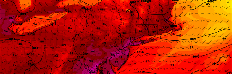
The fourth day of a heatwave — and likely the peak of it — is underway throughout the area. A stronger mid-level ridge and a deeper southwesterly flow will cause temperatures to reach the middle to upper 90s this afternoon. Some spots could reach 100F with enough sunshine. The big difference compared to the past few days, however, is that more humidity will cause oppressive heat today. Heat index values could be between 105° to 110° F this afternoon.
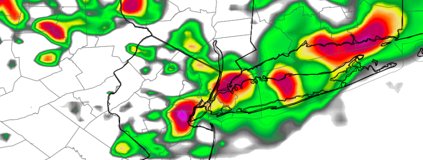
As a pre-frontal trough and then cold front approaches, some showers and thunderstorms are likely in the area from late this afternoon through the evening. There is some potential, with increasing instability and shear, for some more organized strong to severe thunderstorms. Damaging wind gusts will be the main threat from these thunderstorms. The Storm Prediction Center now has a slight risk for severe thunderstorms for most of the region this afternoon and evening. Thunderstorms could also produce frequent cloud to ground lightning and very heavy rainfall with localized flash flooding. Some other highlight for next few days: