-2")
AM All Zones Update: Cold Weekend, Tuesday & Wednesday Storm
A colder than normal airmass will be over the region through at least Saturday night. Some more clouds will be around later today and early tonight with weak shortwave trough and cold front moving through the region. A few widely scattered snow showers can’t be ruled out again, especially over the Interior. But high pressure over the Ohio Valley and Mid-Atlantic regions will largely be in control with dry weather over the next few days.
Temperatures will reach the lower to middle 30s for highs later today. Then skies will clear late tonight, with temperatures dropping into the teens and lower 20s over most of the region by daybreak. Mostly sunny skies are anticipated on Saturday with highs again perhaps a little colder in the upper 20s to lower 30s, across the region. Winds will be mostly light out the west or northwest through Saturday.
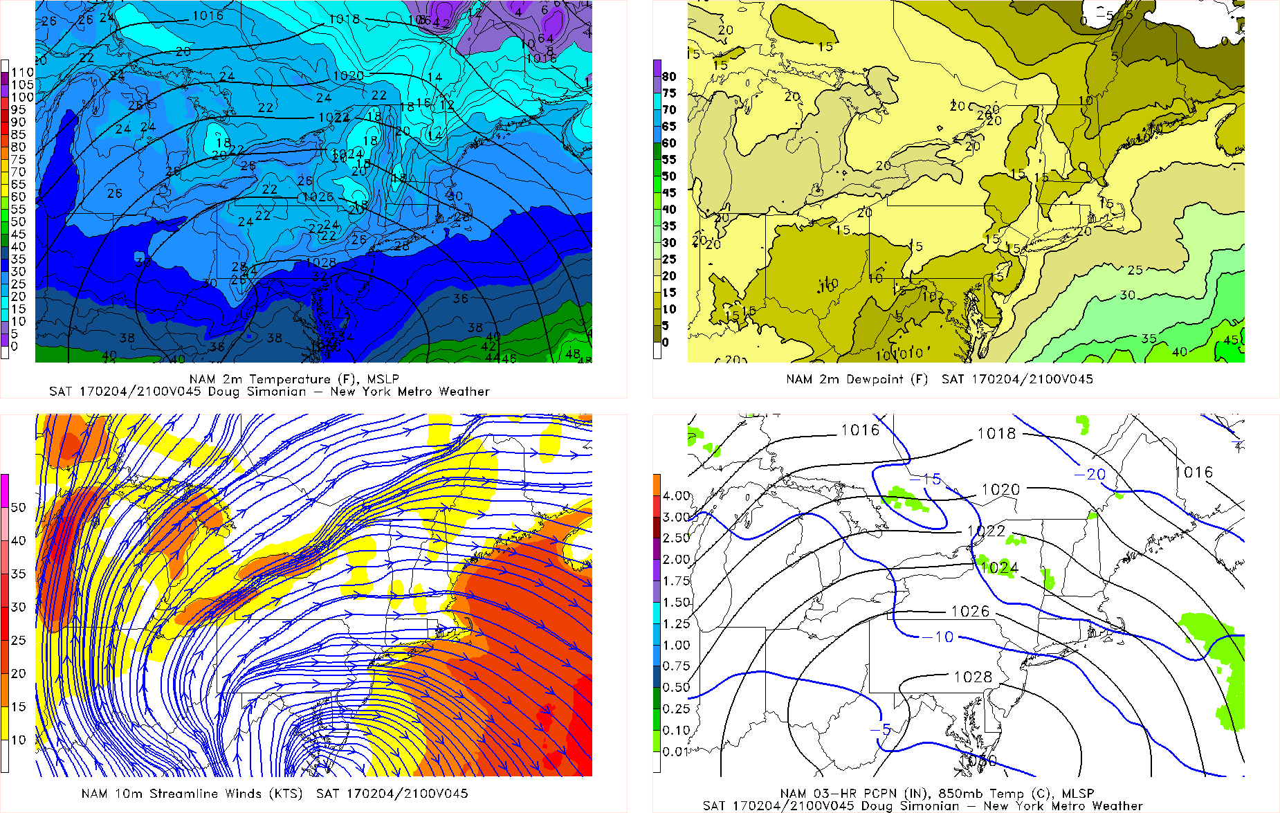
NAM model forecast for 4pm Saturday
Then high pressure shift off the Mid-Atlantic coast with return light southerly flow developing during Saturday night. Some clouds will begin increase ahead of next weak storm system approaching. These will likely keep low temperatures mostly in the 20s over the region.
On Sunday, warm-air advection ahead of frontal boundary approaching will keep more cloud cover around. Lift and moisture overall is limited for much precipitation. But there still a chance of some snow showers, as the frontal boundary moves through region, especially northwest of NYC. Temperatures will likely be rising into the middle 30s further inland to lower 40s near the coast by the afternoon hours. So these snow showers aren’t expected leave much accumulation, even if they occur.
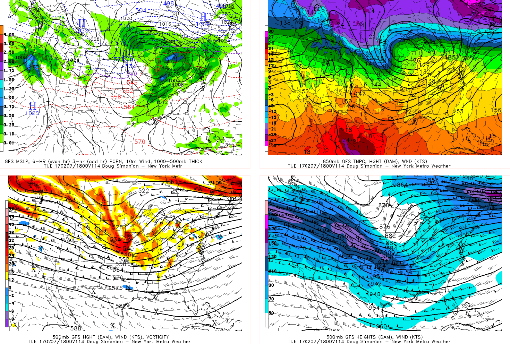
High pressure briefly builds back with more sunshine on Monday. But temperatures might be a little colder than on Sunday. Then a larger storm system, tracking to the northwest, impacts the region on Tuesday and Wednesday. Latest models have trended warmer with this system with predominately some rainfall for much of the region, especially over the coastal areas.
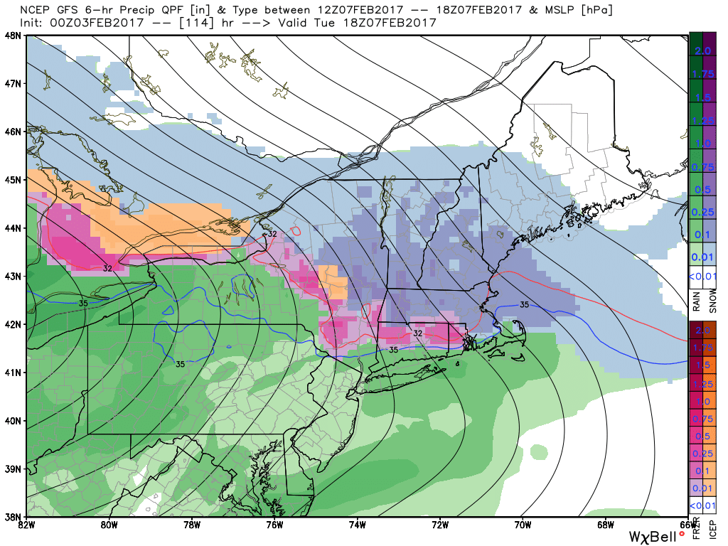
GFS model showing rain for most of the local region Tuesday afternoon, but snow or ice for Interior New York and New England
However, high pressure over Southeast Canada, may still support enough cold air for some snow, sleet and/or freezing rain with some accumulation over the Interior. Before a warm front with this storm system, lifts northward by Tuesday night and Wednesday. Temperatures may rise to well above normal levels on Wednesday (50°F+), if the warm front is north of the region.
A cold front will then passing by Wednesday night. Another wave of low pressure forming along this front is currently shown on model and ensemble guidance to stay well south of the region. But will keep monitoring it. Otherwise high pressure with another colder airmass will return later in the week. Stay tuned for more zone forecast updates and updates on the main dashboard, all these systems as we go through the weekend.