-2")
2/17 Late AM All Zones Update: Unseasonably Mild Weather This Weekend
High pressure with mid-level ridging builds into the region today. This will support more sunshine, with just some high cirrus passing through at times. After a cold start this morning, temperatures will rise into upper 30s to lower 40s this afternoon. Northwest winds will lighter to today, as a deep low moves further out into the Atlantic. So won’t feel as cold this afternoon, as Thursday afternoon was.
Tonight, a weak warm front will move through tonight, as high pressure moves offshore. Light winds will be more out southwest and more high clouds could be around. This will likely keep temperatures from falling out of the lower to middle 30s over coastal areas. However, some of the interior valleys or the suburbs could see still enough radiational cooling for temperatures to drop into the 20s again.
Then some milder and more pleasant weather, is in store for the weekend. Some high clouds could move through again with the disturbances passing well north and south of the region, especially on Saturday night. But sunshine and clear skies are likely to dominate through Sunday night.
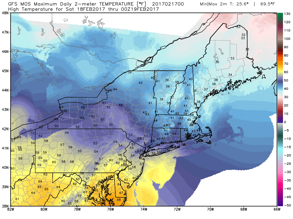
GFS MOS high temperatures for Saturday (quite possibly a little warmer, especially further south)
For Saturday, stronger mid-level ridging and warm-air advection will support high temperatures in at least in the middle to upper 50s, across the much of the area. Which is unseasonably mild for for mid-Feburary. Some northern parts of Lower Hudson Valley and Connecticut areas might be a little cooler, closer to frontal zone further north. While Central and Southern NJ are the most likely to exceed 60F+ with higher heights and warmer mid-level temperatures.
Sunday will likely be similar day with unseasonably mild temperatures. The frontal zone will start push south as backdoor cold front. This will cause winds turn more west to northwest throughout the day. But some ridging and downsloping flow ahead of it, will still allow for temperatures to reach into mid-upper 50s, across the most of region.
A cooler airmass will likely come behind this front, Sunday night into President’s Day Monday. There might be a wider range of temperatures from north to south across the zones on Monday afternoon. But temperatures may be somewhat closer to or just above normal, with more 40s or lower 50s over the region. More sunshine is expected as well, as high pressure builds south from Southeast Canada.
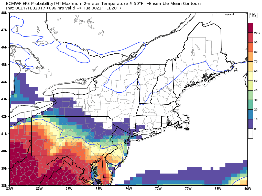
Euro ensemble mean showing 50°F+ temperatures mostly likely over Central and Southern parts of New Jersey on Monday
However, more milder temperatures may return by the middle of next week, before some pattern changes possibly at the end of the month. Check out the main dashboard for more discussion on next week and the extended term. Then stay tuned for more zone forecast updates through the holiday weekend!