-2")
First Major Arctic Intrusion of the Season Blasting South
Good Evening!
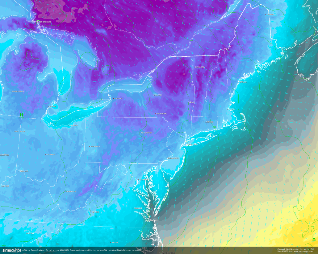
Today was another in a developing string of cooler days after the system that produced some of the first frozen precipitation of the season quickly scooted east. Behind this system, an expansive area of high pressure has slid in and strengthened over Pennsylvania and other surrounding states. This area of high pressure has allowed for drier conditions for the duration of the day, but has also allowed for cooler temperatures aloft to move in as well. The combination of the cooler temperatures aloft and mostly cloudy skies allowed for highs to only get into the middle 40’s to lower 50’s today across much of the New York metro. These cool and calm conditions should last through the night as the area of high pressure continues to move eastward. The combination of light winds, cold mid level temperatures, and relatively clear skies should allow for decent conditions for traditional cooling to take place. This will permit lows dropping into the middle to upper 30’s, with some locations to the north and west of the coast likely seeing lows dipping down into the upper 20’s. If you still have any plants outside that are not able to handle hard freezes, then tonight may be the last chance to take any plants indoors before much colder temperatures arrive.
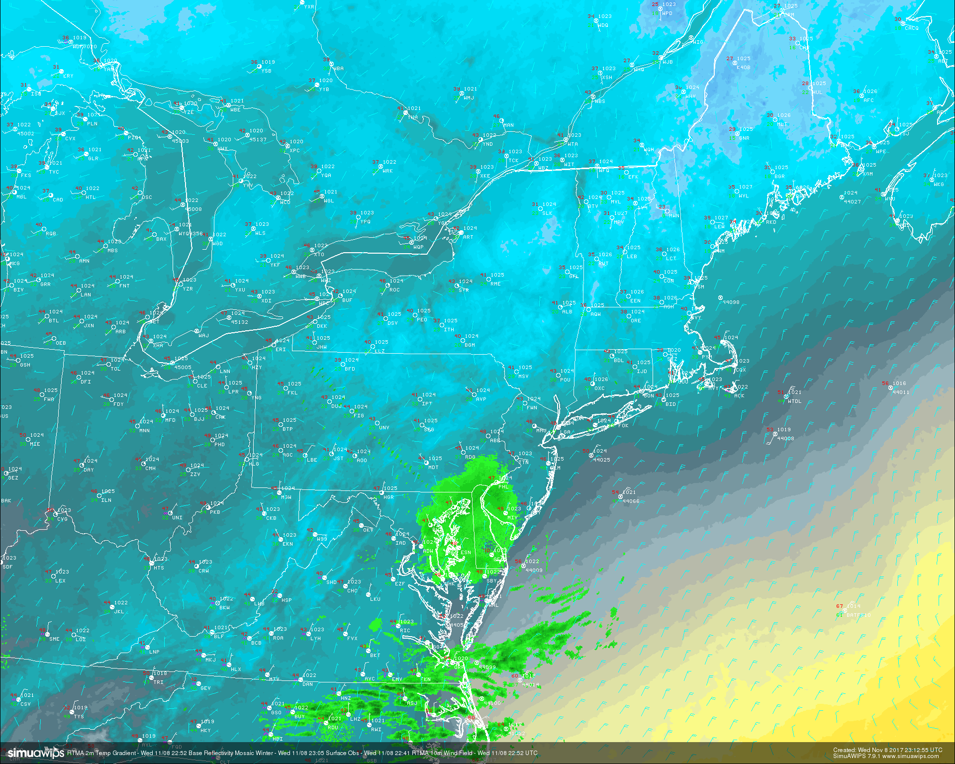
Real time temperature analysis , surface observations, and regional radar showing a calm, but cold end to our Wednesday
Thursday Into This Weekend
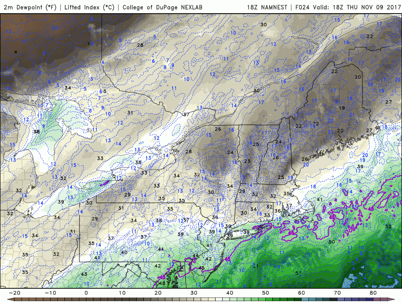
By Thursday, the large Arctic trough that we have been talking about since last week will the located across the northern section of the country after diving south from deep in Canada. Low level flow out ahead of this deep trough will be out of the southwest, which should be able to advect some warmer air from the south over the Northeast and over the I-95 corridor. Despite the southwesterly flow, dry air aloft is expected to keep much of the area dry and relatively cloud-free during the day. This should allow temperatures to warm just a bit to the upper 40’s and lower 50’s across much of the New York metro, with some locations near the coast likely seeing highs rise into the middle 50’s. Though, as the day progresses, the strong Arctic front will rapidly breach the Northeast United States. We may see clouds begin to increase due to the enhanced low level moisture interacting with some cooler temps just ahead of the front, and this may even spark a shower or two over the area very late tomorrow and into the early morning hours of Friday.
Friday should see the full brunt of this Arctic front starting very early in the morning, with the boundary likely clearing the NYC area before dawn. We may see a situation on Friday where the early morning temperatures that take place before the front arrives are actually the highs for the day, with temperatures steadily dropping thereafter. Behind the Arctic blast, skies will likely be partly cloudy, with some locations possibly evening seeing some bursts of snow as moisture streams off of the Great Lakes, which are still quite warm. Winds will also begin to pick up during the day, with gusts likely in the 20-25 mph range. With Fridays highs likely being set in the very early morning, afternoon temperatures should drop into the lower to middle 30’s, with wind chills likely in the teens and 20’s. Friday night will be the coldest night the Northeast has seen since earlier this winter, with overnight lows dropping into the teens and lower 20’s and windchill’s dropping into the single-digits and teens! These temperatures will be more akin to January than November, and will likely be 15-25 degrees below normal across the entire Northeast!
Loop of the Arctic front blasting through the Northeast Thurs PM/ Fri AM
Temperatures will remain very cold into Saturday morning as the core of the area of high pressure begins to pass overhead. This should allow for clear skies on Saturday with diminishing winds. Highs will likely be only a few degrees warmer, with temperatures unlikely to escape the 30’s across much of the region, with the exception of coastal locations. Overnight lows will likely drop past the freezing mark once again as clear skies and cold mid level temperatures dominate the evening. Expect lows in the lower to upper 20’s with coastal sections once again seeing slightly warmer temperatures.
By Sunday, things should warm up into the 40’s ahead of an approaching storm system that will likely be located in the central US and Ohio valley. Sunday should feature This area of low pressure will also increase low level moisture, so expect clouds to develop later in the day, with a chance at some cold showers by the overnight hours.
This system could potentially bring some moderate rain to the Northeast on Monday and Tuesday with an increase in temperatures, but model guidance diverges significantly on this solution at the moment, and we will have much more on this potential system by the end of the week!
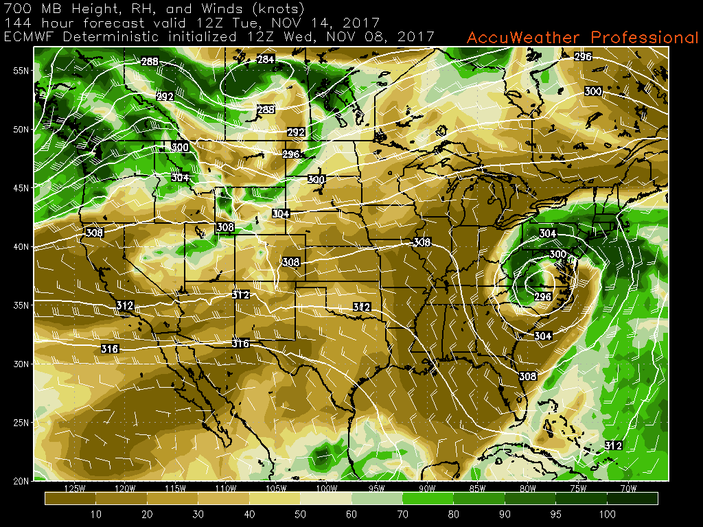
This afternoons ECMWF model showing a potential coastal storm for the beginning of the work week next week
For more information and posts like this one, make sure you sign up for Premium Forecasts — where multiple detailed articles, videos, and interactives are posted each day. Also, come interact with our staff and many other weather enthusiasts at 33andrain.com!
Have a great night!
Steve Copertino
Trackbacks & Pingbacks
2consonant
Comments are closed.