-2")
Tuesday AM Brief: Bitter cold arrives in Northeast, a few storm chances ahead
Good morning and a happy Tuesday to you! Bitter cold has arrived in the Northeast states this morning, in case you haven’t been outside or walked near a window yet. Discussed for quite some time, arctic air has finally surged into the Northern 1/3 of the United States, bringing bitter cold and anomalous temperatures (well below normal in many areas). The worst of the cold is currently situated across the Northern Plains, but is quickly making its move eastward towards the Great Lakes, Ohio Valley and Northeast States.
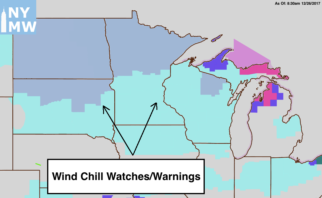
The National Weather Service has, in fact, issued Wind Chill Watches and Wind Chill Warnings for these areas – which isn’t insignificant, especially given the fact that these watches and warnings are tailored by geographical location. In other words, a Wind Chill Warning in Minnesota has a colder threshold than a Wind Chill Warning in New York City. Temperatures in Minnesota and the Dakotas will fall below -20 F tonight.
As we move into the week ahead, the weather pattern will remain bitterly cold across a large majority of the country. Forecast model guidance is in good agreement on that fact, at least, but not much else. As cold air becomes well established (many areas across the Northern 1/3 of the USA will average 10F or more below normal this week), the potential for a few storm systems will begin to evolve during the week ahead.
Guidance has been split on the idea of multiple disturbances affecting the Ohio Valley and Northeast with winter weather this week and upcoming weekend. The first occurs during the latter half of the week, as a piece of the polar vortex in the troposphere approaches the Great Lakes. Models had been more keen on the disturbance becoming amplified and phasing with another shortwave earlier in the week, but have since become more tame in their evolution, now suggesting that the storm will remain rather progressive and the coastal low development remaining offshore.
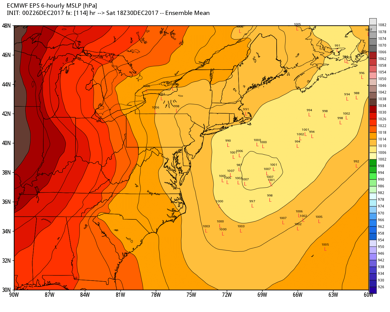
ECMWF ensembles on this weekend’s storm threat.
This seems to make sense given the progressive nature of the weather pattern in the Eastern Pacific Ocean at the time of the disturbances approach. Another storm system approaches during the weekend, more directly associated with the polar vortex, and interest for a potential impact in the Northeast states is higher during this time frame. Forecast models suggest that a blocking high over Canada may act to press the disturbance southward, allowing rapid amplification and development of an offshore surface low.
Plenty of uncertainty still exists in regards to how quickly the storm will amplify, and more specifically, where it will do so. It will have to rapidly amplify near the Great Lakes to produce a significant coastal storm – but either way, light snow appears probable in the Ohio Valley, Northeast (and particularly New England) upon the systems passage during the latter part of the weekend. The ECMWF is most amplified with the storm system currently, while its own Ensembles and the GFS remain slightly more progressive.
We’ll be keeping a close eye on the development of these systems in the next day or so. For now, bundle up!
Trackbacks & Pingbacks
1accessible
Comments are closed.