-2")
Public Analysis: A Tale of Two Seasons This Week
Astronomical Spring has finally arrived even though meteorological Spring has been here since March 1st. The only difference between the two is that meteorological Spring is based on the division of our calendar into four separate seasons, each having three months in each season. This makes it easier for observations and the ability to compare things like seasonal statistics. Astronomical Spring (or the Vernal equinox) is determined by the 23.5 degree tilt of the Earth’s rotational axis in relation to the Earth’s orbit around the sun.
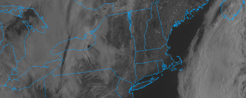
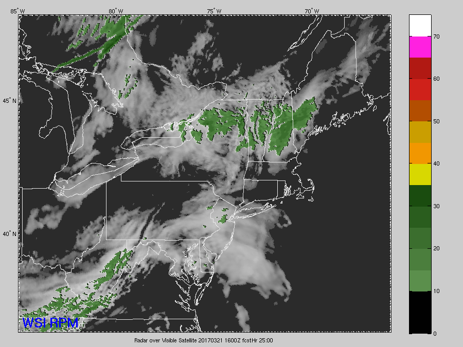
Regardless, today has been mostly sunny across the entire New York Metro area with a few high clouds noted on the latest visible satellite imagery. Temperatures have been able to rise in the high 40’s and lower 50’s across much of the area, which is right around normal for this time of the year-if not a few degrees below normal. Winds are generally calm across the area, but portions of NJ, NYC, and Long Island are seeing some winds in the 10-15 mph range with higher gusts, which are bringing wind-chills into the low 40’s in some locations, so we’re not feeling the Spring weather just yet. As we move on throughout the rest of the day, predominantly clear skies will be commonplace over the area as we await the arrival of a weak frontal system that it currently situated over the Ohio Valley.
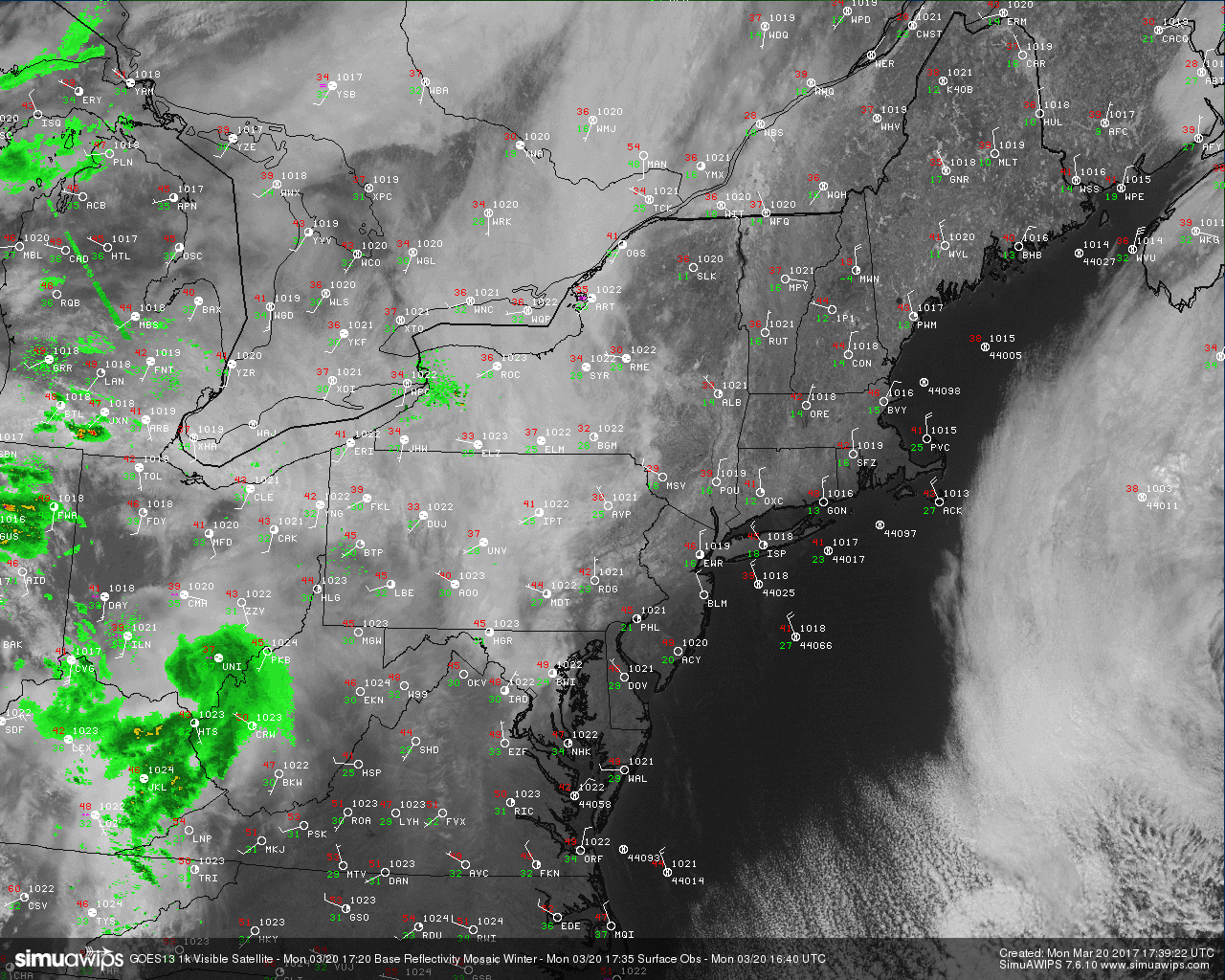
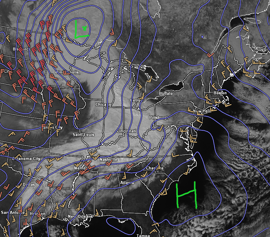
Current visible satellite, surface observations, and regional radar composite for the Northeast US (Courtesy of Simuawips.com)
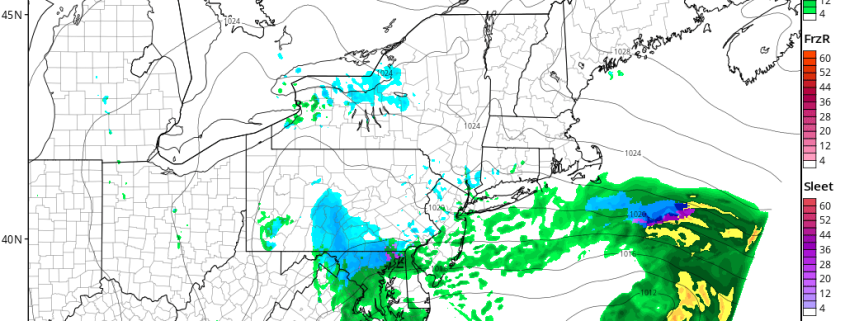
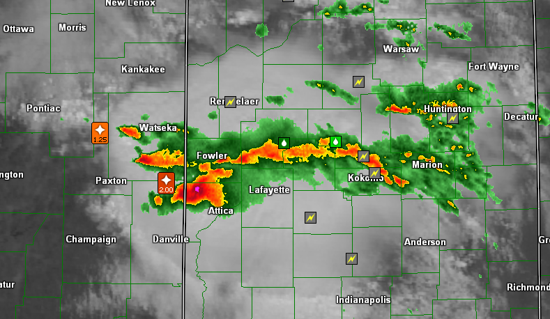
This weak frontal system is currently over Indiana, producing some strong showers and thunderstorms which have dropped hail up to 2″ in diameter as they track to the south-east. This area of showers, in conjunction with a very weak mid-level system located southeastern Canada will work towards our area later this evening. While the main area of stronger thunderstorms will die-off quite quickly as they move into a stable airmass, the associated showers and cloudy weather will begin to take over during the overnight hours.
With increasing cloud cover, temperatures will likely struggle to get lower than the mid 30’s to low 40’s for this evening’s low temperatures across the area. This afternoon’s computer model guidance has the bulk of the shower activity from these systems remaining to the south west of the NYC area as a very weak area of low pressure forms along the frontal system that will push through the region tomorrow morning.
After some limited light showers and clouds initially, Tuesday afternoon should clear up quite nicely as winds from the northwest (moving over deep snowpack in NY and PA) usher in drier air. Temperatures should be able to rebound quite quickly tomorrow into the lower to middle 50’s across much of the area by late afternoon, which will be a few degrees above normal.
This above-normal air mass will be very short-lived as a stronger cold front associated with a large area of high pressure centered in Canada will slowly make its way towards the Northeast. By Wednesday morning this cold front will be situated right to the north west of the metro area, with winds from the NW steadily increasing. Once the front passes, temperatures will likely struggle to push out of the 30’s across the entire area, with gusty winds making it feel like its even colder in most locations.
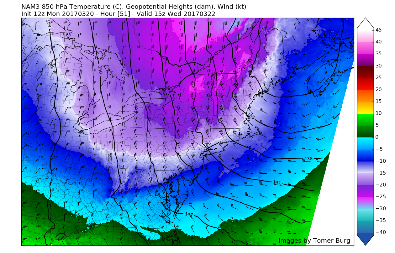
3km NAM model showing the strong cold front and its associated winds and temperatures at 850mb or 5,000 feet in the atmosphere.
Temperatures should remain 10-15 degrees below normal until at least Thursday, before a large ridge begins to build over the central part of the country and begins to head east. This ridge could possibly bring temperatures back to normal or even back to above-normal conditions by this weekend. However, we are monitoring the *potential* for some possible wintry precipitation across the northern sections of the area this weekend as a very delicate and complicated pattern takes shape.
The models at least agree on a cutoff low pressure system developing over the US Plains states by Friday afternoon with a large ridge of high pressure situated over the Southeastern states. With another upper-level system in Canada pressing down on the upper level ridge to its south, this setup would create “confluence” to our north, which would essentially limit the storm system in the Plains from cutting through the Great Lakes like these types of systems usually tend to do. Instead, with a large and cold high to the north, the storm would have the potential to stay underneath that high pressure and track more eastward. While it is getting very late in the season, this setup does have the potential to produce a redeveloping low pressure system off the Mid-Atlantic coast as the initial cutoff low transfers its energy.
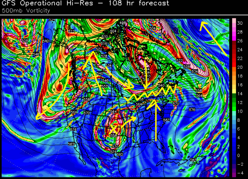
500mb map from the GFS showing a very complex situation developing for this weekend regarding any chance for wintry precipitation
We will continue to monitor this system throughout this week, so make sure to stay tuned for future updates. However at this time, we do not feel there is a lot of support for significant wintry precipitation this weekend, especially closer to the coast.
For more information and posts like this one, make sure you sign up for Zone Forecasts — where multiple detailed articles, videos, and interactives are posted each day. Also, come interact with our staff and many other weather enthusiasts at 33andrain.com!
Have a great evening!
Steve Copertino