-2")
Another Round of Records May Fall, Any Chance of Warmer Weather Soon?
Good Afternoon!
We hope everyone out there has been bundled-up over the past couple of days as we continue to endure a record-breaking temperatures across much of the Northeast. Today was a little warmer than yesterday, but warmer in this sense is still relative. Temperatures were stuck in the upper teens to middle twenties across the entire New York Metro area, with some middle to lower teens further north and west of the city. The same stout northwesterly flow in the mid levels of the atmosphere are still prevalent across the entire northern tier of the country, which continues to pump dry, Continental polar air into the country. Mainly dry conditions can be expected for the rest of the afternoon and into the evening hours before a weak shortwave trough begins to move into the Ohio Valley later tonight. This system looks to be too weak and too far west to really bring any precipitation into the region, but we should see an increase in mid to upper level clouds during the overnight hours. These clouds will work to dampen the maximum amount of radiational cooling we can achieve, but lows tonight will still be downright frigid once again. Middle to lower teens are expected tonight for the immediate NYC area, with single digits likely just to the north and west.
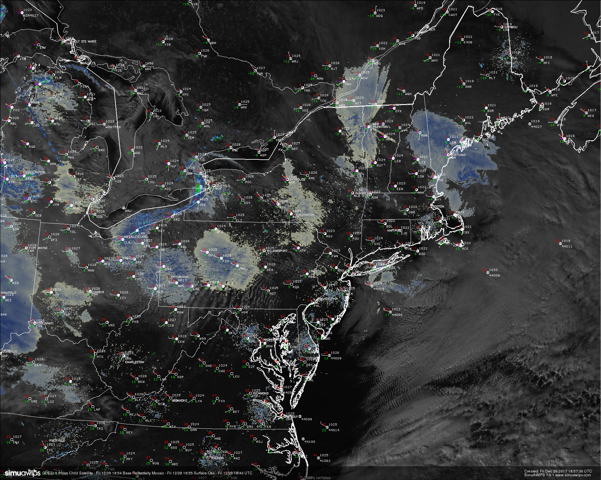
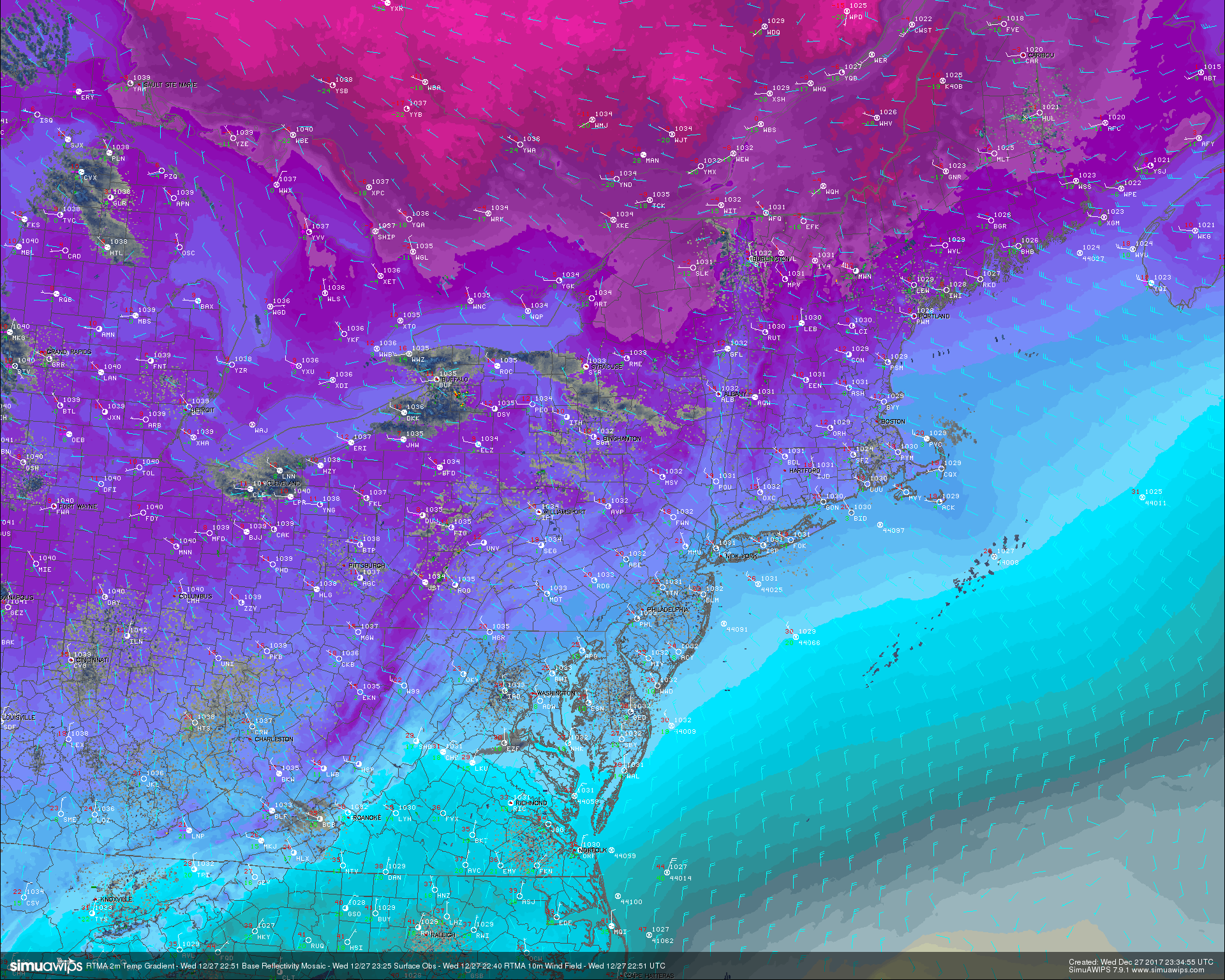
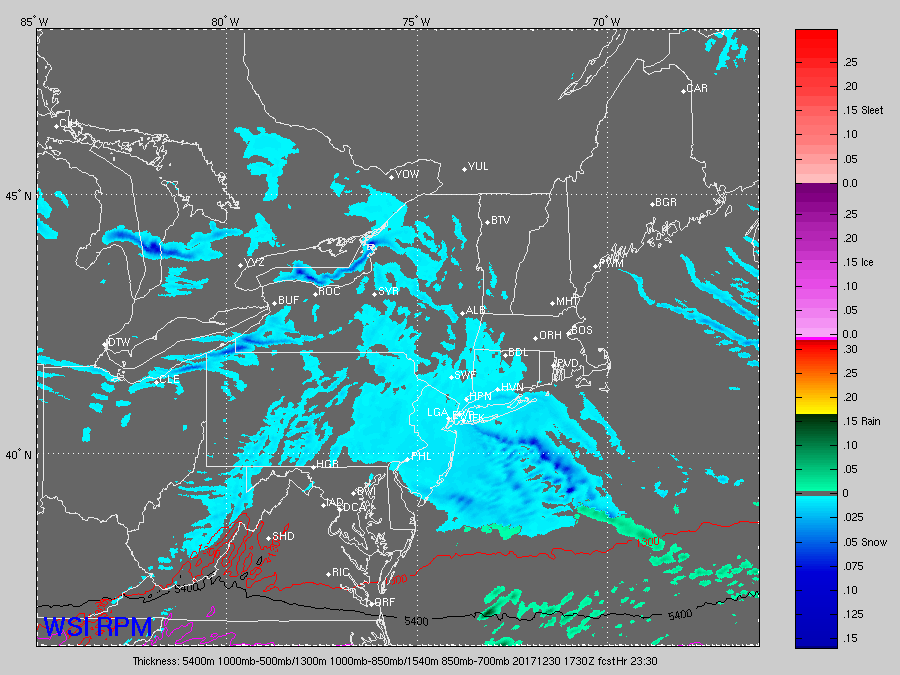
This afternoon high resolution visible satellite imagery, regional radar mosaic, and surface observations showing yet another bitterly cold day across the entire Northeast.
Light Snow Possibly Saturday
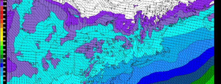
The weak shortwave trough that we mentioned earlier will continue to move east overnight and into the early morning hours on Saturday, likely bringing some very light snow to portions of the Mid Atlantic states. This system will be seriously moisture-starved, but any snow that falls will be high-ratio snow. This means that even if you see around .1″ of liquid, you could still manage to see about 1.5″ of fluffy snow. Scattered light snow should begin to overspread portions of eastern PA and NJ by the early morning hours tomorrow, with more concentrated bands possible over MD/DE. Light snow should then move over the rest of the area by the late morning and afternoon hours as a secondary low begins to develop just off of the Mid Atlantic coast. Once this secondary low begins to mature, snow should be ending over much of NJ and points west, with trace to maybe an inch of snow possible. Our secondary low should have more of an impact further east over portions of Long Islands and Connecticut where it should act to rejuvenate snow over those areas and possibly add a boost to the intensity. Slightly higher accumulations may be possible in these areas, with 2-4″ possible before the low quickly races off to the east and precip shuts down by 8-10pm. Note: Due to the extensive dry air ahead of this system, we could see prolonged periods of virga over the area leading to the possibility of little to no snow at all in some places.
The rest of the night looks to be very cold, with scattered snow showers possible over much of the Northeast as another shot of Polar air moves into the region overnight. Lows will drop down into the middle to lower teens around the city, with single-digits likely to the north and west.
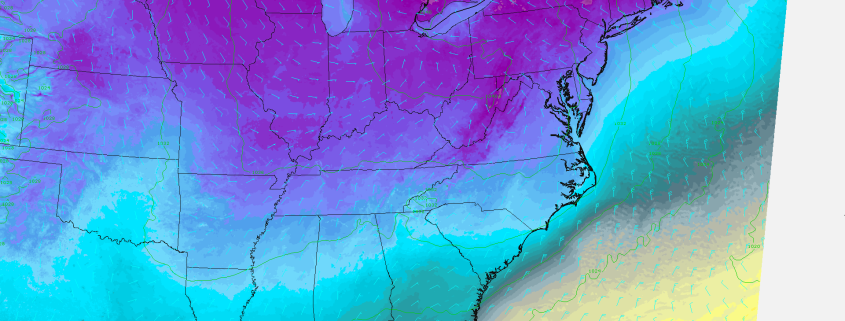
This afternoons RPM model showing a light area of snow overspreading the region on Saturday morning
Sunday will compete to be the coldest day of the year on the last day of the year as Polar high pressure builds into the Northeast during the morning hours. Highs during the day will be bitterly cold, with readings likely in the middle teens to right around 20. Strong northwesterly flow should keep enough dry air in the column to keep any clouds at a minimum. Dry and cold weather can be expected to last into the evening hours, just in time for New Years Eve. This should be one of the colder New Years Eve’s in recent memory, with the potential for quite a few records to fall across the Northeast. NYC may come very close to breaking a record low minimum temperature of around 9F. Readings across the entire area will be exceedingly cold, around the low teens to single digits area, with wind chills a good 5-10 degrees colder. We would seriously advise against being out for a prolonged period of time in this kind of cold, but if you are planning on it, make sure to wear multiple layers of clothing and cover up any exposed skin. Bare skin will be very susceptible to frost-bite during the evening hours!
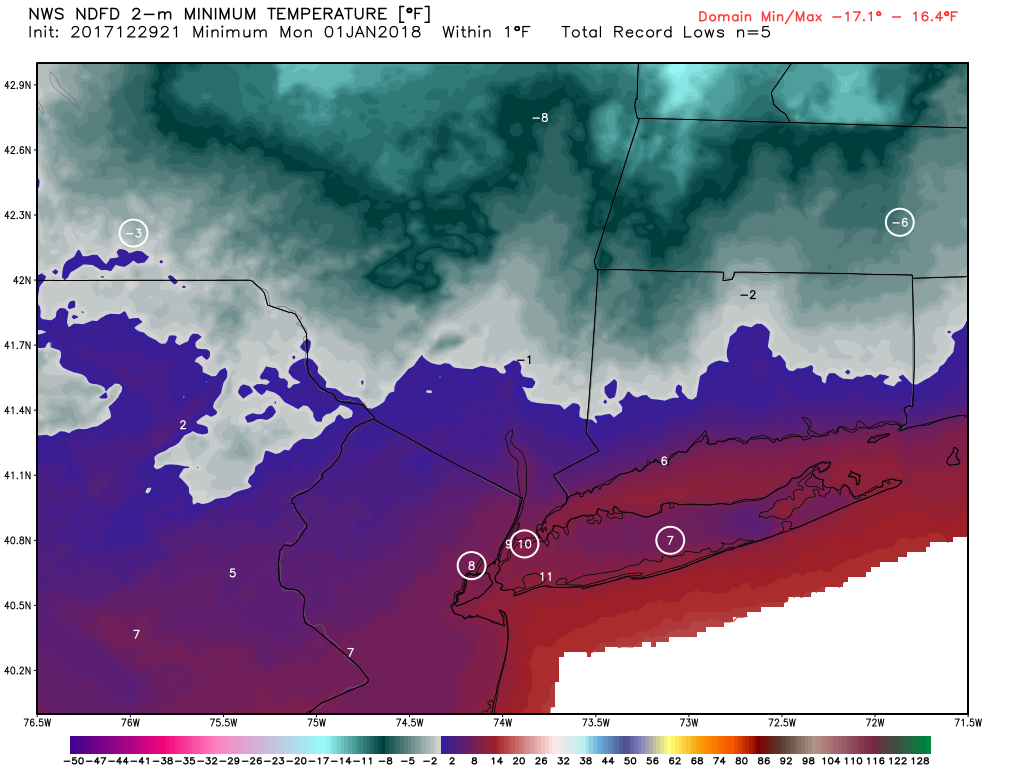
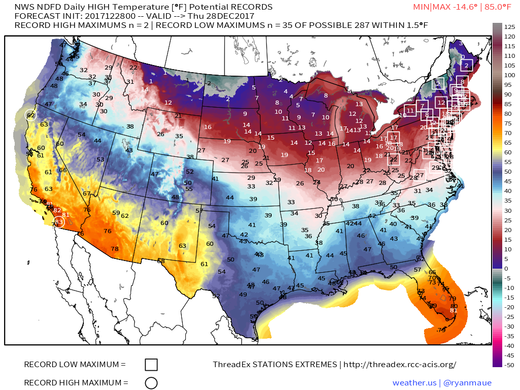
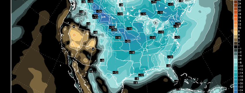
National Weather Service forecasted lows on New Years Eve, with the circles representing possible records being tied or broken!
New Years Day & Beyond!
We look to start off 2018 with another frigid and potential record-breaking day as very strong northerly flow dumps the remaining Polar air right into the Northeast. Most locations near the City will likely not be able to reach the 20’s, with middle to upper teens likely as highs during the day. Locations even further to the north and west will also struggle to see highs come out of the single-digits, making Monday an excellent day to just stay inside and enjoy a nice warm beverage!
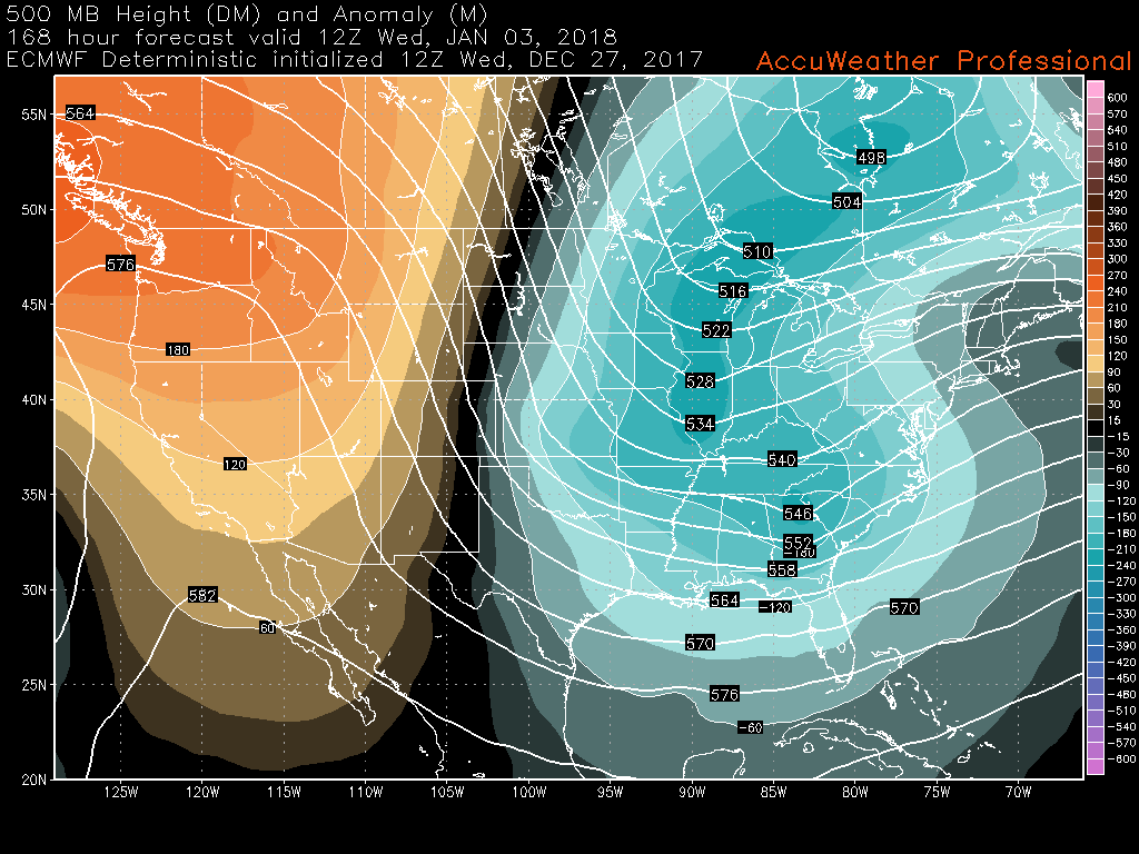
Will things improve and warm up later next week? The short answer is absolutely not. We could see temperatures briefly come back into the upper 20’s, but most of the Northeast may be stuck below-freezing for at least the next 10 days or so! To further complicate things, a coastal storm may past to the east of the region on Wednesday, which would bring down another extremely cold airmass from deep in Canada. At this time, this system appears to have a low chance of impacting the East, but we will be monitoring this system very closely since some of yesterdays guidance did show the potential for a rather high-impact storm if all the pieces come together at just the right time and place (thread the needle type of system)
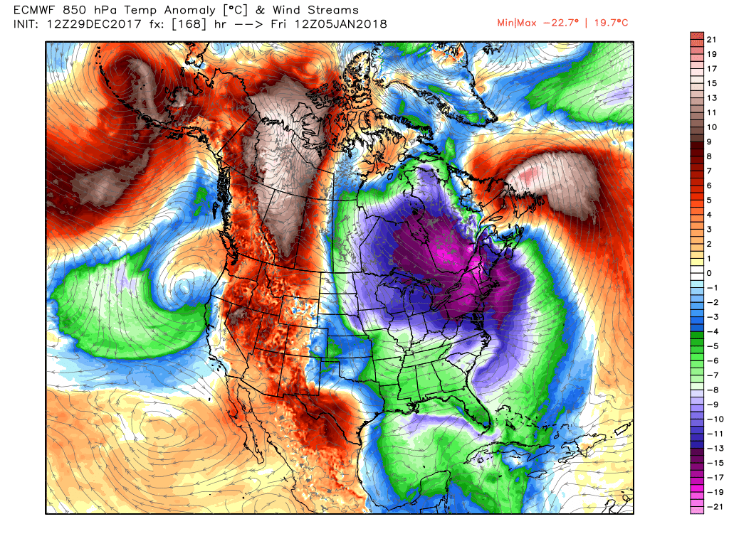
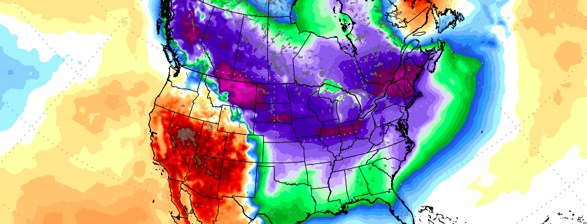
This afternoons ECMWF model showing a reload of the cold weather with a shot of true Arctic air next week.
Have a great weekend and we’ll see you in 2018!
Steve Copertino