-2")
Some Snow Likely in the Northeast Tuesday & Wednesday
Good morning! Very cold temperatures are again starting this week. A mixture of sunshine and clouds are expected for today. Highs will be in the mid-upper 20s. Cold and dry conditions will continue into tonight. But clouds will be increasing, as the next storm system approaches the Northeast. Temperatures will near steady for most of the night.
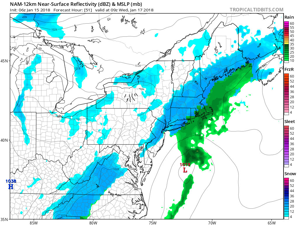
A large positively-tilted trough will begin moving into the Eastern US on Tuesday. A clipper low associated with northern stream shortwave energy along this trough will drag a cold front into the Northeast and Mid-Atlantic region tomorrow. Moisture will be initially limited with this system overall. But some bands of light snow will be developing, over the Interior areas morning and midday hours. Then these bands will be moving into the coastal areas during mid-late afternoon or early evening hours.
Overall light snowfall accumulations of 1″-3″ especially over the Interior areas, are expected through tomorrow afternoon or evening. Light southerly winds ahead of the front, will help surface temperatures rise into the middle or upper 30s during the afternoon and evening as well. This may limited more accumulations to colder surfaces. Boundary level temperatures may also be warm enough to support a light snow and rain mix over coastal areas.
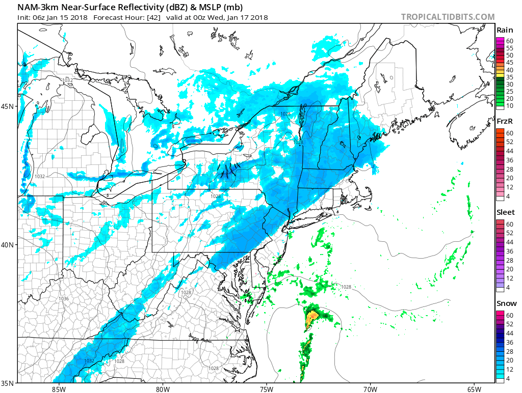
3km NAM model for tomorrow, showing a band of snow approaching coastal areas, early tomorrow evening in the Northeast
Then Tuesday night the clipper low will begin to transfer to a secondary low near the Southeast Virginia coast, This low will begin to draw more moisture from the Atlantic and colder air with northerly winds behind it, as it deepens and tracks northeast to near Cape Cod by Wednesday afternoon. This could enhance more moderate or heavy bands of snow later Tuesday night into Wednesday, especially for parts of Southern New England. If this occurs additional snowfall totals (perhaps more than 3″) will be possible. But confidence is currently low on this happening. There is also possibility for subsidence around the developing secondary low to cause banding to consolidate further east, leaving areas further west drier. These details should begin to become clearer with new model data later today.
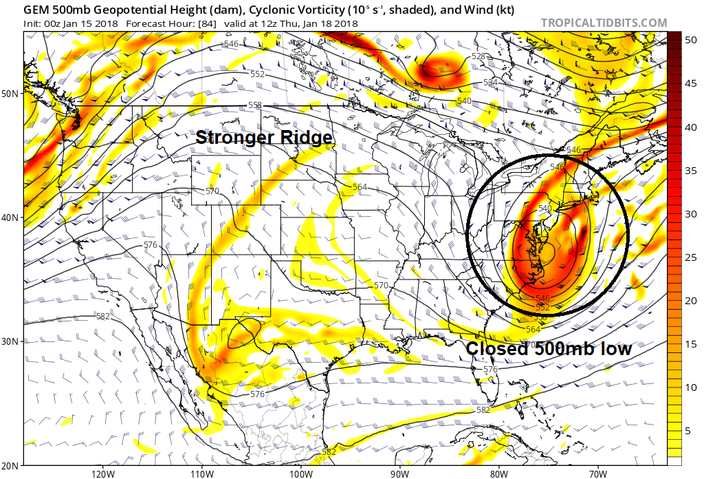
Finally, southern stream shortwave energy with this trough will attempt to amplify or cut-off over the Mid-Atlantic region. This will lead to another coastal low develop to develop off the Carolina coast, Wednesday night and Thursday. However the pattern is progressive with a lack of high-latitude blocking this week. Most model guidance forecasts a strong kicker disturbance (shortwave) to track into to the Midwest and keep shortwave energy more positively-tilted again. As a result, this coastal low is likely to stay to farther south and not impact the Northeast. The stronger Canadian model solution with more ridging over the Midwest, and a closed 500mb low over the Mid-Atlantic region from overnight, is an outlier at this time.
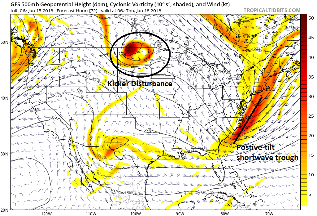
GFS model showing more progressive flow with kicker disturbance, keeping the southern stream shortwave energy from amplifying
Temperatures through Thursday are likely to remain near or just below seasonable cold levels. Then a pacific jet extension with more troughiness over the Western US, will finally result in more ridging building, over the Eastern US, in the longer term. Temperatures will gradually moderate to well above normal over the Northeast and Mid-Atlantic by this weekend. Stay tuned for more updates on the forecast during the week ahead!
Trackbacks & Pingbacks
2organist
Comments are closed.