-2")
Heavy Rain Likely This Weekend, Mild and Unsettled Through Next Week
Good evening!
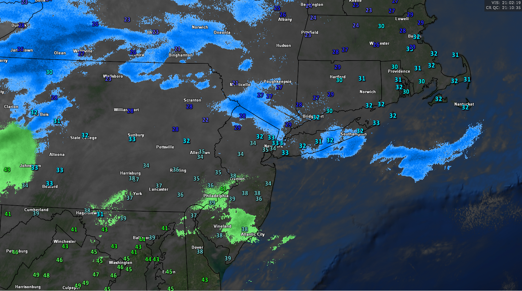
Today has been another cold, but relatively calm day across much of the Northeast and Mid Atlantic. Some weak lift associated with a frontal boundary over the region has spark some patchy areas of light snow and snow flurries, mainly confined to the western parts of New York State as well as southern New York and northern New Jersey. These areas of precipitation will gradually shift north over the rest of the evening as the frontal boundary and lift also begin to gain more latitude. Since precip rates will be rather low and conditions are not ideal for snow accumulations, only a trace is expected for the locations that manage to see more sustained light snow. Otherwise, high pressure retreating off of the Mid Atlantic coast will contribute to more southerly flow this evening, which will begin to bring in a more mild airmass in the mid levels of the atmosphere. Additionally, moisture will begin to increase and this will likely cause the rest of the evening to remain rather cloudy. Lows this evening will come quite early in the evening as the warm air moving into the mid levels of the atmosphere will also help to warm things up tonight after midnight. Most of the area will see lows in the upper 20’s to middle 30’s, but these will rise into the middle to upper 30’s during the overnight hours, with come locations in southern New Jersey likely reaching the 40’s.
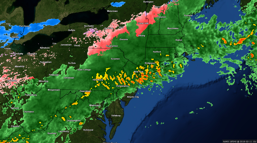
This afternoons current surface observations, regional radar mosaic, and high resolution satellite imagery showing a cold day across the region with areas of light snow
Heavy Rain Likely Sunday
Saturday will likely start off rather mild and with substantial overcast as mid to low level warm air and moisture continue to stream in over the region from the south. This surge in mild temperatures and moisture will be thanks to a large, but disorganized area of mid level energy extending from the West coast, all the way into the Great Lakes. Additionally, the sub-tropical jet stream will also be getting involved by pumping moisture-rich air from the Gulf of Mexico into the southeast United States, creating a large area of showers and thunderstorms. These showers and thunderstorms will gradually work their way north during the day on Saturday, likely working their way into the Mid Atlantic and Northeast by the late afternoon hours. Conditions will almost certainly remain unsettled with a chance of showers lasting well into the evening hours. Highs on Saturday will be quite mild, with most of the Mid Atlantic and Northeast likely getting into the lower 40’s, with some locations to the south possibly seeing highs in the lower 50’s! We’ll have the same situation tomorrow night as we did tonight, were temperatures during the overnight hours actually rise, with temperatures likely getting well into the 40’s and even middle 50’s for portions of the Mid Atlantic and southern New Jersey.
Conditions should really deteriorate during the early morning hours of Sunday morning, as warm/moist air surges ahead of semi-stationary frontal boundary out over the Ohio Valley. Early Sunday morning and into the afternoon hours should virtually be a washout, with a threat of heavy downpours across much of the Mid Atlantic and Northeast. The main batch of moderate to heavy rain should gradually push north and east off the coast during the middle afternoon hours, but there will still be a threat of some steady showers ahead of the last concentrated batch of rain. This last batch looks to come into the Northeast around 6-8pm on Sunday, with some locally heavy rainfall likely. This area of showers will also have a chance at producing some gusty winds as the low level jet streak a few thousand feet above the ground begins to strengthen. Rainfall totals should be above an inch for interior sections of the Northeast, with higher amounts around 1.5-2″ closer to the coast. The threat for stream flooding is rather low at this time, but there could be some urban flooding in locations that are prone to poor drainage. However, this will be highly dependent on just how much rain falls over the six to twelve hours or so on Sunday. Highs on Sunday will be quite impressive, with readings likely breaking into the 50’s areawide ahead of the cold front. Some locations to the south may even make a solid run at the 60’s later in the evening on Sunday.
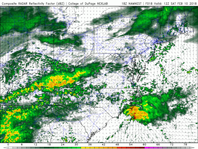
This afternoons NAM model showing the progression of the heavy rain set to impact the region into Sunday night
Unsettled and Mild Next Week
A frontal boundary will move across the Northeast and off the Mid Atlantic coast by Monday afternoon, which should be able to kick most of the moist/unstable airmass out of the region temporarily. Temperatures should moderate back into the upper 30’s to lower 40’s for the most part on Monday and Tuesday, but the large and disorganized area of mid level energy out over the west will begin to undergo a change. This system will gradually drift south and begin to break off from the main upper level flow, causing another period of zonal winds to rage from west to east over the country. As these zonal winds take over, we’ll see more moisture begin to surge northward from the Gulf of Mexico by Wednesday. As this moisture moves over the region, temperatures will once again return to well-above normal across the Northeast. In fact, this afternoon European model even shows the potential for the NYC to get into the 60’s by Thursday, which would likely challenge some records. The best threat for rain appears to be on Thursday as the bulk of the Gulf moisture moves up and over the Northeast. It is too early to say whether or not there will be a heavy rain threat from this system, but we will certainly be monitoring things over the next week or so and provide updates when needed!
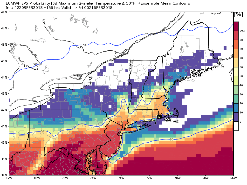
The European Ensembles probability of reaching/exceeding 50 degrees by next Thursday-showing a rather high chance over portions of the Mid Atlantic and Northeast
Have a great weekend!
Steve Copertino
Trackbacks & Pingbacks
1cincinnati
Comments are closed.